城市热污染监测服务
收藏杭州数据交易所2023-11-03 更新2024-05-15 收录
下载链接:
https://mall.hzdex.cn/data-exchange/113400900093017?from=/data-exchange
下载链接
链接失效反馈官方服务:
资源简介:
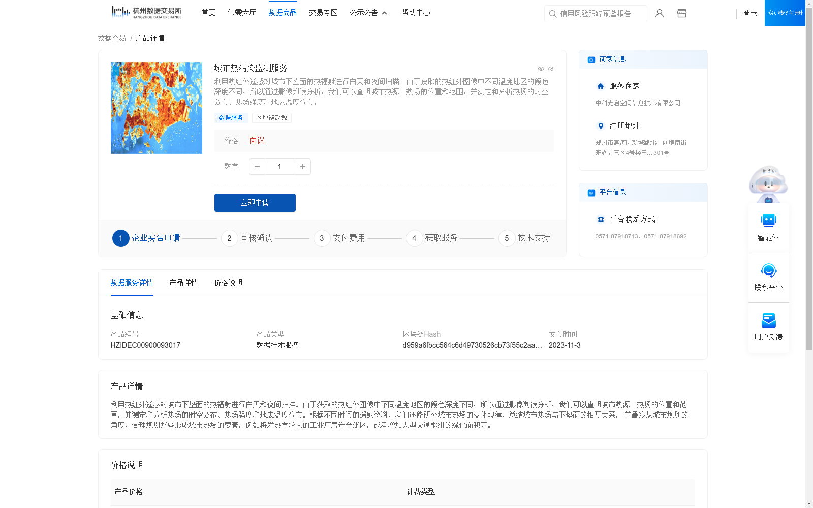
利用热红外遥感对城市下垫面的热辐射进行白天和夜间扫描。由于获取的热红外图像中不同温度地区的颜色深度不同,所以通过影像判读分析,我们可以查明城市热源、热场的位置和范围,并测定和分析热场的时空分布、热场强度和地表温度分布。
Thermal infrared remote sensing is employed to scan the thermal radiation of urban underlying surfaces during both daytime and nighttime. Since the color depth of regions with different temperatures in the acquired thermal infrared images varies, the locations and scopes of urban heat sources and thermal fields can be identified via image interpretation and analysis, and the spatiotemporal distribution, intensity of the thermal fields, and surface temperature distribution can be measured and analyzed.
提供机构:
中科光启空间信息技术有限公司
创建时间:
2023-10-31
搜集汇总
数据集介绍
背景与挑战
背景概述
该数据集提供城市热污染监测服务,利用热红外遥感技术对城市下垫面的热辐射进行昼夜扫描,通过影像判读分析查明热源、热场的位置和范围,测定热场时空分布及地表温度。服务旨在为城市规划提供科学依据,如调整工业布局和增加绿化面积。
以上内容由遇见数据集搜集并总结生成


