中国京津冀区域大气细颗粒物PM2.5质量浓度空间分布数据集(2016)
收藏国家地球系统科学数据中心2019-01-25 更新2024-03-04 收录
下载链接:
https://www.geodata.cn/data/datadetails.html?dataguid=3747432512934&docId=17579
下载链接
链接失效反馈官方服务:
资源简介:
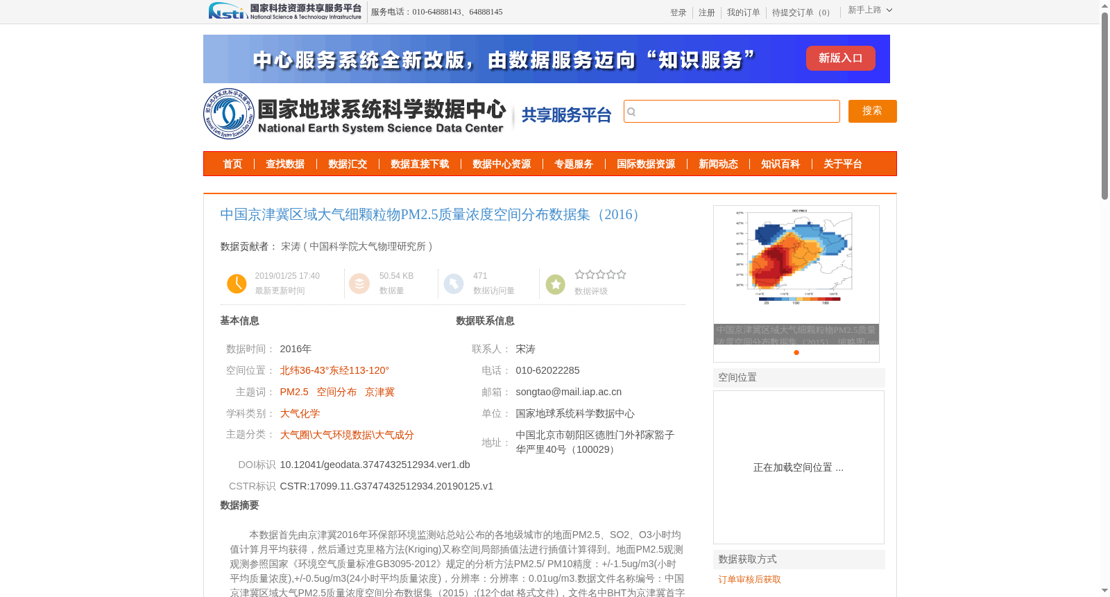
本数据首先由京津冀2016年环保部环境监测站总站公布的各地级城市的地面PM2.5、SO2、O3小时均值计算月平均获得,然后通过克里格方法(Kriging)又称空间局部插值法进行插值计算得到。地面PM2.5观测观测参照国家《环境空气质量标准GB3095-2012》规定的分析方法PM2.5/ PM10精度:+/-1.5ug/m3(小时平均质量浓度),+/-0.5ug/m3(24小时平均质量浓度),分辨率:分辨率:0.01ug/m3.数据文件名称编号:中国京津冀区域大气PM2.5质量浓度空间分布数据集(2015);(12个dat 格式文件),文件名中BHT为京津冀首字母缩写,PM2.5表示数据要素为PM2.5,Jan, Feb, Mar, Apr, May, Jun, Jul, Aug, Sep, Oct, Nov, Dec为1-12月份缩写。其中文件包含2016年1月-12月均值0.25度网格分辨率的 PM2.5的平均浓度记录数据
This dataset was initially generated by calculating monthly average concentrations from hourly mean ground-level PM2.5, SO2, and O3 measurements of prefecture-level cities published by the China National Environmental Monitoring Station under the Ministry of Environmental Protection in 2016. Subsequently, spatial interpolation was conducted using the Kriging method, also referred to as spatial local interpolation.
The ground-based PM2.5 observations follow the analytical methods stipulated in the National Ambient Air Quality Standard GB3095-2012. The accuracy of PM2.5/PM10 measurements is ±1.5 μg/m³ for hourly average mass concentrations and ±0.5 μg/m³ for 24-hour average mass concentrations, with a data resolution of 0.01 μg/m³.
The dataset is titled *Spatial Distribution Dataset of Atmospheric PM2.5 Mass Concentration in Beijing-Tianjin-Hebei Region, China (2015)* and consists of 12 DAT-format files. The file naming convention is as follows: BHT is the acronym for Beijing-Tianjin-Hebei, PM2.5 indicates that the data element is PM2.5, and Jan, Feb, Mar, Apr, May, Jun, Jul, Aug, Sep, Oct, Nov, Dec are the standard abbreviations for the 12 months from January to December. Each file stores the monthly average PM2.5 concentration records with a 0.25° grid resolution for the corresponding month in 2016.
提供机构:
中国科学院大气物理研究所
创建时间:
2019-01-25
搜集汇总
数据集介绍
背景与挑战
背景概述
该数据集提供了2016年中国京津冀区域大气细颗粒物PM2.5质量浓度的空间分布数据,通过克里格方法插值计算获得,覆盖北纬36-43°、东经113-120°范围,包含12个月份的月均值数据,网格分辨率为0.25度。数据适用于大气化学和大气环境研究,需遵守严格的数据使用和引用规范。
以上内容由遇见数据集搜集并总结生成


