MODDIS Terra星MOD13A3 1KM 月植被指数L3产品
收藏地球大数据科学工程2024-04-21 收录
下载链接:
https://data.casearth.cn/sdo/detail/653f6e59819aec161b5dc461
下载链接
链接失效反馈官方服务:
资源简介:
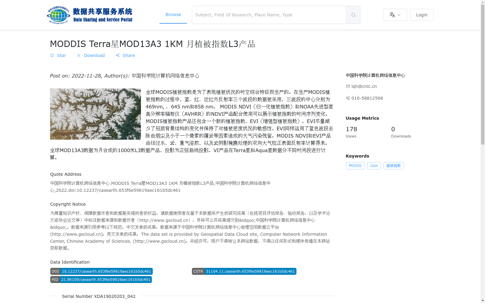
全球MODIS植被指数是为了表现植被状况的时空综合特征而生产的。在生产MODIS植被指数的过程中,蓝、红、近红外反射率三个波段的数据被采用,三波段的中心分别为469nm, 、645 nm和858 nm。
MODIS NDVI(归一化植被指数)和NOAA先进型甚高分辨率辐射仪(AVHRR)的NDVI产品配合使用可以展示植被指数的时间序列变化。MODIS植被指数产品还包含一个新的植被指数,EVI(增强型植被指数)。EVI尽量减少了冠层背景结构的变化并保持了对植被密度状况的敏感性。EVI同样运用了蓝色波段去除由烟尘及小于一个像素的薄云等因素造成的大气污染残留。MODIS NDVI和EVI产品由经过水、云、重气溶胶、以及云阴影掩膜处理的双向大气校正表面反射率计算得来。
全球MOD13A3数据为月合成的1000米L3数据产品,投影为正弦曲线投影。VI产品在Terra星和Aqua星数据分不同时间段进行计算。
Global MODIS vegetation index products are developed to characterize the comprehensive spatiotemporal characteristics of vegetation conditions. Three spectral bands including blue, red, and near-infrared reflectance are utilized in the production of MODIS vegetation indices, with central wavelengths of 469 nm, 645 nm, and 858 nm, respectively.
The MODIS NDVI (Normalized Difference Vegetation Index) products can be combined with the NDVI products from NOAA Advanced Very High Resolution Radiometer (AVHRR) to reveal the temporal sequence variations of vegetation indices. The MODIS vegetation index product portfolio also includes a newly developed vegetation index, the Enhanced Vegetation Index (EVI). EVI minimizes variations in canopy background structure while retaining sensitivity to vegetation density conditions. Furthermore, EVI leverages the blue band to eliminate atmospheric contamination residuals caused by factors such as soot and thin clouds smaller than one pixel. MODIS NDVI and EVI products are derived from bidirectional atmospheric-corrected surface reflectance that has been masked to exclude water bodies, clouds, heavy aerosols, and cloud shadows.
The global MOD13A3 dataset is a monthly synthesized 1000-meter Level 3 data product with a Sinusoidal projection. The VI products are computed using data collected from the Terra and Aqua satellites across distinct time periods.
提供机构:
中国科学院计算机网络信息中心
搜集汇总
数据集介绍
背景与挑战
背景概述
该数据集是MODDIS Terra卫星的MOD13A3 1KM月植被指数L3产品,包含NDVI和EVI两种植被指数,用于监测全球植被状况的时空变化。数据采用正弦曲线投影,空间分辨率为1公里,适用于植被指数的长期序列分析。
以上内容由遇见数据集搜集并总结生成


