2000-2018年时序1km全球土地覆盖
收藏地球大数据科学工程2024-04-26 收录
下载链接:
https://data.casearth.cn/sdo/detail/636e17ed819aec5df66b5232
下载链接
链接失效反馈官方服务:
资源简介:
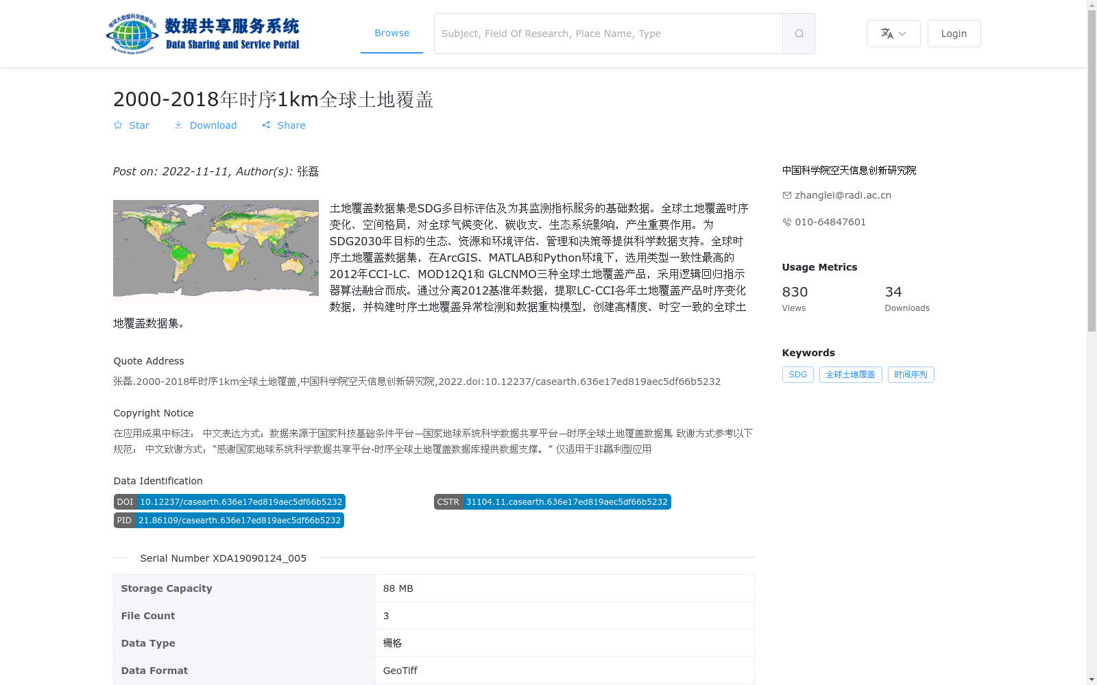
土地覆盖数据集是SDG多目标评估及为其监测指标服务的基础数据。全球土地覆盖时序变化、空间格局,对全球气候变化、碳收支、生态系统影响,产生重要作用。为SDG2030年目标的生态、资源和环境评估、管理和决策等提供科学数据支持。全球时序土地覆盖数据集,在ArcGIS、MATLAB和Python环境下,选用类型一致性最高的2012年CCI-LC、MOD12Q1和 GLCNMO三种全球土地覆盖产品,采用逻辑回归指示器算法融合而成。通过分离2012基准年数据,提取LC-CCI各年土地覆盖产品时序变化数据,并构建时序土地覆盖异常检测和数据重构模型,创建高精度、时空一致的全球土地覆盖数据集。
The Land Cover Dataset is fundamental data for SDG multi-objective assessments and supporting its monitoring indicators. The temporal variations and spatial patterns of global land cover exert a critical impact on global climate change, carbon budget and ecosystem-related effects. It provides scientific data support for ecological, resource and environmental assessment, management and decision-making related to the 2030 SDG targets. The Global Temporal Land Cover Dataset was developed under the environments of ArcGIS, MATLAB and Python, by fusing three global land cover products (CCI-LC 2012, MOD12Q1 and GLCNMO) with the highest type consistency using the logistic regression indicator algorithm. Specifically, by separating the 2012 baseline year data, extracting the temporal variation data of annual land cover products from LC-CCI, and constructing a temporal land cover anomaly detection and data reconstruction model, a high-precision, spatio-temporally consistent global land cover dataset was ultimately created.
提供机构:
中国科学院空天信息创新研究院
搜集汇总
数据集介绍
背景与挑战
背景概述
该数据集是2000年至2018年全球1公里分辨率的时序土地覆盖数据,通过融合CCI-LC、MOD12Q1和GLCNMO三种产品并使用逻辑回归指示器算法生成,确保了高精度和时空一致性。它主要用于支持SDG目标的生态评估、全球气候变化研究和碳收支分析,为科学决策提供数据基础。
以上内容由遇见数据集搜集并总结生成


