2000-2019年北极地区1kmMODIS积雪面积比例时序数据集
收藏地球大数据科学工程2024-04-26 收录
下载链接:
https://data.casearth.cn/sdo/detail/636e17ec819aec5df66b51fb
下载链接
链接失效反馈官方服务:
资源简介:
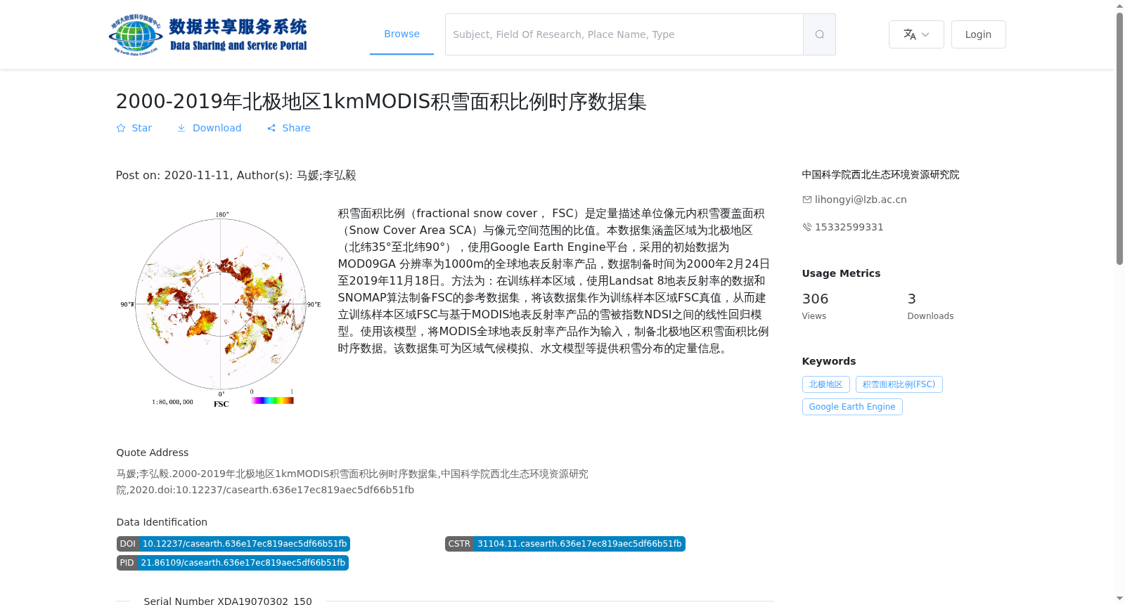
积雪面积比例(fractional snow cover, FSC)是定量描述单位像元内积雪覆盖面积(Snow Cover Area SCA)与像元空间范围的比值。本数据集涵盖区域为北极地区(北纬35°至北纬90°),使用Google Earth Engine平台,采用的初始数据为MOD09GA 分辨率为1000m的全球地表反射率产品,数据制备时间为2000年2月24日至2019年11月18日。方法为:在训练样本区域,使用Landsat 8地表反射率的数据和SNOMAP算法制备FSC的参考数据集,将该数据集作为训练样本区域FSC真值,从而建立训练样本区域FSC与基于MODIS地表反射率产品的雪被指数NDSI之间的线性回归模型。使用该模型,将MODIS全球地表反射率产品作为输入,制备北极地区积雪面积比例时序数据。该数据集可为区域气候模拟、水文模型等提供积雪分布的定量信息。
Fractional Snow Cover (FSC) is a quantitative indicator describing the ratio of the Snow Cover Area (SCA) within a single pixel to the spatial scope of that pixel. This dataset covers the Arctic region (35°N to 90°N), which was developed using the Google Earth Engine platform. The initial input data is the MOD09GA global surface reflectance product with a spatial resolution of 1000 m, and the data production period spans from February 24, 2000 to November 18, 2019. The production method is as follows: For the training sample regions, a reference FSC dataset was generated using Landsat 8 surface reflectance data and the SNOMAP algorithm, which was treated as the ground truth of FSC in these regions. A linear regression model was then established between the FSC values of the training sample regions and the Normalized Difference Snow Index (NDSI) derived from the MODIS surface reflectance product. Using this model, the MODIS global surface reflectance product was used as input to generate the time-series fractional snow cover data for the Arctic region. This dataset can provide quantitative information on snow distribution for regional climate simulation, hydrological modeling and other relevant research fields.
提供机构:
中国科学院西北生态环境资源研究院
搜集汇总
数据集介绍
背景与挑战
背景概述
该数据集为2000-2019年北极地区1km分辨率的MODIS积雪面积比例时序数据,采用Google Earth Engine平台和线性回归模型制备,适用于区域气候模拟和水文模型研究。
以上内容由遇见数据集搜集并总结生成


