自然资源高频次卫星遥感监测----非农非粮化监测产品
收藏海南省数据产品超市2023-07-21 更新2024-03-01 收录
下载链接:
https://www.datadex.cn/app/buyApi?id=ad2d8fbcef5b4579971cdfe79eeb25b7
下载链接
链接失效反馈官方服务:
资源简介:
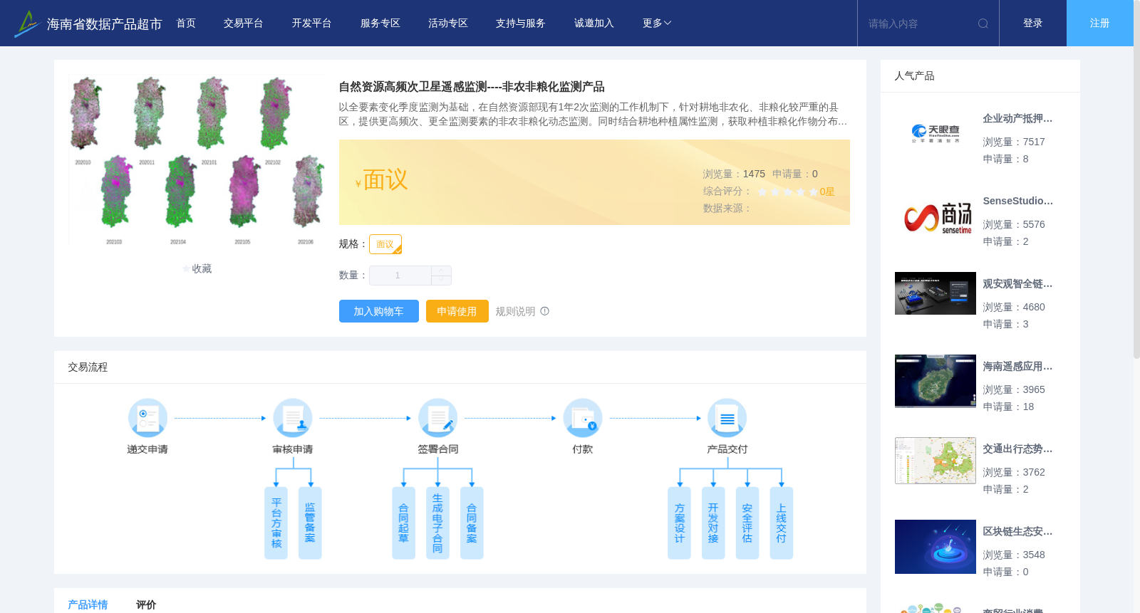
以全要素变化季度监测为基础,在自然资源部现有1年2次监测的工作机制下,针对耕地非农化、非粮化较严重的县区,提供更高频次、更全监测要素的非农非粮化动态监测。同时结合耕地种植属性监测,获取种植非粮化作物分布信息,辅助耕地非粮化监测。
非农化监测是基于遥感影像提取的耕地范围内新增的建(构)筑物、线形地物、推填土、光伏用地等变化的位置、分布与面积等信息。可提供非农化监测图斑产品、影像产品及专题图件产品。
非粮化监测是基于遥感影像提取的占用耕地挖湖造景、建设绿色通道、绿化造林、种植草皮等用地的位置、分布与面积等信息。可提供非粮化化监测图斑产品、影像产品及专题图件产品。
Based on quarterly all-factor change monitoring, under the existing twice-annual monitoring framework of the Ministry of Natural Resources (MNR), this dataset provides dynamic monitoring of non-agricultural conversion and non-grain cultivation on cultivated land for counties and districts with severe cases of these two issues. The monitoring adopts higher frequency and more comprehensive monitoring indicators compared to the regular mechanism. In addition, it combines with the monitoring of cultivated land planting attributes to obtain distribution information of non-grain crops planted on cultivated land, so as to assist the monitoring of non-grain cultivation on cultivated land.
Non-agricultural conversion monitoring extracts information such as the location, distribution and area of new changes including buildings and structures, linear features, earth filling, photovoltaic land use and other types within cultivated land based on remote sensing images. It can provide monitoring patch products, image products and thematic map products for non-agricultural conversion monitoring.
Non-grain cultivation monitoring extracts information such as the location, distribution and area of land uses including lake excavation for landscape construction, green corridor construction, afforestation, grass planting and other types that occupy cultivated land based on remote sensing images. It can provide monitoring patch products, image products and thematic map products for non-grain cultivation monitoring.
提供机构:
北京四维空间数码科技有限公司
创建时间:
2023-07-21
搜集汇总
数据集介绍
背景与挑战
背景概述
该数据集针对耕地非农化、非粮化严重区域,通过卫星遥感技术提供季度性动态监测,包括建(构)筑物、光伏用地等非农化变化,以及挖湖造景、绿化造林等非粮化变化的位置分布信息,并生成相应的图斑、影像和专题图产品。
以上内容由遇见数据集搜集并总结生成


