中国西南地区(云贵川渝)全天候逐日1km地表温度数据集(2001-2022)
收藏国家青藏高原科学数据中心2025-12-22 更新2026-01-24 收录
下载链接:
https://data.tpdc.ac.cn/zh-hans/data/f0774902-9a8e-468c-a2b4-2e4f89b19a64
下载链接
链接失效反馈官方服务:
资源简介:
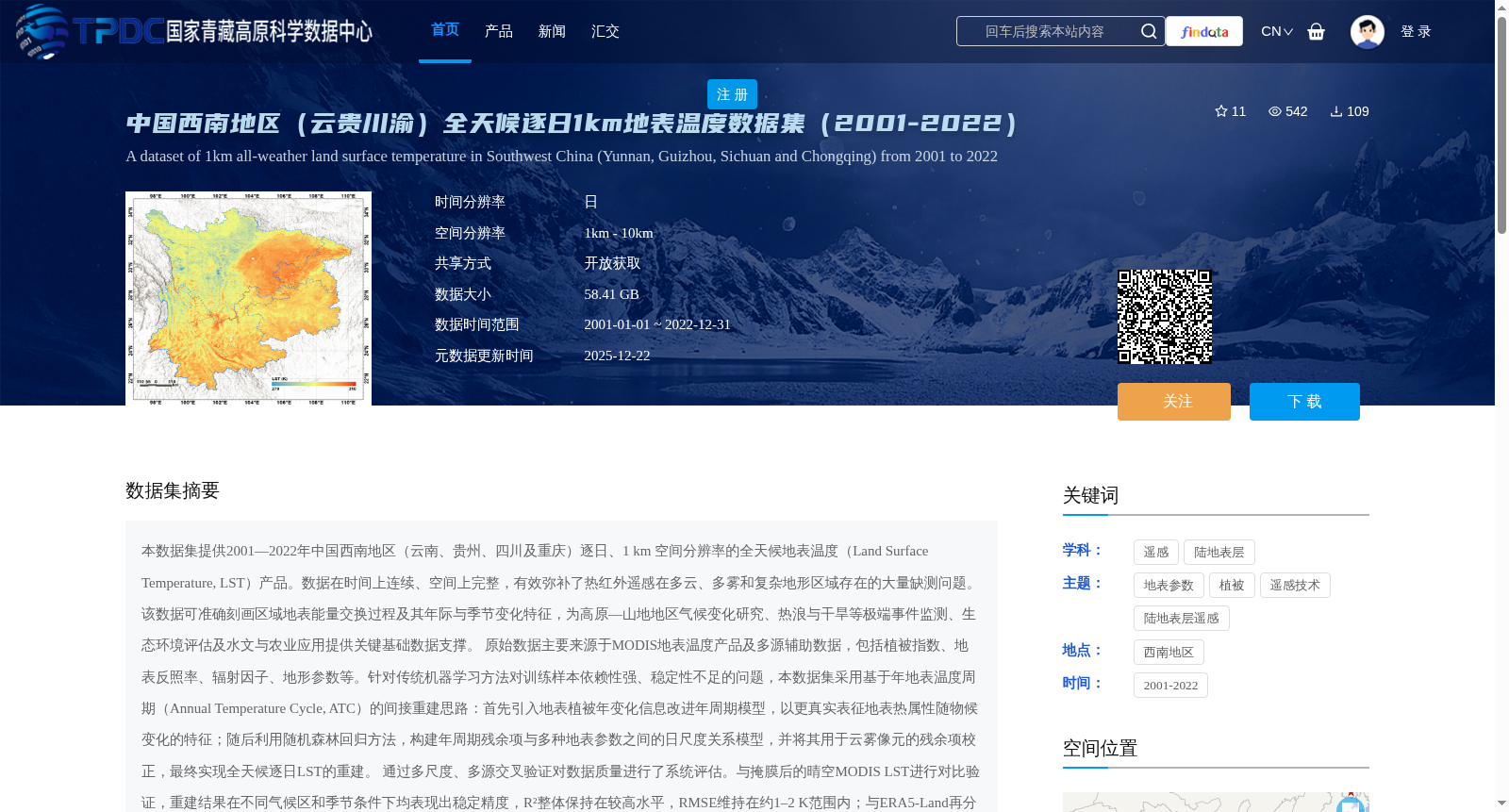
本数据集提供2001—2022年中国西南地区(云南、贵州、四川及重庆)逐日、1 km 空间分辨率的全天候地表温度(Land Surface Temperature, LST)产品。数据在时间上连续、空间上完整,有效弥补了热红外遥感在多云、多雾和复杂地形区域存在的大量缺测问题。该数据可准确刻画区域地表能量交换过程及其年际与季节变化特征,为高原—山地地区气候变化研究、热浪与干旱等极端事件监测、生态环境评估及水文与农业应用提供关键基础数据支撑。
原始数据主要来源于MODIS地表温度产品及多源辅助数据,包括植被指数、地表反照率、辐射因子、地形参数等。针对传统机器学习方法对训练样本依赖性强、稳定性不足的问题,本数据集采用基于年地表温度周期(Annual Temperature Cycle, ATC)的间接重建思路:首先引入地表植被年变化信息改进年周期模型,以更真实表征地表热属性随物候变化的特征;随后利用随机森林回归方法,构建年周期残余项与多种地表参数之间的日尺度关系模型,并将其用于云雾像元的残余项校正,最终实现全天候逐日LST的重建。
通过多尺度、多源交叉验证对数据质量进行了系统评估。与掩膜后的晴空MODIS LST进行对比验证,重建结果在不同气候区和季节条件下均表现出稳定精度,R²整体保持在较高水平,RMSE维持在约1–2 K范围内;与ERA5-Land再分析数据及近地面气温的间接验证结果也显示出良好一致性,表明该数据集在复杂地形和多云条件下仍具有较高可靠性和稳定性。
该数据集可广泛应用于中国西南地区地表热环境变化、极端高温事件识别、山地生态系统响应、农业干旱监测及城市热环境研究等方向。依托其长时间序列和全天候优势,未来可进一步服务于区域气候变化评估、高分辨率陆面过程模拟及多源遥感数据融合研究,并为高原—山地可持续发展和灾害风险管理提供重要的数据基础。
This dataset provides daily all-sky Land Surface Temperature (LST) products with 1 km spatial resolution across Southwest China (Yunnan, Guizhou, Sichuan and Chongqing) from 2001 to 2022. The data features temporal continuity and spatial completeness, effectively filling the widespread data gaps in thermal infrared remote sensing products over cloudy, foggy and complex terrain areas. It can accurately characterize regional surface energy exchange processes and their interannual and seasonal variation characteristics, providing critical foundational data support for climate change research in plateau-mountain regions, monitoring of extreme events such as heatwaves and droughts, ecological environment assessment, and hydrological and agricultural applications.
The raw data is primarily sourced from MODIS Land Surface Temperature products and multi-source auxiliary datasets, including vegetation indices, surface albedo, radiation factors, topographic parameters and others. To address the limitations of traditional machine learning methods, which exhibit strong dependence on training samples and insufficient stability, this dataset adopts an indirect reconstruction framework based on the Annual Temperature Cycle (ATC). First, annual vegetation dynamics information is introduced to improve the annual cycle model, enabling more realistic characterization of the variations of surface thermal properties with phenology. Subsequently, a random forest regression model is employed to establish a daily-scale relational model between the annual cycle residual terms and multiple surface parameters, which is then used to correct the residual terms of cloud and fog contaminated pixels, ultimately achieving the reconstruction of all-sky daily LST.
The data quality was systematically evaluated through multi-scale and multi-source cross-validation. Comparative validation against masked clear-sky MODIS LST showed that the reconstructed results achieved stable accuracy across different climate zones and seasonal conditions, with an overall high R² value and RMSE maintained within approximately 1–2 Kelvin. Indirect validation against ERA5-Land reanalysis data and near-surface air temperature also demonstrated good consistency, indicating that this dataset maintains high reliability and stability even in complex terrain and cloudy environments.
This dataset can be widely applied to research on surface thermal environment changes, extreme high-temperature event identification, mountain ecosystem responses, agricultural drought monitoring, urban thermal environment and other related topics in Southwest China. Leveraging its advantages of long time series and all-sky coverage, it can further support regional climate change assessment, high-resolution land surface process simulation, and multi-source remote sensing data fusion research in the future, and provide an important data foundation for plateau-mountain sustainable development and disaster risk management.
提供机构:
杨羽佳,赵伟
创建时间:
2025-12-17
搜集汇总
数据集介绍
背景与挑战
背景概述
本数据集提供2001年至2022年中国西南地区(云南、贵州、四川、重庆)的逐日、1公里空间分辨率全天候地表温度产品,采用基于年地表温度周期的间接重建方法,有效解决了多云、多雾和复杂地形区域的缺测问题。数据经过多尺度验证,精度稳定(RMSE约1-2K),适用于气候变化研究、极端高温事件监测和生态环境评估等应用。
以上内容由遇见数据集搜集并总结生成


