三江源地区最大冻土数据集(1961-2020,站 点;1979-2018,格点)
收藏国家青藏高原科学数据中心2025-04-08 更新2025-03-29 收录
下载链接:
https://data.tpdc.ac.cn/zh-hans/data/0916829c-e3c1-4dc6-8502-65482128aaf4
下载链接
链接失效反馈官方服务:
资源简介:
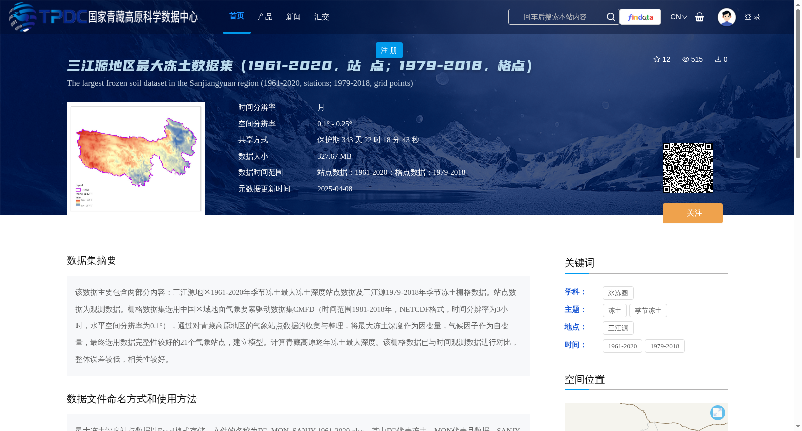
该数据主要包含两部分内容:三江源地区1961-2020年季节冻土最大冻土深度站点数据及三江源1979-2018年季节冻土栅格数据。站点数据为观测数据。栅格数据集选用中国区域地面气象要素驱动数据集CMFD(时间范围1981-2018年,NETCDF格式,时间分辨率为3小时,水平空间分辨率为0.1°),通过对青藏高原地区的气象站点数据的收集与整理,将最大冻土深度作为因变量,气候因子作为自变量,最终选用数据完整性较好的21个气象站点,建立模型。计算青藏高原逐年冻土最大深度。该栅格数据已与时间观测数据进行对比,整体误差较低,相关性较好。
This dataset primarily comprises two parts: in-situ station data of maximum seasonal frozen soil depth in the Three-River Headwaters Region from 1961 to 2020, and gridded seasonal frozen soil dataset for the Three-River Headwaters Region spanning 1979 to 2018. The station dataset consists of field observational measurements. The gridded dataset was developed using the China Meteorological Forcing Dataset (CMFD), which covers the period from 1981 to 2018, is stored in NETCDF format, has a temporal resolution of 3 hours, and a horizontal spatial resolution of 0.1°. By collecting and organizing meteorological station data over the Qinghai-Tibet Plateau, maximum seasonal frozen soil depth was set as the dependent variable and climatic factors as independent variables. Finally, 21 meteorological stations with good data integrity were selected to establish the model. This model was used to calculate the annual maximum frozen soil depth across the Qinghai-Tibet Plateau. This gridded dataset has been validated against in-situ observational data, exhibiting low overall error and good correlation.
提供机构:
周秉荣
创建时间:
2025-02-28
搜集汇总
数据集介绍
背景与挑战
背景概述
该数据集包含三江源地区1961-2020年的站点观测最大冻土深度数据,以及1979-2018年的格点栅格数据。站点数据为观测数据,格点数据基于气象站点数据和气候因子模型计算得出,整体误差较低,相关性较好。
以上内容由遇见数据集搜集并总结生成


