黄土高原延河流域1:10万土地利用图(1990年)
收藏国家地球系统科学数据中心2023-04-07 更新2024-03-04 收录
下载链接:
https://www.geodata.cn/data/datadetails.html?dataguid=91569488599866&docId=6045
下载链接
链接失效反馈官方服务:
资源简介:
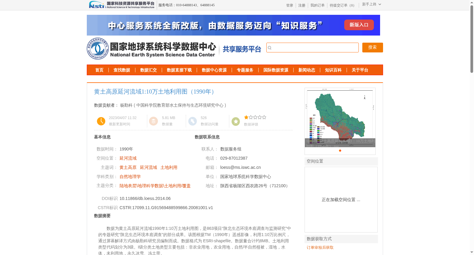
数据为黄土高原延河流域1990年1:10万土地利用图,是863项目“陕北生态环境本底调查与监测研究”中的专题研究“陕北生态环境本底调查”的部分成果。该图根据TM(1990年)遥感影像,利用1:10万比例尺,通过屏幕解译方式由杨勤科研究员编制而成。数据格式为 ESRI-shapefile。数据量合计约8MB。土地利用类型代码划分为3级。I级分类土地类型主要包括:非农业用地,农业用地,自然/半自然植被,湿地,水体,未利用地,永久冰雪、冻土带。
The dataset is a 1:100,000-scale land use map of the Yanhe River Basin on the Loess Plateau, created in 1990. It is a partial research outcome of the special topic "Investigation of Ecological Environment Background in Northern Shaanxi" under the 863 Program project "Investigation and Monitoring of Ecological Environment Background in Northern Shaanxi". This map was compiled by Researcher Yang Qinke through screen interpretation based on TM (1990) remote sensing images at a scale of 1:100,000. The data format is ESRI Shapefile, with a total volume of approximately 8 MB. The land use type codes are divided into three levels. The main Level I land use categories include: non-agricultural land, agricultural land, natural/semi-natural vegetation, wetlands, water bodies, unused land, and permanent snow and ice, permafrost zones.
提供机构:
中国科学院教育部水土保持与生态环境研究中心
创建时间:
2008-10-01
搜集汇总
数据集介绍
背景与挑战
背景概述
该数据集是黄土高原延河流域1990年的1:10万土地利用图,基于TM遥感影像通过屏幕解译编制,数据格式为ESRI-shapefile,土地利用类型代码分为3级。它作为863项目“陕北生态环境本底调查与监测研究”的专题成果,主要用于黄土高原生态环境本底调查和监测研究,具有较高的空间精度和明确的时空覆盖范围。
以上内容由遇见数据集搜集并总结生成


