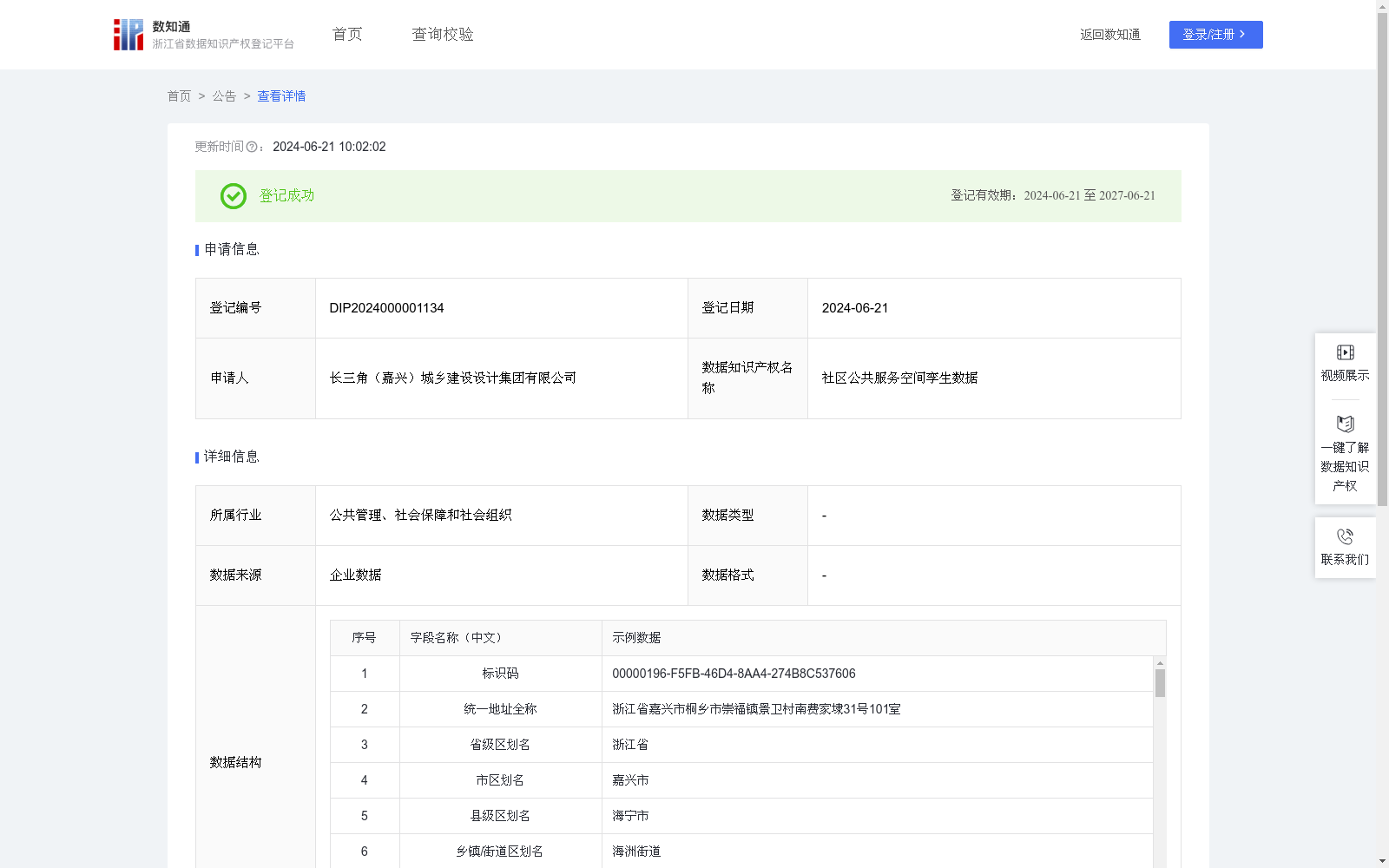
社区公共服务空间孪生数据
收藏资源简介:
社区公共服务空间孪生数据能够分析各个社区内各类公共服务设施的个数和面积,并利用设施数据的空间位置,通过缓冲分析、空间相交分析等算法计算出公共服务设施的服务范围,为优化公共服务管理、提升居民生活品质提供思路。1.数据采集:无人机采集、现场拍照调查、内业数据处理生产方式获取数据。2.数据处理:对采集到房户数据进行地址处理、数据去重、合并,便于分析使用。3.算法加工: (1)统计每个社区各类设施的数量:对“所在城市”、“所在区县”、“所在街道”、“所在社区”、“设施类型”字段进行分类汇总即可得出每个社区各设施类型的数量; (2)统计每个社区各类设施的面积:先对“所在城市”、“所在区县”、“所在街道”、“所在社区”、“设施类型”字段进行分类汇总,再对“公共设施建筑面积”字段的数据进行合计即可得出每个社区各设施类型的建筑面积; (3)计算某个设施的服务范围:获取某个设施的“经度”和“维度”信息,以它为中心点,设置缓冲半径为100米,得到一个缓冲范围,该缓冲范围即为设施的服务范围。
Community Public Service Spatial Twin Data can analyze the quantity and area of various public service facilities within each community, and leverage the spatial position data of these facilities to calculate their service scopes via algorithms such as buffer analysis and spatial intersection analysis, providing insights for optimizing public service management and enhancing residents' quality of life. 1. Data Collection: Data is acquired through three methods: drone collection, on-site photo survey, and indoor data processing and production. 2. Data Processing: Address standardization, deduplication and merging are conducted on the collected household data to facilitate subsequent analysis and usage. 3. Algorithm Processing: (1) Count the quantity of each type of facility in each community: Classify and aggregate the fields of "city where located", "district and county where located", "street where located", "community where located" and "facility type" to obtain the quantity of each facility type in each community; (2) Count the area of each type of facility in each community: First classify and aggregate the fields of "city where located", "district and county where located", "street where located", "community where located" and "facility type", then sum the data in the "construction area of public facilities" field to calculate the total construction area of each facility type in each community; (3) Calculate the service scope of a specific facility: Obtain the "longitude" and "latitude" information of a given facility, take it as the center point, set the buffer radius to 100 meters, and the resulting buffer range will be the service scope of the facility.