青藏高原五道梁地区高空间分辨率(100m)土壤水分产品(2019-2020)
收藏国家青藏高原科学数据中心2024-02-01 更新2024-03-01 收录
下载链接:
https://data.tpdc.ac.cn/zh-hans/data/11a2d8b7-31b7-49a5-b3ea-9387ffe1e23d
下载链接
链接失效反馈官方服务:
资源简介:
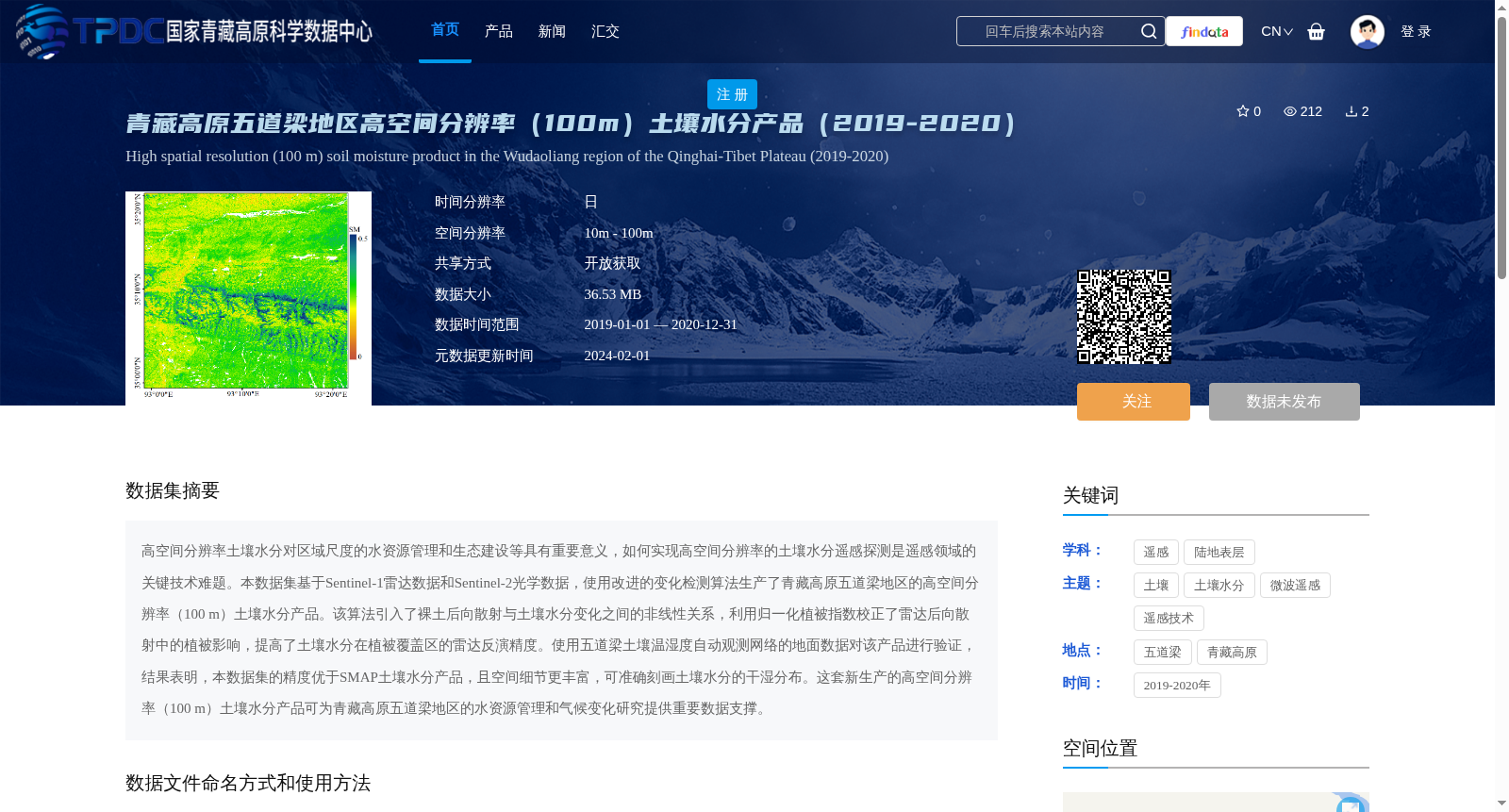
高空间分辨率土壤水分对区域尺度的水资源管理和生态建设等具有重要意义,如何实现高空间分辨率的土壤水分遥感探测是遥感领域的关键技术难题。本数据集基于Sentinel-1雷达数据和Sentinel-2光学数据,使用改进的变化检测算法生产了青藏高原五道梁地区的高空间分辨率(100 m)土壤水分产品。该算法引入了裸土后向散射与土壤水分变化之间的非线性关系,利用归一化植被指数校正了雷达后向散射中的植被影响,提高了土壤水分在植被覆盖区的雷达反演精度。使用五道梁土壤温湿度自动观测网络的地面数据对该产品进行验证,结果表明,本数据集的精度优于SMAP土壤水分产品,且空间细节更丰富,可准确刻画土壤水分的干湿分布。这套新生产的高空间分辨率(100 m)土壤水分产品可为青藏高原五道梁地区的水资源管理和气候变化研究提供重要数据支撑。
High-spatial-resolution soil moisture is of great significance for regional-scale water resources management, ecological construction and other related fields. Achieving high-spatial-resolution remote sensing detection of soil moisture has long been a key technical challenge in the remote sensing domain. This dataset generates a high-spatial-resolution (100 m) soil moisture product for the Wudaoliang region of the Qinghai-Tibet Plateau using an improved change detection algorithm based on Sentinel-1 radar data and Sentinel-2 optical data. The proposed algorithm introduces the nonlinear relationship between bare soil backscattering and soil moisture variation, and corrects the vegetation effects on radar backscattering using the Normalized Difference Vegetation Index (NDVI), thereby improving the radar retrieval accuracy of soil moisture in vegetated areas. The product was validated using in-situ data from the Wudaoliang Automatic Soil Temperature and Moisture Observation Network. The results demonstrate that this dataset outperforms the SMAP soil moisture product in terms of accuracy, and has richer spatial details, enabling accurate depiction of the wet-dry distribution of soil moisture. This newly generated high-spatial-resolution (100 m) soil moisture product can provide critical data support for water resources management and climate change research in the Wudaoliang region of the Qinghai-Tibet Plateau.
提供机构:
杜绍杰,赵天杰,姚盼盼,郑景耀,段潘
创建时间:
2023-06-14
搜集汇总
数据集介绍
背景与挑战
背景概述
该数据集提供了2019-2020年青藏高原五道梁地区的高空间分辨率(100m)土壤水分产品,基于Sentinel-1和Sentinel-2数据使用改进的变化检测算法生成,精度优于SMAP产品,适用于水资源管理和气候变化研究。数据以tiff文件存储,开放获取,需按规定引用。
以上内容由遇见数据集搜集并总结生成


