青藏高原东南三江流域滑坡灾害数据集
收藏国家青藏高原科学数据中心2022-02-28 更新2024-03-06 收录
下载链接:
https://data.tpdc.ac.cn/zh-hans/data/8f5d570b-0bda-4c3b-a29f-7b509248f68e
下载链接
链接失效反馈官方服务:
资源简介:
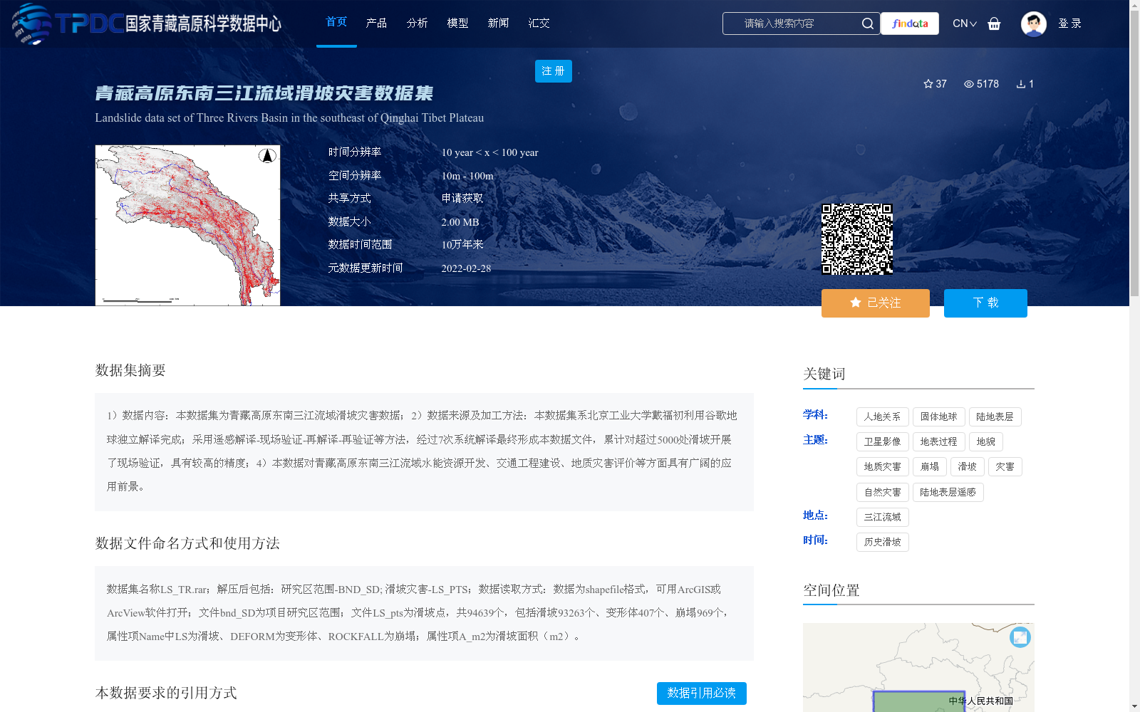
1)数据内容:本数据集为青藏高原东南三江流域滑坡灾害数据;2)数据来源及加工方法:本数据集系北京工业大学戴福初利用谷歌地球独立解译完成;采用遥感解译-现场验证-再解译-再验证等方法,经过7次系统解译最终形成本数据文件,累计对超过5000处滑坡开展了现场验证,具有较高的精度;4)本数据对青藏高原东南三江流域水能资源开发、交通工程建设、地质灾害评价等方面具有广阔的应用前景。
1) Data Content: This dataset covers landslide disaster data for the Three Rivers (Jinsha, Lancang and Nujiang) Basin in the southeastern Qinghai-Tibet Plateau.
2) Data Source and Processing Method: This dataset was independently interpreted by Dai Fuchu from Beijing University of Technology using Google Earth. The processing workflow follows the steps of remote sensing interpretation, field validation, re-interpretation and re-validation. After 7 systematic interpretation cycles, the final dataset was compiled, with a cumulative on-site verification of more than 5000 landslides, ensuring high data accuracy.
4) Application Prospect: This dataset has broad application prospects in multiple fields including hydropower resource development, transportation engineering construction and geological disaster assessment for the Three Rivers Basin in the southeastern Qinghai-Tibet Plateau.
提供机构:
戴福初
创建时间:
2022-02-27
搜集汇总
数据集介绍
背景与挑战
背景概述
该数据集是青藏高原东南三江流域的滑坡灾害数据,包含94639个滑坡点(包括滑坡、变形体和崩塌),由北京工业大学戴福初通过谷歌地球遥感解译和多次现场验证(验证超过5000处滑坡)制作而成,具有较高精度。数据集覆盖10万年的时间范围,空间分辨率为10m-100m,适用于水能资源开发、交通工程建设和地质灾害评价等应用。
以上内容由遇见数据集搜集并总结生成


