Improved remote sensing ecological index dataset of the Qinghai-Tibet Plateau from 2000 to 2022
收藏DataCite Commons2025-04-27 更新2025-05-18 收录
下载链接:
https://www.scidb.cn/detail?dataSetId=85b967b92ff0428ca3f7863781f79763
下载链接
链接失效反馈官方服务:
资源简介:
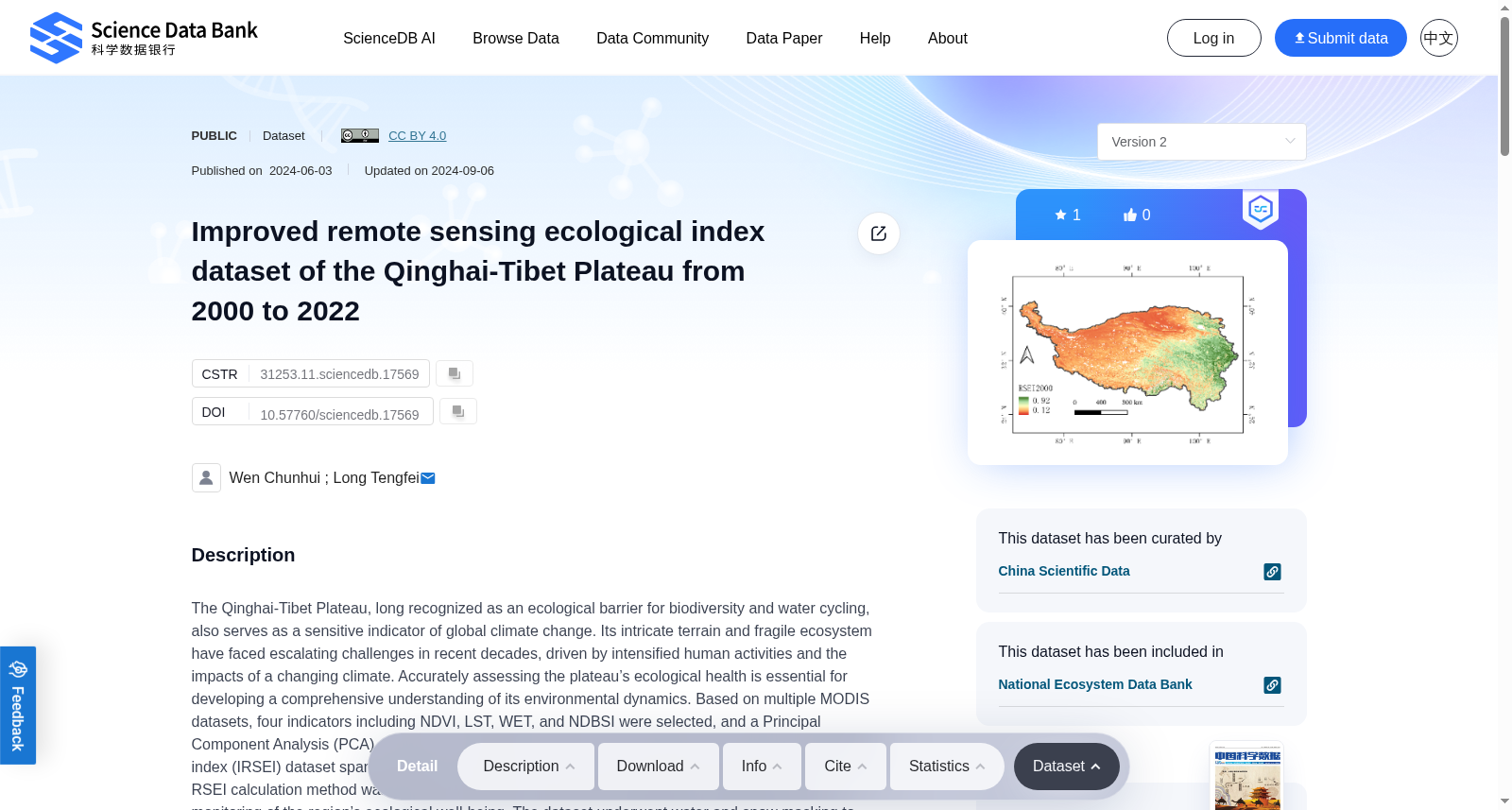
The Qinghai-Tibet Plateau, long recognized as an ecological barrier for biodiversity and water cycling, also serves as a sensitive indicator of global climate change. Its intricate terrain and fragile ecosystem have faced escalating challenges in recent decades, driven by intensified human activities and the impacts of a changing climate. Accurately assessing the plateau’s ecological health is essential for developing a comprehensive understanding of its environmental dynamics. Based on multiple MODIS datasets, four indicators including NDVI, LST, WET, and NDBSI were selected, and a Principal Component Analysis (PCA) method was employed to generate an improved remote sensing ecological index (IRSEI) dataset spanning the years 2000–2022, with a spatial resolution of 500 meters. Notably, the RSEI calculation method was refined to enhance its temporal comparability, facilitating long-term monitoring of the region’s ecological well-being. The dataset underwent water and snow masking to eliminate the influence of water bodies and snow. The spatial distribution of the IRSEI was validated against a land use dataset, and the results demonstrated a high degree of consistency between the IRSEI data distribution and the land use types on the Qinghai-Tibet Plateau. This dataset can serve as a theoretical basis and scientific support for the sustainable management and development of the Qinghai-Tibet Plateau, contributing to its high-quality development.
提供机构:
Science Data Bank
创建时间:
2024-06-03
搜集汇总
数据集介绍
背景与挑战
背景概述
该数据集是一个改进的遥感生态指数(IRSEI)数据集,覆盖青藏高原2000年至2022年,空间分辨率为500米,基于NDVI、LST、WET和NDBSI四个指标通过主成分分析生成,优化了时间可比性并进行了水和雪掩膜处理。数据集验证了与土地利用类型的高度一致性,旨在为青藏高原的生态健康评估和可持续管理提供科学支持。
以上内容由遇见数据集搜集并总结生成


