美国阿肯色州10米分辨率深度学习模型训练水稻样本集(2020年)
收藏国家地球系统科学数据中心2023-11-17 更新2024-03-04 收录
下载链接:
https://www.geodata.cn/data/datadetails.html?dataguid=247990812910524&docId=4381
下载链接
链接失效反馈官方服务:
资源简介:
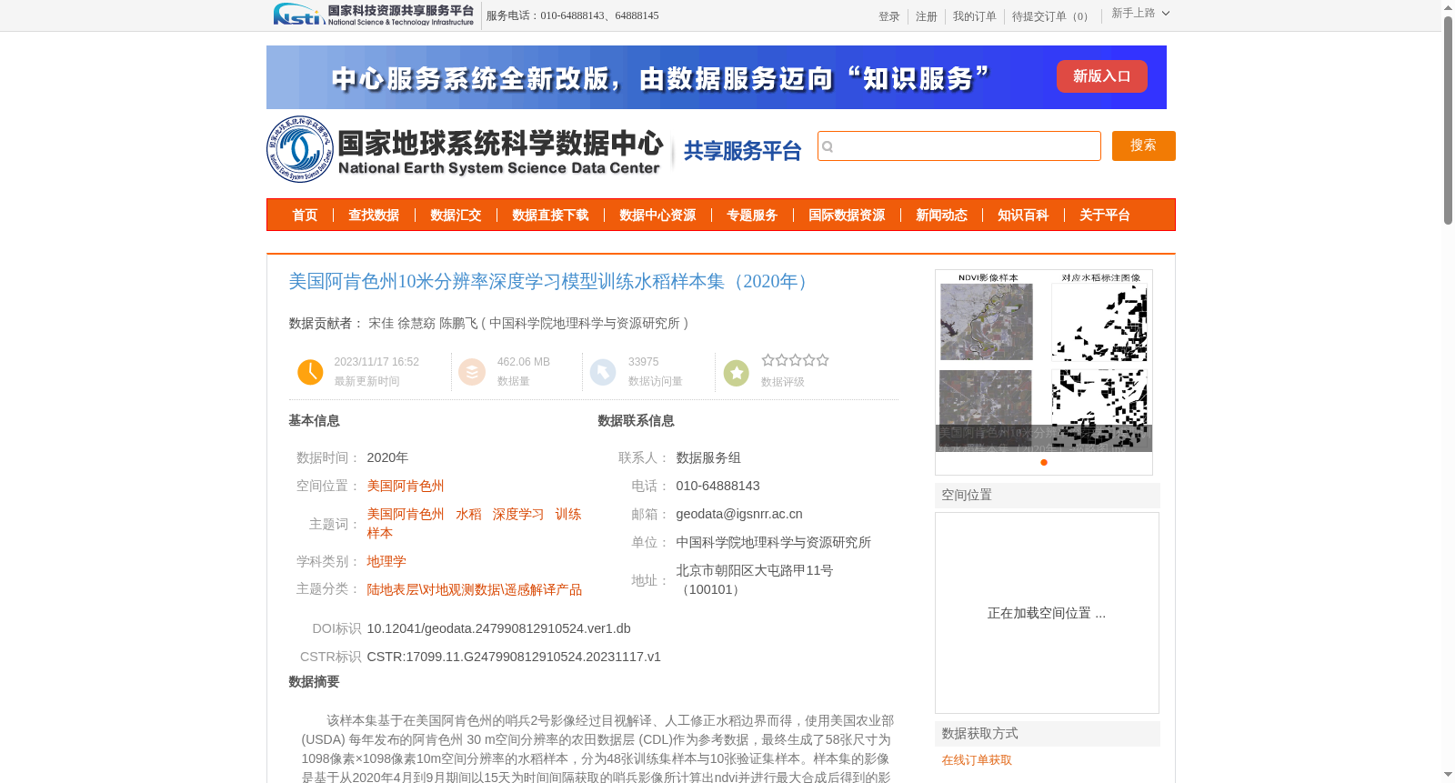
该样本集基于在美国阿肯色州的哨兵2号影像经过目视解译、人工修正水稻边界而得,使用美国农业部 (USDA) 每年发布的阿肯色州 30 m空间分辨率的农田数据层 (CDL)作为参考数据,最终生成了58张尺寸为1098像素×1098像素10m空间分辨率的水稻样本,分为48张训练集样本与10张验证集样本。样本集的影像是基于从2020年4月到9月期间以15天为时间间隔获取的哨兵影像所计算出ndvi并进行最大合成后得到的影像。
This dataset is developed from Sentinel-2 imagery acquired over Arkansas, USA, where rice field boundaries were delineated through visual interpretation and manual correction. The annually released 30 m spatial resolution Cropland Data Layer (CDL) for Arkansas from the United States Department of Agriculture (USDA) was used as reference data. Ultimately, 58 rice field samples were generated, each with a size of 1098 × 1098 pixels and 10 m spatial resolution, split into 48 training samples and 10 validation samples. The imagery of this dataset is produced as maximum NDVI composite images calculated from Sentinel-2 imagery captured at 15-day intervals between April and September 2020.
提供机构:
中国科学院地理科学与资源研究所
创建时间:
2023-11-17
搜集汇总
数据集介绍
背景与挑战
背景概述
该数据集是针对美国阿肯色州2020年水稻识别而构建的深度学习训练样本集,包含58张10米空间分辨率的样本图像(48张训练集和10张验证集),基于哨兵2号影像通过人工目视解译和修正生成,用于提升深度学习模型在水稻提取任务中的精度和可靠性。
以上内容由遇见数据集搜集并总结生成


