2020年中国海岸带10m土地覆盖遥感制图
收藏地球大数据科学工程2024-06-15 收录
下载链接:
https://data.casearth.cn/sdo/detail/66693de6819aec0d5564a42a
下载链接
链接失效反馈官方服务:
资源简介:
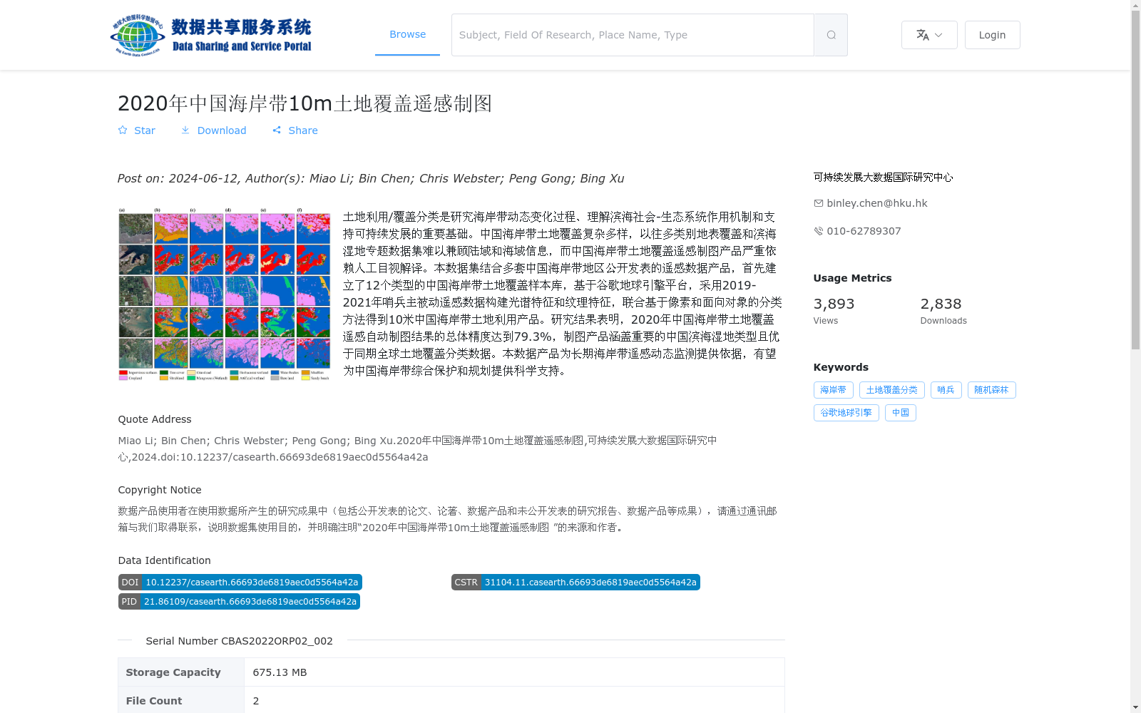
土地利用/覆盖分类是研究海岸带动态变化过程、理解滨海社会-生态系统作用机制和支持可持续发展的重要基础。中国海岸带土地覆盖复杂多样,以往多类别地表覆盖和滨海湿地专题数据集难以兼顾陆域和海域信息,而中国海岸带土地覆盖遥感制图产品严重依赖人工目视解译。本数据集结合多套中国海岸带地区公开发表的遥感数据产品,首先建立了12个类型的中国海岸带土地覆盖样本库,基于谷歌地球引擎平台,采用2019-2021年哨兵主被动遥感数据构建光谱特征和纹理特征,联合基于像素和面向对象的分类方法得到10米中国海岸带土地利用产品。研究结果表明,2020年中国海岸带土地覆盖遥感自动制图结果的总体精度达到79.3%,制图产品涵盖重要的中国滨海湿地类型且优于同期全球土地覆盖分类数据。本数据产品为长期海岸带遥感动态监测提供依据,有望为中国海岸带综合保护和规划提供科学支持。
Land use/cover classification is a fundamental basis for studying the dynamic changes of coastal zones, understanding the operational mechanisms of coastal social-ecological systems, and supporting sustainable development. China's coastal zones have complex and diverse land covers. Previously, multi-category land cover and coastal wetland thematic datasets struggled to balance terrestrial and marine information, while remote sensing mapping products for China's coastal land covers heavily relied on manual visual interpretation. This dataset integrates multiple publicly available remote sensing data products from China's coastal zones. Firstly, a sample database of China's coastal land covers with 12 categories was established. Based on the Google Earth Engine platform, spectral and textural features were constructed using Sentinel active and passive remote sensing data from 2019 to 2021, and a 10-meter resolution China's coastal land use product was generated via combined pixel-based and object-oriented classification methods. The research results show that the overall accuracy of the remote sensing automatic mapping results for China's coastal land covers in 2020 reached 79.3%. The mapping product covers important coastal wetland types in China and outperforms global land cover classification data from the same period. This data product provides a basis for long-term remote sensing dynamic monitoring of coastal zones, and is expected to offer scientific support for the comprehensive conservation and planning of China's coastal zones.
提供机构:
可持续发展大数据国际研究中心
搜集汇总
数据集介绍
背景与挑战
背景概述
该数据集是一个2020年中国海岸带10米空间分辨率的土地覆盖遥感制图产品,基于2019-2021年哨兵主被动遥感数据,采用光谱和纹理特征及联合分类方法生成,涵盖12种土地覆盖类型(包括林地、耕地、湿地等),总体分类精度达79.3%,优于同期全球数据,旨在支持海岸带动态监测和可持续发展规划。
以上内容由遇见数据集搜集并总结生成


