明清以来长江口河势与等盐度线主轴时空演变特征数据集
收藏国家地球系统科学数据中心2025-03-28 更新2025-03-29 收录
下载链接:
https://www.geodata.cn/data/datadetails.html?dataguid=107295915881943&docId=1772
下载链接
链接失效反馈官方服务:
资源简介:
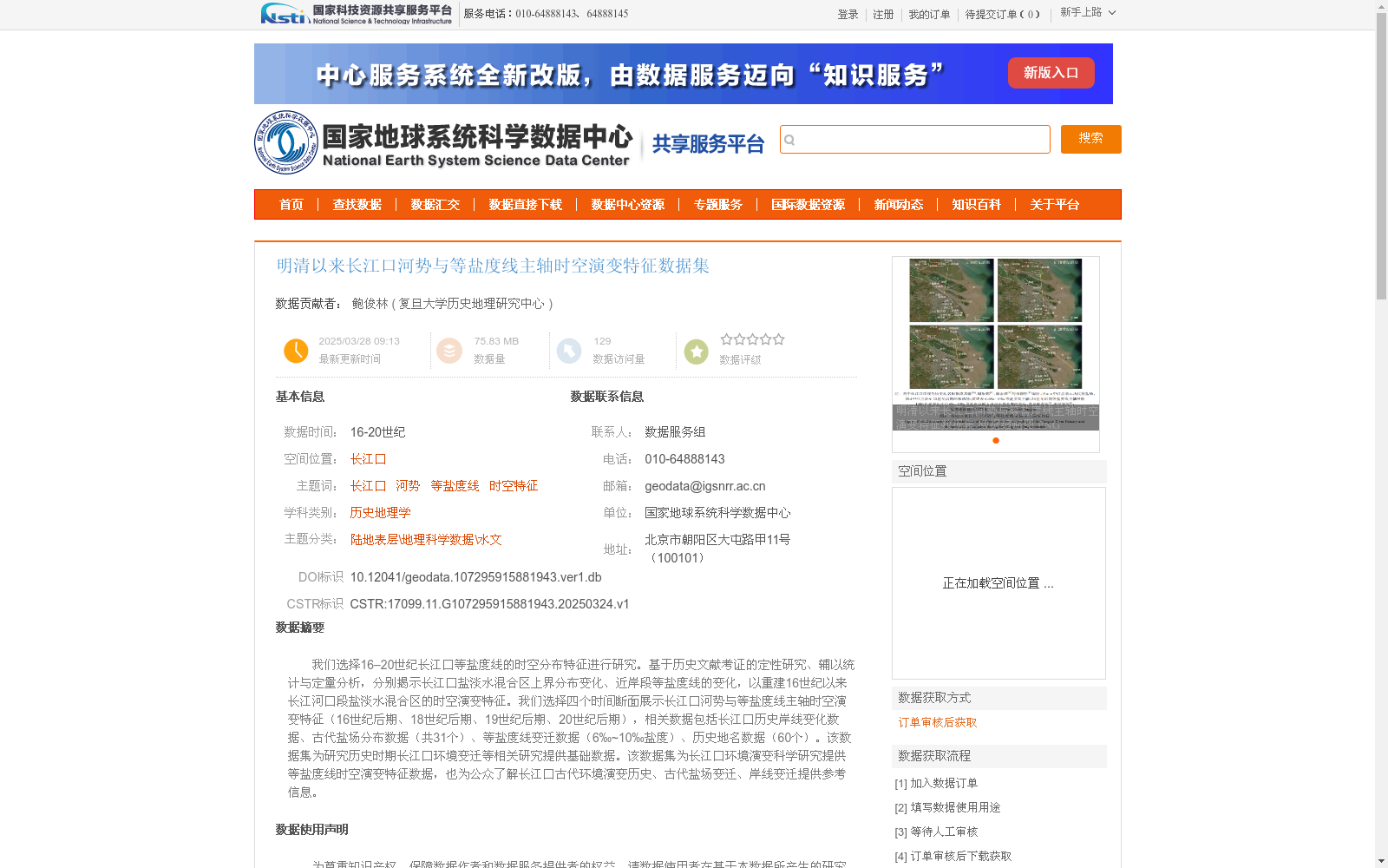
我们选择16–20世纪长江口等盐度线的时空分布特征进行研究。基于历史文献考证的定性研究、辅以统计与定量分析,分别揭示长江口盐淡水混合区上界分布变化、近岸段等盐度线的变化,以重建16世纪以来长江河口段盐淡水混合区的时空演变特征。我们选择四个时间断面展示长江口河势与等盐度线主轴时空演变特征(16世纪后期、18世纪后期、19世纪后期、20世纪后期),相关数据包括长江口历史岸线变化数据、古代盐场分布数据(共31个)、等盐度线变迁数据(6‰~10‰盐度)、历史地名数据(60个)。该数据集为研究历史时期长江口环境变迁等相关研究提供基础数据。该数据集为长江口环境演变科学研究提供等盐度线时空演变特征数据,也为公众了解长江口古代环境演变历史、古代盐场变迁、岸线变迁提供参考信息。
We selected the spatiotemporal distribution characteristics of isohalines in the Yangtze Estuary from the 16th to the 20th century as the research focus. Based on qualitative research via historical literature textual criticism, supplemented by statistical and quantitative analyses, we revealed the distribution changes of the upper boundary of the salt-fresh water mixing zone and the variations of nearshore isohalines in the Yangtze Estuary, thereby reconstructing the spatiotemporal evolution characteristics of the salt-fresh water mixing zone in the Yangtze Estuary since the 16th century. We chose four time sections to showcase the spatiotemporal evolution characteristics of the river regime and the main axis of isohalines in the Yangtze Estuary: late 16th century, late 18th century, late 19th century, and late 20th century. The relevant datasets cover historical coastline change data of the Yangtze Estuary, ancient salt farm distribution data (31 in total), isohaline evolution data corresponding to salinity ranging from 6‰ to 10‰, and historical place name data (60 in total). This dataset provides fundamental data for relevant studies including environmental changes of the Yangtze Estuary during historical periods. It offers data on the spatiotemporal evolution characteristics of isohalines for scientific research on the environmental evolution of the Yangtze Estuary, and also provides reference information for the public to learn about the historical environmental evolution, ancient salt farm changes, and coastline changes of the Yangtze Estuary.
提供机构:
复旦大学历史地理研究中心
创建时间:
2025-03-24
搜集汇总
数据集介绍
背景与挑战
背景概述
该数据集研究了16-20世纪长江口河势与等盐度线主轴的时空演变特征,包含历史岸线变化、古代盐场分布、等盐度线变迁和历史地名等数据,为研究长江口环境变迁提供了基础数据。数据集采用历史文献考证与定量分析相结合的方法,重建了长江口盐淡水混合区的时空演变特征。
以上内容由遇见数据集搜集并总结生成


