2046-2065年青藏高原地区在不同RCP情景下未来水资源时空分布数据集
收藏地球大数据科学工程2024-03-04 收录
下载链接:
https://data.casearth.cn/sdo/detail/6542052a819aec3beb19bb2b
下载链接
链接失效反馈官方服务:
资源简介:
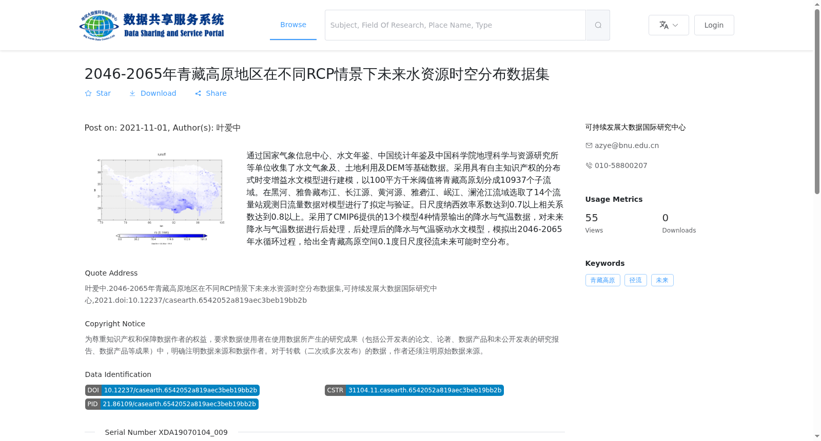
通过国家气象信息中心、水文年鉴、中国统计年鉴及中国科学院地理科学与资源研究所等单位收集了水文气象及、土地利用及DEM等基础数据。采用具有自主知识产权的分布式时变增益水文模型进行建模,以100平方千米阈值将青藏高原划分成10937个子流域。在黑河、雅鲁藏布江、长江源、黄河源、雅砻江、岷江、澜沧江流域选取了14个流量站观测日流量数据对模型进行了拟定与验证。日尺度纳西效率系数达到0.7以上相关系数达到0.8以上。采用了CMIP6提供的13个模型4种情景输出的降水与气温数据,对未来降水与气温数据进行后处理,后处理后的降水与气温驱动水文模型,模拟出2046-2065年水循环过程,给出全青藏高原空间0.1度日尺度径流未来可能时空分布。
Basic data including hydrometeorological, land use and DEM were collected from the National Meteorological Information Center, Hydrological Yearbook, China Statistical Yearbook, Institute of Geographic Sciences and Natural Resources Research, Chinese Academy of Sciences and other relevant institutions. A distributed time-variant gain hydrological model with independent intellectual property rights was adopted for modeling, and the Qinghai-Tibet Plateau was divided into 10,937 sub-basins with a threshold of 100 km². Daily streamflow data from 14 gauging stations located in the basins of Heihe River, Yarlung Zangbo River, source regions of the Yangtze River and Yellow River, Yalong River, Minjiang River and Lancang River were used for model calibration and validation. The Nash-Sutcliffe Efficiency coefficient on daily scale reached above 0.7, and the correlation coefficient reached above 0.8. Precipitation and temperature data from 13 CMIP6 models under 4 emission scenarios were utilized, and the future precipitation and temperature data were post-processed. The hydrological model was driven by the post-processed precipitation and temperature data to simulate the water cycle during 2046–2065, and the potential future spatiotemporal distribution of daily-scale runoff at 0.1° spatial resolution across the entire Qinghai-Tibet Plateau was obtained.
提供机构:
可持续发展大数据国际研究中心
搜集汇总
数据集介绍
背景与挑战
背景概述
该数据集提供了2046-2065年青藏高原地区在不同RCP情景下的未来水资源时空分布,基于CMIP6模型和分布式水文模型模拟,空间分辨率为0.1度,时间分辨率为日尺度,适用于气候变化和水资源管理研究。
以上内容由遇见数据集搜集并总结生成


