青藏高原30米分辨率植被图(1990-2020)
收藏国家青藏高原科学数据中心2024-06-06 更新2024-07-27 收录
下载链接:
https://data.tpdc.ac.cn/zh-hans/data/0c84a954-435d-45f4-bf42-d561f7c7da2a
下载链接
链接失效反馈官方服务:
资源简介:
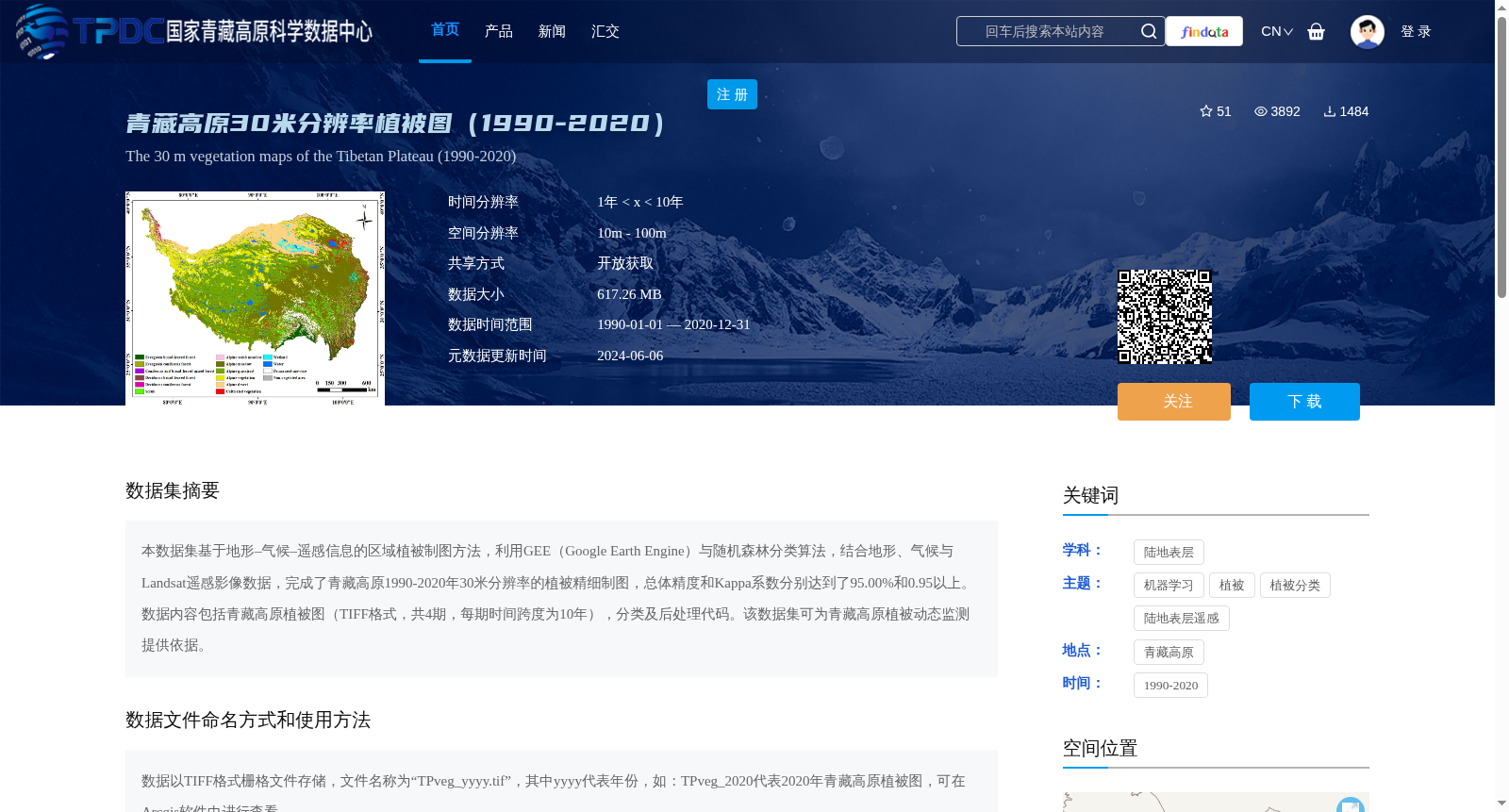
本数据集基于地形–气候–遥感信息的区域植被制图方法,利用GEE(Google Earth Engine)与随机森林分类算法,结合地形、气候与Landsat遥感影像数据,完成了青藏高原1990-2020年30米分辨率的植被精细制图,总体精度和Kappa系数分别达到了95.00%和0.95以上。数据内容包括青藏高原植被图(TIFF格式,共4期,每期时间跨度为10年),分类及后处理代码。该数据集可为青藏高原植被动态监测提供依据。
This dataset is developed based on the regional vegetation mapping method integrating topographic, climatic and remote sensing information. Leveraging Google Earth Engine (GEE) and the random forest classification algorithm, alongside topographic, climatic and Landsat remote sensing datasets, it produced fine-scale vegetation maps at 30-meter resolution across the Qinghai-Tibet Plateau for the period 1990–2020, achieving an overall accuracy of 95.00% and a Kappa coefficient of ≥0.95. The dataset includes vegetation maps of the Qinghai-Tibet Plateau (in TIFF format, 4 temporal periods in total, with each period spanning a 10-year interval), as well as classification and post-processing code scripts. This dataset provides a reliable basis for dynamic vegetation monitoring over the Qinghai-Tibet Plateau.
提供机构:
任鸿瑞,武帆,周广胜
创建时间:
2024-03-13
搜集汇总
数据集介绍
背景与挑战
背景概述
该数据集提供了1990-2020年间青藏高原30米分辨率的植被精细制图,基于GEE和随机森林分类算法生成,总体精度达95%以上。数据以TIFF格式存储,适用于植被动态监测研究,并需按规定引用相关文献和数据来源。
以上内容由遇见数据集搜集并总结生成


