青藏地区高等级公路沿线道路、桥梁及冻土分布
收藏国家青藏高原科学数据中心2025-03-07 更新2025-03-29 收录
下载链接:
https://data.tpdc.ac.cn/zh-hans/data/1d880769-3901-4bdf-848e-adae5c769a4d
下载链接
链接失效反馈官方服务:
资源简介:
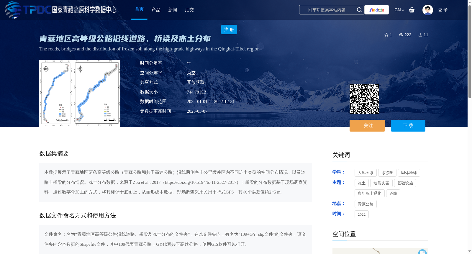
本数据展示了青藏地区两条高等级公路(青藏公路和共玉高速公路)沿线两侧各十公里缓冲区内不同冻土类型的空间分布情况,以及道路上桥梁的分布情况。冻土分布数据,来源于Zou et al., 2017(https://doi.org/10.5194/tc-11-2527-2017);桥梁的分布数据基于现场调查资料,通过数字化加工的方式,将其标记于底图上,从而形成本数据。现场调查采用民用手持式GPS,其水平误差值约2~5 m。
This dataset depicts the spatial distribution of various permafrost types within 10-kilometer buffer zones on both sides along two high-grade highways (Qinghai-Tibet Highway and Gongyu Expressway) in the Qinghai-Tibet Plateau region, alongside the distribution of bridges on these roads. The permafrost distribution data is sourced from Zou et al., 2017 (https://doi.org/10.5194/tc-11-2527-2017); the bridge distribution data was developed based on field survey records, which were digitized and marked on the base map to generate this dataset. The field survey utilized civilian handheld GPS devices, with a horizontal error of approximately 2–5 m.
提供机构:
蒋观利,高思如
创建时间:
2024-01-02
搜集汇总
数据集介绍
背景与挑战
背景概述
本数据集聚焦青藏地区高等级公路(青藏公路和共玉高速公路)沿线,提供了2022年沿线两侧十公里缓冲区内冻土类型和桥梁的空间分布数据。冻土数据来源于已有研究,桥梁数据基于现场调查并数字化加工,数据以Shapefile格式存储,需使用GIS软件处理。数据集适用于人地关系、冰冻圈和基础设施相关研究,支持开放获取。
以上内容由遇见数据集搜集并总结生成


