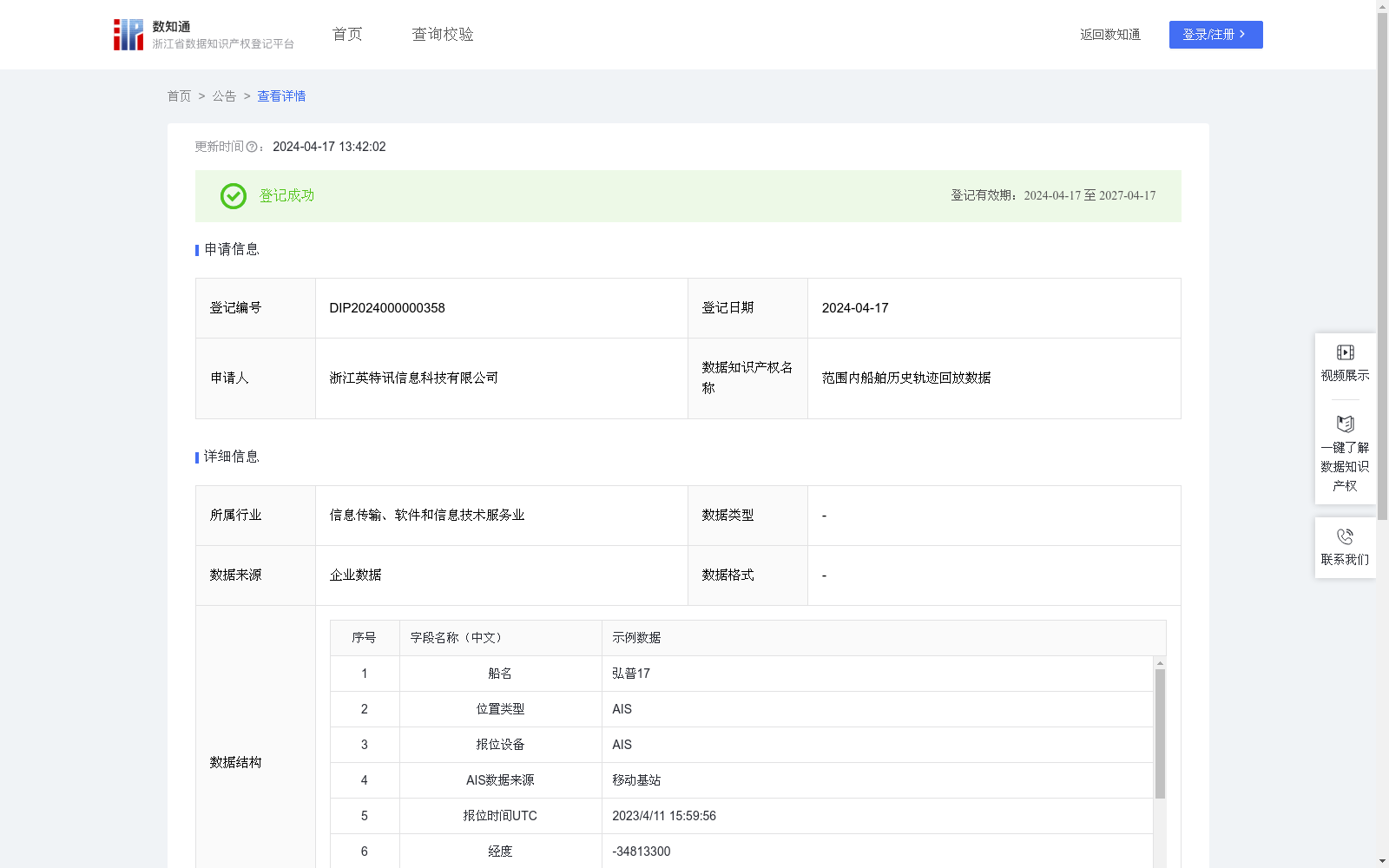
范围内船舶历史轨迹回放数据
收藏浙江省数据知识产权登记平台2024-04-17 更新2024-05-08 收录
下载链接:
https://www.zjip.org.cn/home/announce/trends/32521
下载链接
链接失效反馈官方服务:
资源简介:
当船舶出现事故时,比如两船相撞,可通过事发前一段时间在事故地点附件出现的船只做轨迹回放,动态呈现当时的场景1、数据采集:通过安装在船端的移动基站和卫星网络采集全球船舶的纬度、经度及船舶静态信息。并根据航速是否合理过滤掉跳点和冒用的数据,将清洗过的数据存入全球船舶位置数据库表格。
2、数据更新:收到新船位后,替换掉当前船位数据表格中的数据。
3、数据展示:在海图上以事故地点(用户在海图上选择)为中心,画边长为10海里的正方形区域。
4、将全球船舶位置数据与正方形四顶点的经纬度比较,半个小时内(用户可调整)在正方形内出现过的船只(经纬度点在正方形四个顶点之间的),按照时间轴动态地显示在海图上,并按照一定比例加速呈现,动态再现事故发生过程。
When a maritime accident occurs, such as a collision between two vessels, trajectory playback can be performed using ships that appeared near the accident site during a period prior to the incident to dynamically reproduce the scene at that time.
1. Data Collection: Collect latitude, longitude and static information of global ships via shipborne mobile base stations and satellite networks. Filter out jump points and spoofed data based on the rationality of ship speed, and store the cleaned data into a global ship position database table.
2. Data Update: Upon receiving new ship position reports, replace the corresponding records in the current ship position data table.
3. Data Visualization: Draw a square area with a side length of 10 nautical miles on the nautical chart, taking the accident site (selected by the user on the nautical chart) as the center.
4. Compare the global ship position data with the latitude and longitude of the four vertices of the square. Within 30 minutes (adjustable by the user), ships that have appeared within the square (whose longitude and latitude points lie within the bounds of the square) will be dynamically displayed on the nautical chart along the timeline, and presented at an accelerated rate according to a certain proportion to dynamically reproduce the accident occurrence process.
提供机构:
浙江英特讯信息科技有限公司
创建时间:
2024-01-29
搜集汇总
数据集介绍
以上内容由遇见数据集搜集并总结生成


