交通廊道(100m-1km,年)生态风险评估图(2022-2024)
收藏国家青藏高原科学数据中心2025-04-15 更新2025-04-26 收录
下载链接:
https://data.tpdc.ac.cn/zh-hans/data/da7a2654-97d6-4715-8014-a6343b73d458
下载链接
链接失效反馈官方服务:
资源简介:
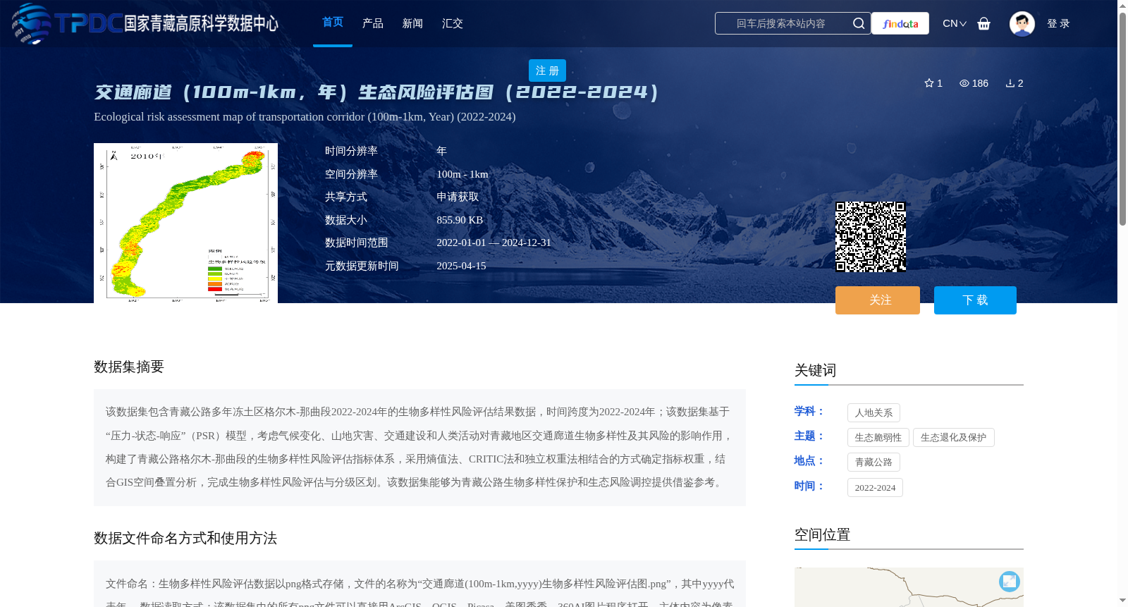
该数据集包含青藏公路多年冻土区格尔木-那曲段2022-2024年的生物多样性风险评估结果数据,时间跨度为2022-2024年;该数据集基于“压力-状态-响应”(PSR)模型,考虑气候变化、山地灾害、交通建设和人类活动对青藏地区交通廊道生物多样性及其风险的影响作用,构建了青藏公路格尔木-那曲段的生物多样性风险评估指标体系,采用熵值法、CRITIC法和独立权重法相结合的方式确定指标权重,结合GIS空间叠置分析,完成生物多样性风险评估与分级区划。该数据集能够为青藏公路生物多样性保护和生态风险调控提供借鉴参考。
This dataset contains biodiversity risk assessment results for the Golmud-Nagqu section of the Qinghai-Tibet Highway within the permafrost region, spanning the period from 2022 to 2024. Built upon the Pressure-State-Response (PSR) model, this dataset accounts for the impacts of climate change, mountain hazards, transportation construction and human activities on the biodiversity and associated risks of the transport corridor in the Qinghai-Tibet area, and constructs a biodiversity risk assessment index system for the Golmud-Nagqu section of the Qinghai-Tibet Highway. The index weights were determined using a combined framework of the Entropy Weight Method, CRITIC Method and Independent Weight Method, and biodiversity risk assessment and hierarchical zoning were completed in conjunction with GIS spatial overlay analysis. This dataset can provide reliable references for biodiversity conservation and ecological risk regulation of the Qinghai-Tibet Highway.
提供机构:
韩用顺,王云
创建时间:
2025-03-06
搜集汇总
数据集介绍
背景与挑战
背景概述
该数据集为青藏公路格尔木-那曲段2022-2024年的生物多样性风险评估结果,基于PSR模型构建评估指标体系,采用多种权重确定方法和GIS空间分析技术,数据以png格式存储,适用于ArcGIS等软件打开。数据集旨在为青藏公路生物多样性保护和生态风险调控提供参考。
以上内容由遇见数据集搜集并总结生成


