2015年中国西部冰湖编目数据集
收藏Mendeley Data2024-01-31 更新2024-06-27 收录
下载链接:
https://www.scidb.cn/en/detail?dataSetId=633694461079060482
下载链接
链接失效反馈官方服务:
资源简介:
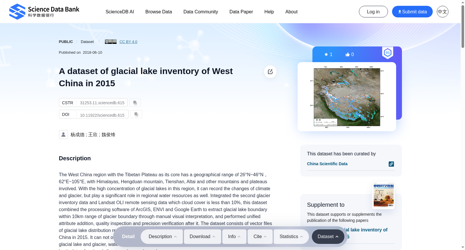
The West China region with the Tibetan Plateau as its core has a geographical range of 26°N~46°N,62°E~105°E, with Himalayas, Hengduan mountain, Tienshan, Altai and other mountains and plateaus involved. With the high concentration of glacial lakes in this region, it can record the changes of climate and glacier, but play a significant role in regional water resources as well. Integrated the second glacier inventory data and Landsat OLI remote sensing data which cloud cover is less than 10%, this dataset combined the processing software of ArcGIS, ENVI and Google Earth to extract glacial lake boundary within 10km range of glacier boundary through manual visual interpretation, and performed unified attribute addition, quality inspection and precision verification after it. The dataset consists of vector files of glacial lake distribution region derived from glacier inventory data and the glacial lake inventory of West China in 2015. It can not only be the reference data for the study of the coupling relationship between glacial lake and glacier, water resource usage and management in West China, but also be used as the basic data of regional climate and cryosphere change.
以青藏高原为核心的中国西部地区,地理范围为北纬26°~46°、东经62°~105°,涵盖喜马拉雅山脉、横断山脉、天山、阿尔泰山等山地与高原地貌单元。该区域冰川湖泊分布高度集中,不仅可用于记录气候与冰川变化,同时对区域水资源安全具有重要意义。本数据集整合第二次冰川编目数据与云量低于10%的Landsat OLI遥感数据,借助ArcGIS、ENVI及Google Earth等工具软件,通过人工目视解译提取冰川边界10公里范围内的冰川湖泊边界,并在提取完成后统一开展属性赋值、质量核查与精度验证工作。数据集包含由冰川编目数据衍生的冰川湖泊分布矢量文件,以及2015年中国西部冰川湖泊编目数据。该数据集既可作为中国西部冰川湖泊与冰川耦合关系研究、水资源利用与管理的参考依据,也可作为区域气候与冰冻圈变化研究的基础数据资料。
创建时间:
2024-01-31
搜集汇总
数据集介绍
背景与挑战
背景概述
该数据集包含2015年中国西部冰湖的分布矢量文件,用于研究冰湖与冰川的耦合关系、水资源利用及区域气候变化。数据集基于Landsat OLI遥感数据和冰川编目数据,通过人工视觉解译和软件处理完成,具有较高的精度和可靠性。
以上内容由遇见数据集搜集并总结生成


