中国高分辨率国家土壤信息格网基本属性数据集_90米土壤厚度(2010-2018)
收藏国家地球系统科学数据中心2022-03-15 更新2024-03-04 收录
下载链接:
https://www.geodata.cn/data/datadetails.html?dataguid=72011393607093&docId=9847
下载链接
链接失效反馈官方服务:
资源简介:
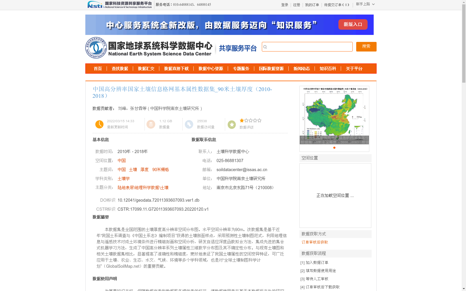
本数据集是全国范围的土壤厚度高分辨率空间分布图。水平空间分辨率为90m。该数据集是基于近年“我国土系调查与《中国土系志》编制项目”获得的土壤剖面样点,采用预测性土壤制图范式,利用地理信息与遥感技术对成土环境条件进行精细刻画和空间分析,研发自适应深度函数拟合方法,集成先进的集合式机器学习方法,生成了中国高分辨率系列土壤属性三维数字分布图及其不确定性分布。与现有土壤图和相关土壤数据集相比,显著提高了准确性和精细度,更好地表征了我国土壤属性的空间变异特征,可广泛应用于土壤、农业、生态、水文、气候、环境等多个学科领域,也是对“全球土壤制图科学计划”(GlobalSoilMap.net)的重要贡献。
This dataset is a high-resolution spatial distribution map of national-scale soil thickness, with a horizontal spatial resolution of 90 meters. It is developed based on soil profile sampling points obtained from the recent project "National Soil Series Survey and Compilation of Soil Series Annals of China". Adopting the predictive soil mapping paradigm, this work utilized geographic information and remote sensing technologies to finely characterize soil-forming environmental conditions and conduct spatial analysis, developed an adaptive deep function fitting method integrated with advanced ensemble machine learning approaches, and generated high-resolution three-dimensional digital distribution maps of a series of soil properties across China, along with their corresponding uncertainty distributions. Compared with existing soil maps and related soil datasets, this product significantly enhances both accuracy and spatial detail, better characterizes the spatial variability of soil properties in China, and can be widely applied across multiple disciplines including soil science, agriculture, ecology, hydrology, climatology and environmental science. It also constitutes an important contribution to the GlobalSoilMap.net Global Soil Mapping Initiative.
提供机构:
中国科学院南京土壤研究所创建时间:
2022-01-20
搜集汇总
数据集介绍
背景与挑战
背景概述
该数据集是中国高分辨率土壤厚度空间分布图,覆盖2010年至2018年,水平空间分辨率为90米,基于全国土壤剖面调查数据,采用先进的预测性土壤制图方法和机器学习技术生成。与现有数据相比,它显著提高了准确性和精细度,能更好地表征中国土壤属性的空间变异特征,适用于土壤学、农业、生态学等多个学科领域的研究和应用。
以上内容由遇见数据集搜集并总结生成

暂无相关数据集


