青藏高原陆路交通走廊路域范围入侵植物分布数据
收藏国家青藏高原科学数据中心2024-08-20 更新2024-09-14 收录
下载链接:
https://data.tpdc.ac.cn/zh-hans/data/d690a3bb-049c-4a7d-972f-e851a4220349
下载链接
链接失效反馈官方服务:
资源简介:
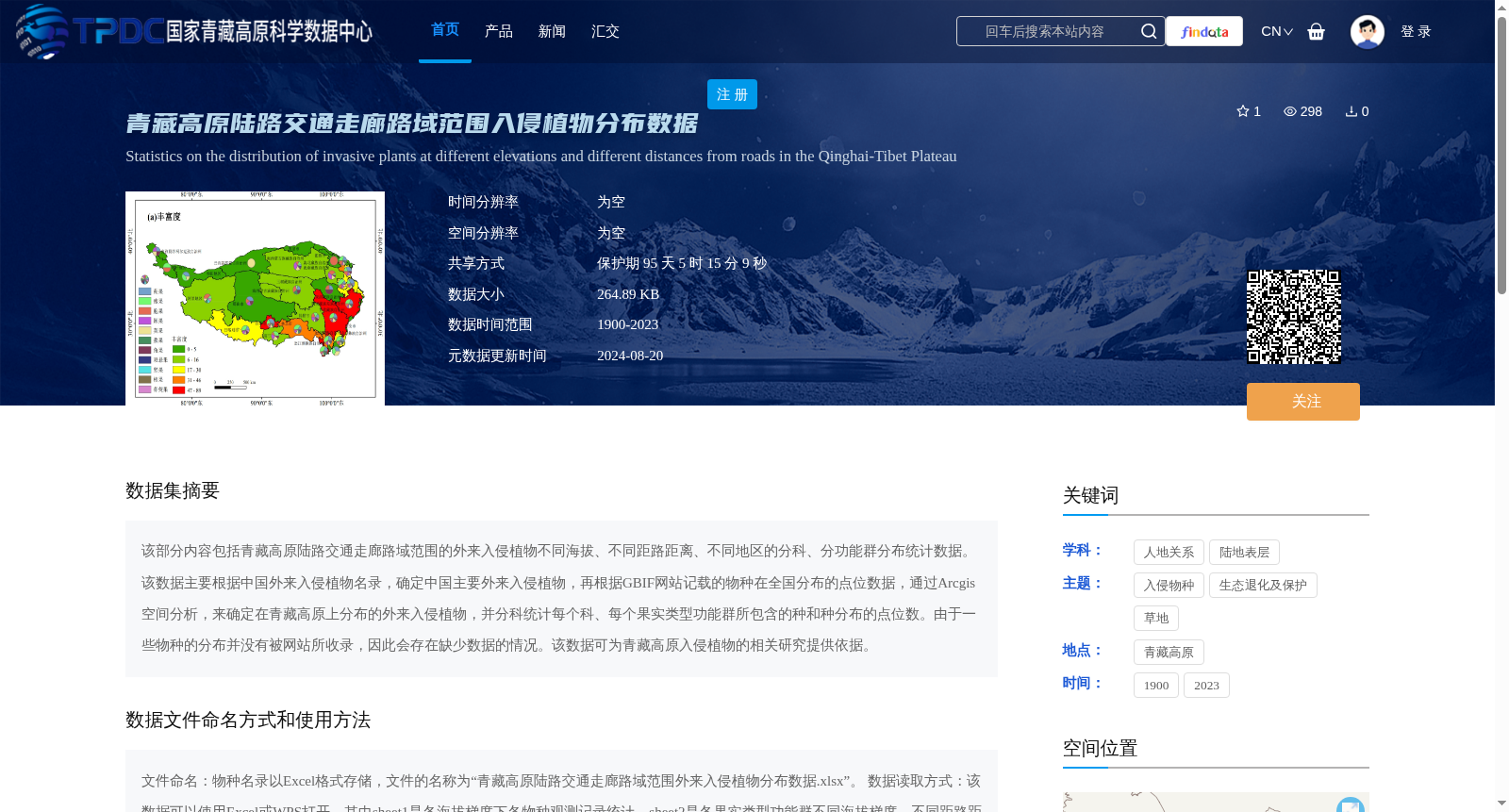
该部分内容包括青藏高原陆路交通走廊路域范围的外来入侵植物不同海拔、不同距路距离、不同地区的分科、分功能群分布统计数据。该数据主要根据中国外来入侵植物名录,确定中国主要外来入侵植物,再根据GBIF网站记载的物种在全国分布的点位数据,通过Arcgis空间分析,来确定在青藏高原上分布的外来入侵植物,并分科统计每个科、每个果实类型功能群所包含的种和种分布的点位数。由于一些物种的分布并没有被网站所收录,因此会存在缺少数据的情况。该数据可为青藏高原入侵植物的相关研究提供依据。
This section presents statistical data on the distribution of alien invasive plants within the road zones of land transportation corridors on the Qinghai-Tibet Plateau, categorized by plant family and functional group, with breakdowns across different elevation levels, distances to roads, and regional groups. This dataset first identifies major alien invasive plant species in China using the *China National List of Alien Invasive Plants*, then acquires national species occurrence records from the GBIF website, and employs ArcGIS spatial analysis to confirm which of these species are distributed on the Qinghai-Tibet Plateau. It then counts the quantity of species and their respective occurrence points for each plant family and each fruit-type functional group. Data gaps may exist as the occurrence records of some species are not included in the GBIF database. This dataset can provide a reliable scientific basis for relevant studies on invasive plants on the Qinghai-Tibet Plateau.
提供机构:
李愈哲
创建时间:
2024-08-13
搜集汇总
数据集介绍
背景与挑战
背景概述
该数据集统计了青藏高原陆路交通走廊路域范围内外来入侵植物的分布情况,涵盖不同海拔、距路距离和地区,并分科和功能群进行数据分析。数据基于中国入侵植物名录和GBIF点位,通过Arcgis空间分析生成,以Excel格式提供,包括物种观测记录和丰富度统计,可用于青藏高原入侵植物相关研究,但可能存在数据缺失。
以上内容由遇见数据集搜集并总结生成


