黄土高原1:500万地理要素数据集(2000、2020年)
收藏国家地球系统科学数据中心2024-10-25 更新2024-10-26 收录
下载链接:
https://www.geodata.cn/data/datadetails.html?dataguid=14955480171164&docId=2302
下载链接
链接失效反馈官方服务:
资源简介:
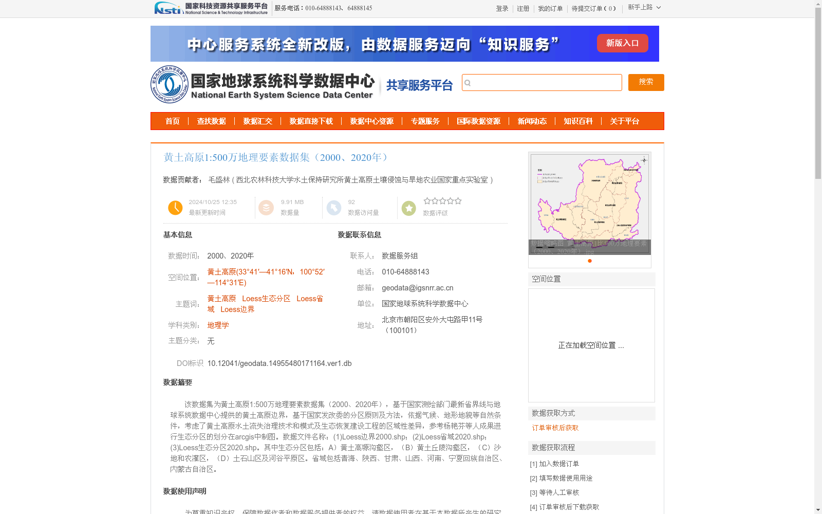
该数据集为黄土高原1:500万地理要素数据集(2000、2020年),基于国家测绘部门最新省界线与地球系统数据中心提供的黄土高原边界,基于国家发改委的分区原则及方法,依据气候、地形地貌等自然条件,考虑了黄土高原水土流失治理技术和模式及生态恢复建设工程的区域性差异,参考杨艳芬等人成果进行生态分区的划分在arcgis中制图。数据文件名称:(1)Loess边界2000.shp;(2)Loess省域2020.shp;(3)Loess生态分区2020.shp。其中生态分区包括:A)黄土高塬沟壑区,(B)黄土丘陵沟壑区,(C)沙地和农灌区,(D)土石山区及河谷平原区。省域包括青海、陕西、甘肃、山西、河南、宁夏回族自治区、内蒙古自治区。
This dataset is the 1:5,000,000 geographic feature dataset of the Loess Plateau (for the years 2000 and 2020). It was developed based on the latest provincial boundary data from the national surveying and mapping authorities and the Loess Plateau boundary provided by the Earth System Data Center. Following the zoning principles and methods formulated by the National Development and Reform Commission, taking into account natural conditions such as climate, topography and landform, as well as regional differences in soil and water loss control technologies, models and ecological restoration construction projects across the Loess Plateau, the ecological zoning was conducted with reference to the research results of Yang Yanfen et al., and then mapped in ArcGIS.
The data files are listed as follows: (1) Loess Boundary 2000.shp; (2) Loess Provincial Boundary 2020.shp; (3) Loess Ecological Zoning 2020.shp.
The ecological zoning includes the following categories: (A) Loess Plateau Gully Region, (B) Loess Hilly Gully Region, (C) Sandy Land and Agricultural Irrigation Area, (D) Rocky Mountain and Valley Plain Region.
The involved provincial-level administrative regions cover Qinghai, Shaanxi, Gansu, Shanxi, Henan, Ningxia Hui Autonomous Region, and Inner Mongolia Autonomous Region.
提供机构:
西北农林科技大学水土保持研究所黄土高原土壤侵蚀与旱地农业国家重点实验室
创建时间:
2024-10-25
搜集汇总
数据集介绍
背景与挑战
背景概述
该数据集包含黄土高原2000年和2020年的地理要素数据,涵盖生态分区、省域和边界信息,数据基于自然条件划分,适用于地理学和生态学研究。
以上内容由遇见数据集搜集并总结生成


