2021年全球高分辨率不透水面产品
收藏地球大数据科学工程2024-05-06 收录
下载链接:
https://data.casearth.cn/sdo/detail/6628a088819aec27fa7d0eea
下载链接
链接失效反馈官方服务:
资源简介:
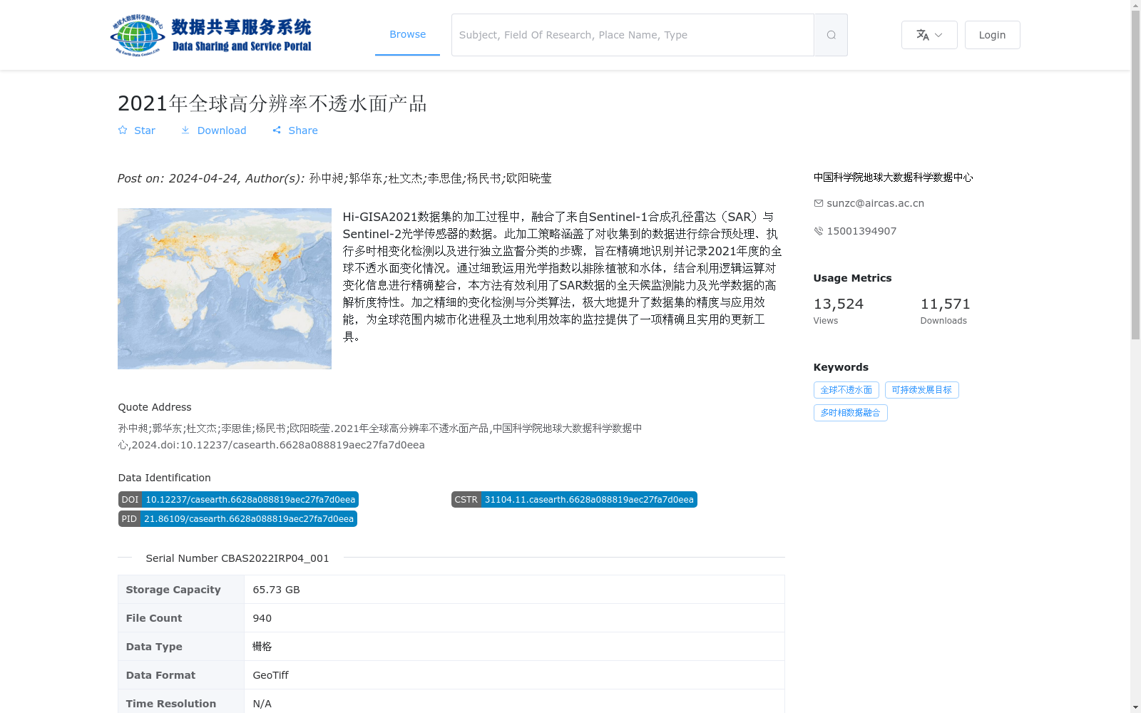
Hi-GISA2021数据集的加工过程中,融合了来自Sentinel-1合成孔径雷达(SAR)与Sentinel-2光学传感器的数据。此加工策略涵盖了对收集到的数据进行综合预处理、执行多时相变化检测以及进行独立监督分类的步骤,旨在精确地识别并记录2021年度的全球不透水面变化情况。通过细致运用光学指数以排除植被和水体,结合利用逻辑运算对变化信息进行精确整合,本方法有效利用了SAR数据的全天候监测能力及光学数据的高解析度特性。加之精细的变化检测与分类算法,极大地提升了数据集的精度与应用效能,为全球范围内城市化进程及土地利用效率的监控提供了一项精确且实用的更新工具。
The processing pipeline of the Hi-GISA2021 dataset fuses data from Sentinel-1 Synthetic Aperture Radar (SAR) and Sentinel-2 optical sensors. This processing strategy encompasses three core steps: comprehensive preprocessing of the acquired data, multi-temporal change detection, and independent supervised classification, with the goal of accurately identifying and documenting global impervious surface changes in 2021. By meticulously utilizing optical indices to eliminate vegetation and water bodies, and precisely integrating change information through logical operations, this approach effectively exploits the all-weather monitoring capability of SAR data and the high-resolution features of optical data. Combined with refined change detection and classification algorithms, this work substantially enhances the dataset's accuracy and application utility, providing an accurate and practical updated tool for monitoring global urbanization processes and land use efficiency.
提供机构:
中国科学院地球大数据科学数据中心
搜集汇总
数据集介绍
背景与挑战
背景概述
该数据集是2021年全球高分辨率不透水面产品(Hi-GISA2021),融合了Sentinel-1合成孔径雷达和Sentinel-2光学影像数据,实现了10米分辨率的全球不透水面精确映射。通过多源数据融合和精细的变化检测算法,有效提升了在低密度地区和相似土地类型中的提取精度,为全球城市化进程监测和可持续发展目标研究提供了关键支持。
以上内容由遇见数据集搜集并总结生成


