青藏高原月平均地表蒸散发数据集(2001-2018)
收藏资源简介:
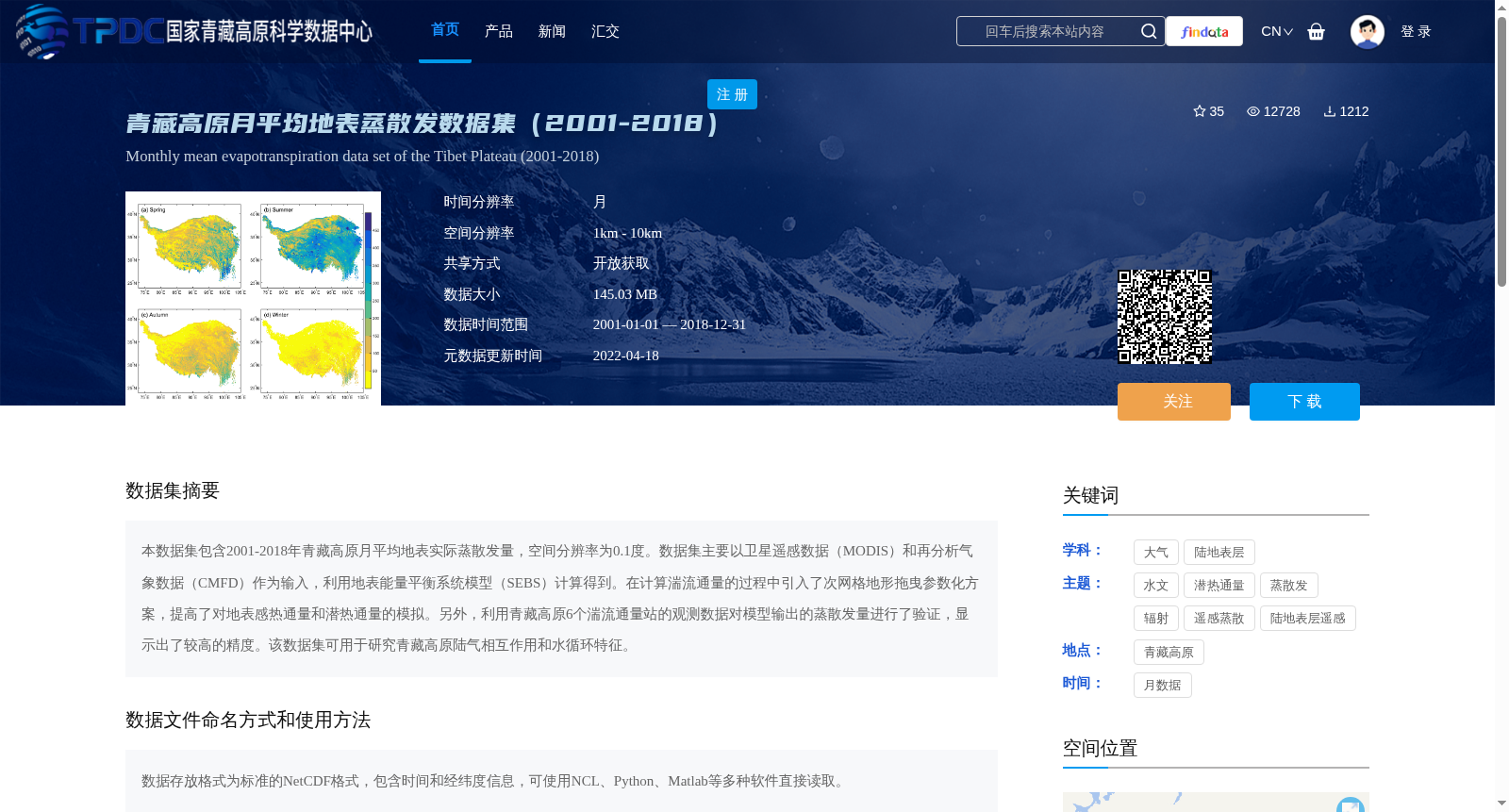
本数据集包含2001-2018年青藏高原月平均地表实际蒸散发量,空间分辨率为0.1度。数据集主要以卫星遥感数据(MODIS)和再分析气象数据(CMFD)作为输入,利用地表能量平衡系统模型(SEBS)计算得到。在计算湍流通量的过程中引入了次网格地形拖曳参数化方案,提高了对地表感热通量和潜热通量的模拟。另外,利用青藏高原6个湍流通量站的观测数据对模型输出的蒸散发量进行了验证,显示出了较高的精度。该数据集可用于研究青藏高原陆气相互作用和水循环特征。
This dataset contains monthly average actual surface evapotranspiration over the Qinghai-Tibet Plateau from 2001 to 2018, with a spatial resolution of 0.1 degrees. It was mainly derived using the Surface Energy Balance System (SEBS) model, taking satellite remote sensing data (MODIS) and reanalysis meteorological data (CMFD) as input sources. A sub-grid terrain drag parameterization scheme was introduced during the turbulent flux calculation process, which improved the simulation of surface sensible heat flux and latent heat flux. In addition, the modeled evapotranspiration was validated using observation data from 6 turbulent flux stations over the Qinghai-Tibet Plateau, demonstrating high accuracy. This dataset can be used to study land-atmosphere interactions and water cycle characteristics over the Qinghai-Tibet Plateau.