中国西北、西藏和周边地区每十年1 km季节冻土最大冻结深度数据集(1961-2020)
收藏国家青藏高原科学数据中心2022-04-15 更新2024-03-06 收录
下载链接:
https://data.tpdc.ac.cn/zh-hans/data/3794b246-515a-4506-85a3-95d092c23f63
下载链接
链接失效反馈官方服务:
资源简介:
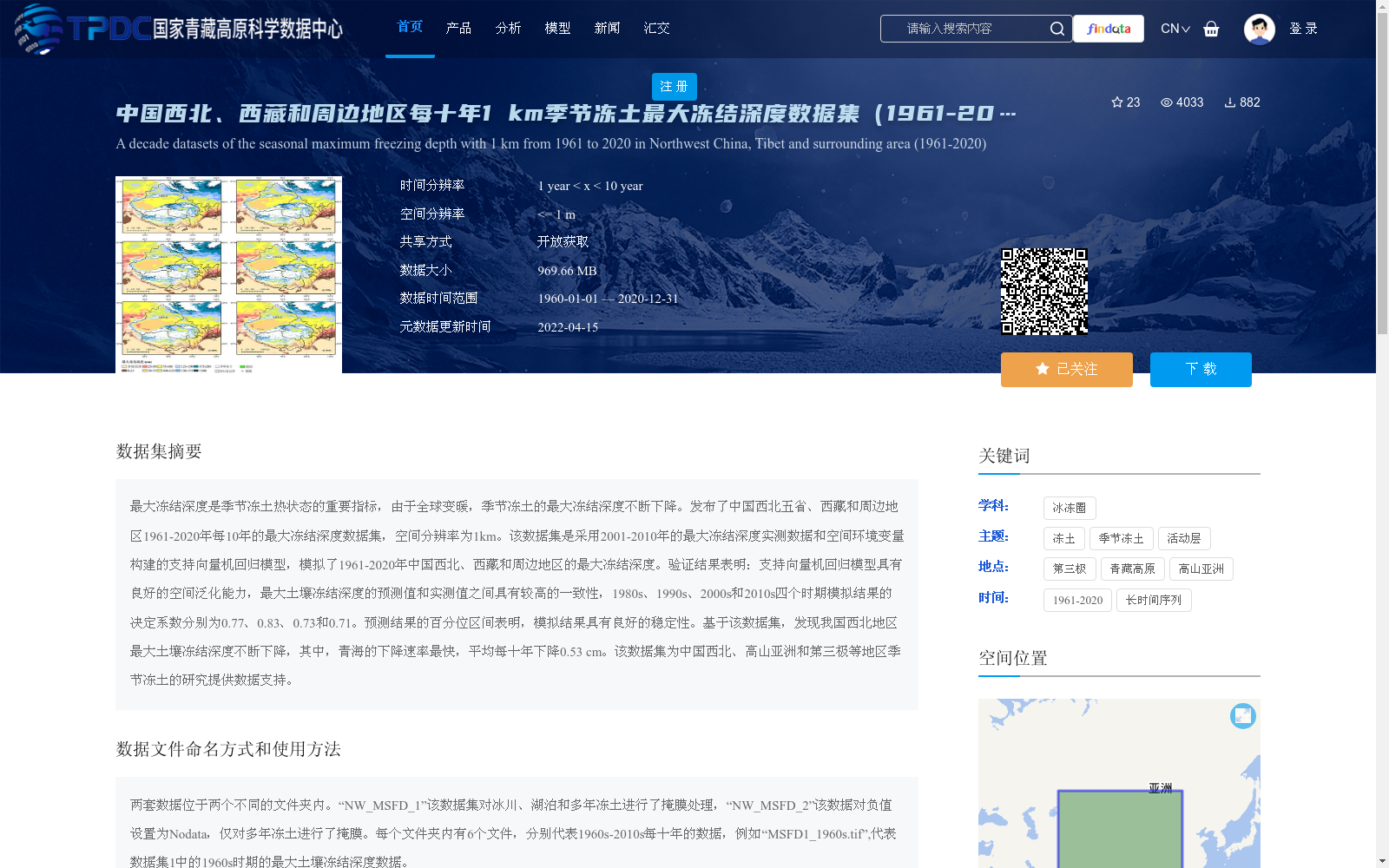
最大冻结深度是季节冻土热状态的重要指标,由于全球变暖,季节冻土的最大冻结深度不断下降。发布了中国西北五省、西藏和周边地区1961-2020年每10年的最大冻结深度数据集,空间分辨率为1km。该数据集是采用2001-2010年的最大冻结深度实测数据和空间环境变量构建的支持向量机回归模型,模拟了1961-2020年中国西北、西藏和周边地区的最大冻结深度。验证结果表明:支持向量机回归模型具有良好的空间泛化能力,最大土壤冻结深度的预测值和实测值之间具有较高的一致性,1980s、1990s、2000s和2010s四个时期模拟结果的决定系数分别为0.77、0.83、0.73和0.71。预测结果的百分位区间表明,模拟结果具有良好的稳定性。基于该数据集,发现我国西北地区最大土壤冻结深度不断下降,其中,青海的下降速率最快,平均每十年下降0.53 cm。该数据集为中国西北、高山亚洲和第三极等地区季节冻土的研究提供数据支持。
Maximum frozen depth is a critical indicator of the thermal regime of seasonally frozen ground. Under global warming, the maximum frozen depth of seasonally frozen ground has been continuously decreasing. We have released a decadal maximum frozen depth dataset for five provinces in Northwest China, Tibet and their surrounding areas, spanning from 1961 to 2020, with a spatial resolution of 1 km. This dataset was developed using support vector machine regression (SVR) models constructed with in-situ measured maximum frozen depth data from 2001 to 2010 and spatial environmental variables, to simulate the maximum frozen depth over Northwest China, Tibet and their surrounding areas during 1961–2020. Validation results demonstrate that the SVR model exhibits excellent spatial generalization ability, with high consistency between the predicted and measured maximum soil frozen depths. The determination coefficients (R²) of the simulation results for the 1980s, 1990s, 2000s and 2010s are 0.77, 0.83, 0.73 and 0.71, respectively. The percentile intervals of the predicted results also indicate that the simulation outcomes have good stability. Based on this dataset, it is found that the maximum soil frozen depth in Northwest China has been continuously decreasing, with Qinghai Province exhibiting the fastest decline rate, at an average of 0.53 cm per decade. This dataset provides valuable data support for research on seasonally frozen ground in Northwest China, High Mountain Asia and the Third Pole regions.
提供机构:
王冰泉,冉有华
创建时间:
2021-10-27
搜集汇总
数据集介绍
背景与挑战
背景概述
该数据集提供了中国西北、西藏及周边地区1961-2020年每十年的季节冻土最大冻结深度数据,空间分辨率为1公里,基于支持向量机回归模型模拟生成,验证显示模型具有较高准确性(决定系数0.71-0.83)。数据集包含两套处理方式不同的文件,用于分析最大冻结深度下降趋势,例如青海地区平均每十年下降0.53厘米,为相关冻土研究提供数据支持。
以上内容由遇见数据集搜集并总结生成


