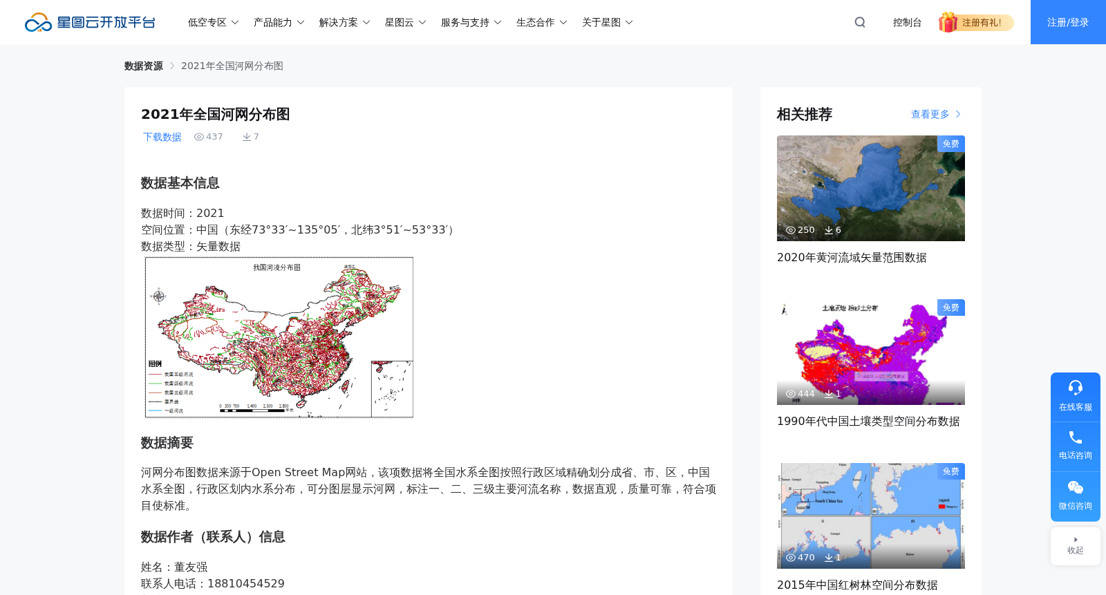
2021年全国河网分布图
收藏资源简介:
数据基本信息数据时间:2021空间位置:中国(东经73°33′~135°05′,北纬3°51′~53°33′)数据类型:矢量数据数据摘要河网分布图数据来源于Open Street Map网站,该项数据将全国水系全图按照行政区域精确划分成省、市、区,中国水系全图,行政区划内水系分布,可分图层显示河网,标注一、二、三级主要河流名称,数据直观,质量可靠,符合项目使标准。数据作者(联系人)信息姓名:董友强联系人电话:18810454529邮编:102616联系人邮箱:dyqstruggling@126.com单位:北京建筑大学地址:北京市大兴区永源路15号数据引用方式及申明数据集使用申明:2021年全国河网分布图数据集来源于国家重点研发计划项目“不可移动文物自然灾害风险评估与应急处置研究(2019YFC1520800)”。引用方式:中国文化遗产研究院.2021年全国河网分布图数据集.2022.数据溯源信息数据来源描述:数据集中的原始数据为自主产生。数据生成过程描述:数据集中数据加工处理的方法为将原始数据信息转变为量化指标,依据各指标的权重设定加权计算。数据质量信息:中国水系全图,行政区划内水系分布,可分图层显示河网,标注一、二、三级主要河流名称,数据质量可靠。
Data Basic Information Data Time: 2021 Spatial Location: China (73°33′E ~ 135°05′E, 3°51′N ~ 53°33′N) Data Type: Vector Data Data Abstract: This dataset is a river network distribution map sourced from the Open Street Map website. It accurately divides the national water system map into provincial, municipal and district-level administrative divisions across China. The dataset includes the national water system map of China, water system distribution within administrative divisions, supports layered display of river networks, and labels the names of primary, secondary and tertiary major rivers. The data is intuitive, reliable in quality, and conforms to the project usage standards. Data Author (Contact Person) Information Name: Dong Youqiang Contact Phone: +86 18810454529 Postal Code: 102616 Contact Email: dyqstruggling@126.com Affiliation: Beijing University of Civil Engineering and Architecture Address: No.15, Yongyuan Road, Daxing District, Beijing, China Data Citation and Declaration Dataset Usage Declaration: The 2021 National River Network Distribution Map Dataset is derived from the National Key R&D Program Project "Study on Natural Disaster Risk Assessment and Emergency Disposal of Immovable Cultural Relics (2019YFC1520800)". Citation Method: Chinese Academy of Cultural Heritage. 2021 National River Network Distribution Map Dataset. 2022. Data Traceability Information Data Source Description: The original data in this dataset was independently generated. Data Generation Process Description: The data processing method for this dataset is to convert original data information into quantitative indicators, and perform weighted calculations based on the weight settings of each indicator. Data Quality Information: The dataset includes the national water system map of China, water system distribution within administrative divisions, supports layered display of river networks, and labels the names of primary, secondary and tertiary major rivers, with reliable data quality.