青藏高原10米分辨率DEM数据集
收藏国家青藏高原科学数据中心2025-09-29 更新2025-10-04 收录
下载链接:
https://data.tpdc.ac.cn/zh-hans/data/d9c271b4-c32a-4f89-af60-4f8d32ed2bfb
下载链接
链接失效反馈官方服务:
资源简介:
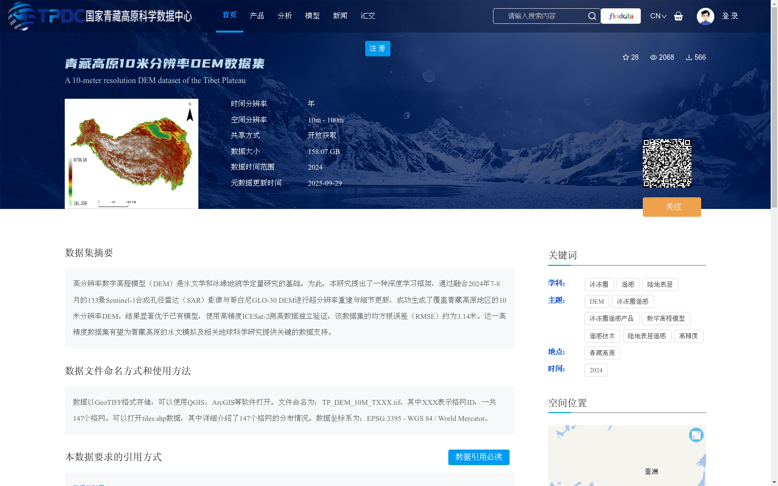
高分辨率数字高程模型(DEM)是水文学和冰缘地貌学定量研究的基础。为此,本研究提出了一种深度学习框架,通过融合2024年7-8月的133景Sentinel-1合成孔径雷达(SAR)影像与哥白尼GLO-30 DEM进行超分辨率重建与细节更新,成功生成了覆盖青藏高原地区的10米分辨率DEM。结果显著优于已有模型,使用高精度ICESat-2测高数据独立验证,该数据集的均方根误差(RMSE)约为3.14米。这一高精度数据集有望为青藏高原的水文模拟及相关地球科学研究提供关键的数据支持。
High-resolution Digital Elevation Models (DEM) serve as the foundation for quantitative studies in hydrology and periglacial geomorphology. To this end, this study proposes a deep learning framework that fuses 133 scenes of Sentinel-1 Synthetic Aperture Radar (SAR) images acquired between July and August 2024 with the Copernicus GLO-30 DEM for super-resolution reconstruction and detail enhancement, successfully generating a 10-meter resolution DEM covering the Qinghai-Tibet Plateau. The results show that this dataset significantly outperforms existing models. Independent validation using high-precision ICESat-2 altimetry data reveals that its Root Mean Square Error (RMSE) is approximately 3.14 meters. This high-precision dataset is expected to provide critical data support for hydrological simulations and related geoscientific research over the Qinghai-Tibet Plateau.
提供机构:
伍清林,徐瑾昊,冯敏
创建时间:
2025-09-27
搜集汇总
数据集介绍
背景与挑战
背景概述
青藏高原10米分辨率DEM数据集是一个高精度的数字高程模型数据集,覆盖青藏高原地区,空间分辨率为10米,数据大小为158.07 GB。该数据集通过融合Sentinel-1 SAR影像与哥白尼GLO-30 DEM进行超分辨率重建与细节更新生成,经ICESat-2测高数据验证,均方根误差约为3.14米,适用于水文模拟及相关地球科学研究。
以上内容由遇见数据集搜集并总结生成


