2020年黑土粮仓科技会战海伦示范区10 m分辨率作物种植结构据集
收藏国家地球系统科学数据中心2022-02-24 更新2024-03-04 收录
下载链接:
https://www.geodata.cn/data/datadetails.html?dataguid=162174301079258&docId=10317
下载链接
链接失效反馈官方服务:
资源简介:
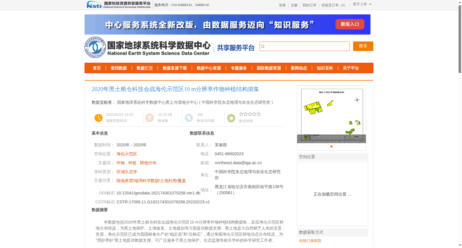
本数据包括2020年黑土粮仓科技会战海伦示范区10 m分辨率作物种植结构数据集,反应海伦示范区耕地分布情况,为黑土地保护、土壤修复、土地规划等方面提供数据支撑。黑土地是大自然赋予人类的宝贵资源,海伦示范区已成为我国粮食生产的“稳定器”和“压舱石”,通过掌握海伦示范区耕地动态分布情况,为“用好养好”黑土地提供数据支撑。可广泛服务于黑土地保护、生态监测等相关学科的科学研究工作者。
This dataset refers to the 10-meter resolution crop planting structure dataset of the Hailun Demonstration Zone in the 2020 Black Soil Granary Science and Technology Campaign, which reflects the cultivated land distribution in the demonstration zone and provides data support for black soil conservation, soil remediation, land planning and other related fields. Black soil is a precious natural resource bestowed to mankind by nature. The Hailun Demonstration Zone has become a "stabilizer" and "ballast stone" for China's grain production. By mastering the dynamic distribution of cultivated land in the zone, this dataset offers data backing for the "proper utilization and conservation" of black soils. It can be widely applied to support scientific research by scholars in relevant disciplines such as black soil conservation and ecological monitoring.
提供机构:
中国科学院东北地理与农业生态研究所
创建时间:
2022-02-23
搜集汇总
数据集介绍
背景与挑战
背景概述
该数据集是2020年海伦示范区的作物种植结构数据,具有10米高分辨率,反映了耕地分布情况。它主要用于支持黑土地保护、土壤修复和土地规划等科学研究,数据源为sentinel遥感影像,通过目视解译方法生成。
以上内容由遇见数据集搜集并总结生成


