黄土高原不同时期各省域、生态分区土地类型图集(2000、2010、2017年)
收藏国家地球系统科学数据中心2024-10-25 更新2024-10-26 收录
下载链接:
https://www.geodata.cn/data/datadetails.html?dataguid=23816597964565&docId=2253
下载链接
链接失效反馈官方服务:
资源简介:
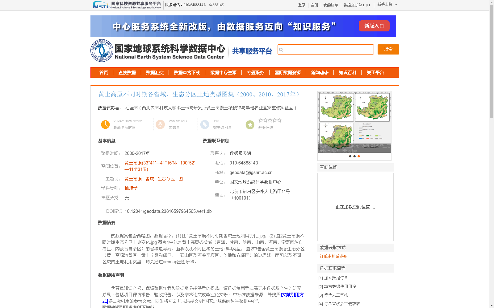
该数据集包含两幅图,数据名称:(1) 图1黄土高原不同时期省域土地利用变化.jpg;(2) 图2黄土高原不同时期生态分区土地变化.jpg
图片1中包含黄土高原各省域(青海、甘肃、陕西、山西、河南、宁夏回族自治区、内蒙古自治区)的省域边界线、面积以及不同区域的土地利用类型;
图2中包含黄土高原各生态分区(黄土高塬沟壑区、黄土丘陵沟壑区、土石山区及河谷平原区、沙地和农灌区)的边界线、面积以及不同区域的土地利用类型;均为经过arcmap出图所得。
This dataset contains two images. The filenames are: (1) Figure 1: Land Use Changes at Provincial Levels in the Loess Plateau Across Different Periods.jpg; (2) Figure 2: Land Use Changes in Ecological Zones of the Loess Plateau Across Different Periods.jpg. Image 1 includes the provincial boundary lines, areas, and land use types of various regions for each province in the Loess Plateau, namely Qinghai, Gansu, Shaanxi, Shanxi, Henan, Ningxia Hui Autonomous Region, and Inner Mongolia Autonomous Region. Image 2 contains the boundary lines, areas, and land use types of various regions for each ecological zone in the Loess Plateau, including Loess Tableland Gully Region, Loess Hilly-Gully Region, Rocky Mountainous and River Valley Plain Region, Sandy Land and Agricultural Irrigation District. All these images were generated using ArcMap.
提供机构:
西北农林科技大学水土保持研究所黄土高原土壤侵蚀与旱地农业国家重点实验室
创建时间:
2024-10-25
搜集汇总
数据集介绍
背景与挑战
背景概述
该数据集包含黄土高原2000、2010、2017年各省域和生态分区的土地利用变化图,展示了省域边界线、面积及不同区域的土地利用类型。数据基于30m土地利用数据在arcmap中制作,比例尺为1:110万,精度可靠,适用于地理学和生态学研究。
以上内容由遇见数据集搜集并总结生成


