咸海流域耕地数据集(2018)
收藏国家青藏高原科学数据中心2021-04-19 更新2024-03-01 收录
下载链接:
https://data.tpdc.ac.cn/zh-hans/data/10006cd6-e49b-4bcf-b49c-8d7c889be81d
下载链接
链接失效反馈官方服务:
资源简介:
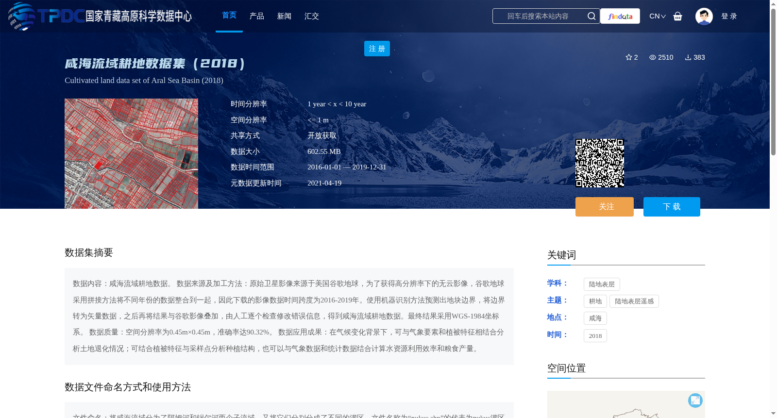
数据内容:咸海流域耕地数据。
数据来源及加工方法:原始卫星影像来源于美国谷歌地球,为了获得高分辨率下的无云影像,谷歌地球采用拼接方法将不同年份的数据整合到一起,因此下载的影像数据时间跨度为2016-2019年。使用机器识别方法预测出地块边界,将边界转为矢量数据,之后再将结果与谷歌影像叠加,由人工逐个检查修改错误信息,得到咸海流域耕地数据。最终结果采用WGS-1984坐标系。
数据质量:空间分辨率为0.45m×0.45m,准确率达90.32%。
数据应用成果:在气候变化背景下,可与气象要素和植被特征相结合分析土地退化情况;可结合植被特征与采样点分析种植结构,也可以与气象数据和统计数据结合计算水资源利用效率和粮食产量。
Dataset Content: Cultivated land data of the Aral Sea Basin.
Data Source and Processing Method: The original satellite imagery was sourced from Google Earth (United States). To obtain cloud-free high-resolution imagery, Google Earth integrated data from different years via mosaicking, so the downloaded image data spans the years 2016 to 2019. We employed machine recognition methods to predict parcel boundaries, converted the boundaries into vector data, then overlaid the results with Google Earth imagery, and manually checked and corrected erroneous information individually to generate the final cultivated land data of the Aral Sea Basin. The final dataset adopts the WGS-1984 coordinate system.
Data Quality: The spatial resolution is 0.45m × 0.45m, with an overall accuracy of 90.32%.
Data Application Outcomes: Against the backdrop of climate change, this dataset can be combined with meteorological factors and vegetation characteristics to analyze land degradation. It can also be integrated with vegetation characteristics and sampling points to analyze planting structures, and paired with meteorological and statistical data to calculate water use efficiency and grain yield.
提供机构:
刘铁
创建时间:
2021-02-09
搜集汇总
数据集介绍
背景与挑战
背景概述
该数据集是2018年咸海流域的耕地数据,基于2016-2019年谷歌地球高分辨率影像,通过机器识别和人工修正生成,空间分辨率达0.45米,准确率90.32%。数据以矢量格式提供,覆盖阿姆河和锡尔河子流域的灌区,适用于土地退化、种植结构和水资源利用效率等研究。
以上内容由遇见数据集搜集并总结生成


