新疆塔城地区塔城市2010年二类调查森林资源分布图
收藏国家林业和草原科学数据中心2017-12-17 更新2024-03-06 收录
下载链接:
https://www.forestdata.cn/dataDetail.html?id=CSTR:17575.11.0120211217066.010001.V1
下载链接
链接失效反馈官方服务:
资源简介:
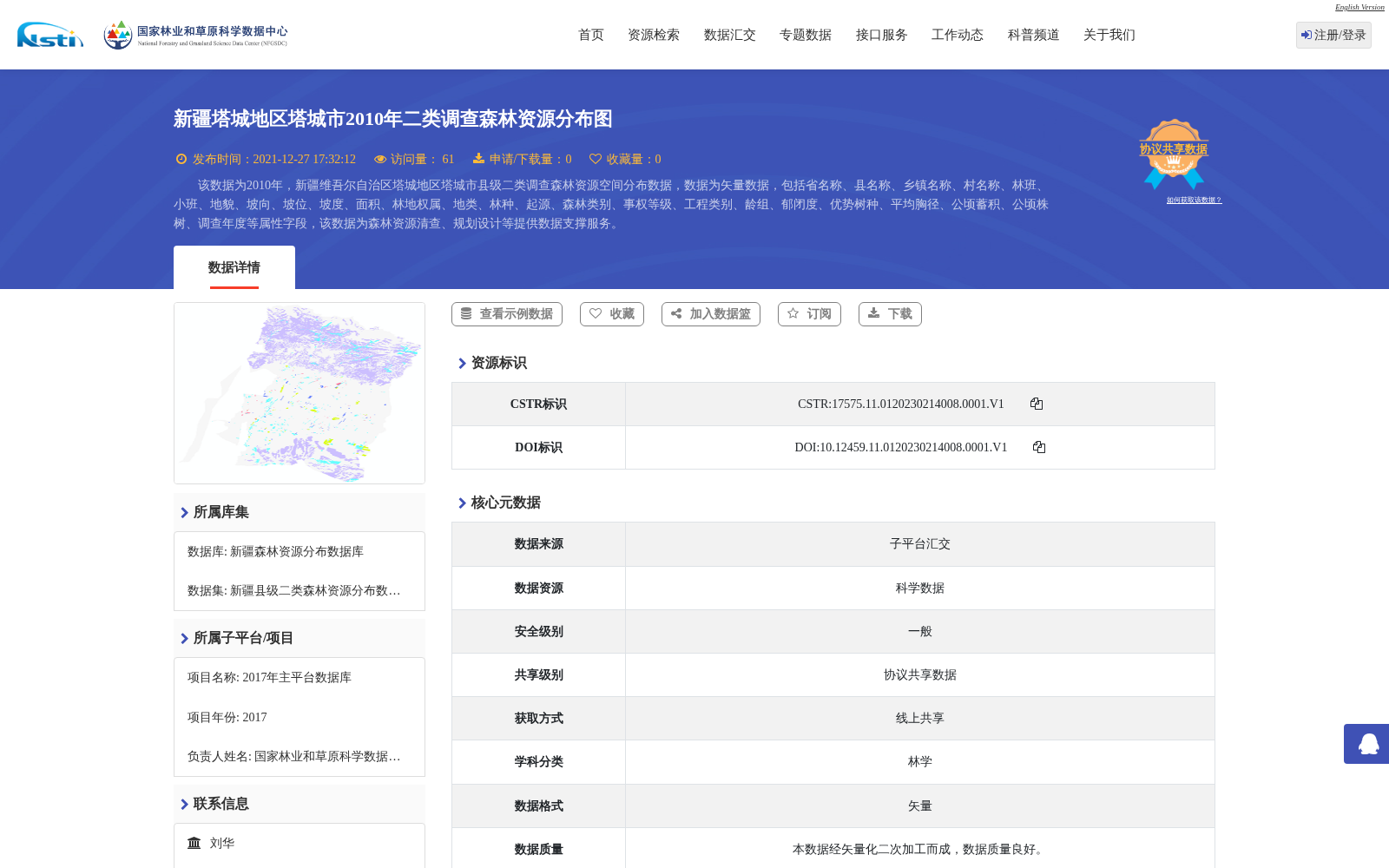
该数据为2010年,新疆维吾尔自治区塔城地区塔城市县级二类调查森林资源空间分布数据,数据为矢量数据,包括省名称、县名称、乡镇名称、村名称、林班、小班、地貌、坡向、坡位、坡度、面积、林地权属、地类、林种、起源、森林类别、事权等级、工程类别、龄组、郁闭度、优势树种、平均胸径、公顷蓄积、公顷株树、调查年度等属性字段,该数据为森林资源清查、规划设计等提供数据支撑服务。
This dataset is the spatial distribution data of forest resources from the county-level second-class forest inventory of Tacheng City, Tacheng Prefecture, Xinjiang Uygur Autonomous Region in 2010. The data is in vector format, with attribute fields including province name, county name, township name, village name, forest compartment, sub-compartment, landform, slope aspect, slope position, slope gradient, area, forestland ownership, land type, forest category, forest origin, forest management category, administrative authority grade, engineering category, age group, crown density, dominant tree species, average DBH, stock volume per hectare, number of trees per hectare, survey year, etc. This dataset provides data support for forest resource inventory, planning and design and other relevant applications.
提供机构:
国家林业和草原科学数据中心
创建时间:
2017-12-17
搜集汇总
数据集介绍
背景与挑战
背景概述
该数据集是2010年新疆塔城地区塔城市的县级二类调查森林资源空间分布矢量数据,包含省、县、乡镇、村、林班、小班等详细属性字段。它为森林资源清查和规划设计提供了重要的数据支撑服务。
以上内容由遇见数据集搜集并总结生成


