中国广西、云南、贵州及东盟十国河流、湖库面域矢量及其覆盖率数据集
收藏地球大数据科学工程2025-09-29 更新2025-12-20 收录
下载链接:
https://data.casearth.cn/dataset/68d9db619418b437b225adfb
下载链接
链接失效反馈官方服务:
资源简介:
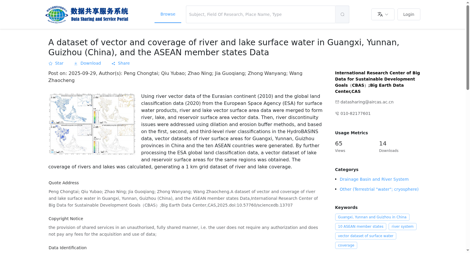
利用欧亚大陆河流矢量数据(2010 年)和欧洲航天局(ESA)全球陆地分类数据(2020 年)陆地地表水产品,融合形成河流、湖库水面面域矢量数据。然后,利用膨胀和收缩缓冲方法解决河流不连续的问题,并根据 HyroBASINS 数据中的一、二、三级河流等级进行判断,生成了中国广西、云南、贵州和东盟十国的河流面域矢量数据集。通过对欧洲航天局(ESA)全球陆地分类数据的进一步处理获得同一地区的湖库表面域矢量数据集。计算河流、湖库的覆盖度,生成 1km 网格的河流、湖库覆盖度数据集。
Vector datasets of river and lake/reservoir surface areas were initially created by integrating the Eurasian river vector dataset (2010) and the ESA 2020 Global Land Cover products. Next, the issue of discontinuous river segments was resolved using expansion and contraction buffering techniques, and river hierarchies were classified based on the first-, second-, and third-order river grades from the HyroBASINS dataset. This yielded a vector dataset of river surface areas spanning Guangxi, Yunnan, and Guizhou provinces in China, as well as the ten ASEAN member states. Separately, vector datasets of lake and reservoir surface areas for the same geographic region were derived through further processing of the ESA Global Land Cover data. Finally, the areal coverage of rivers and lakes/reservoirs was computed, and a 1-kilometer grid-based dataset of river and lake/reservoir coverage was produced.
创建时间:
2025-09-29
搜集汇总
数据集介绍
背景与挑战
背景概述
该数据集提供了中国广西、云南、贵州三省及东盟十国的河流和湖库(湖泊和水库)面域矢量数据及其覆盖率信息。数据基于欧空局(ESA)的2020年全球土地分类产品和2010年欧亚大陆河流矢量数据生成,通过处理解决了河流不连续性问题,并包括河流分级分类。数据集还包括一个1公里网格的覆盖率数据集,适用于区域水资源研究、环境监测和可持续发展分析。
以上内容由遇见数据集搜集并总结生成


