极端气候条件下内蒙古土壤水分和土壤温度时空分布图(2017)
收藏国家青藏高原科学数据中心2023-05-31 更新2024-03-01 收录
下载链接:
https://data.tpdc.ac.cn/zh-hans/data/bc02d568-723a-4b4f-9a9c-07f0c2d2bf06
下载链接
链接失效反馈官方服务:
资源简介:
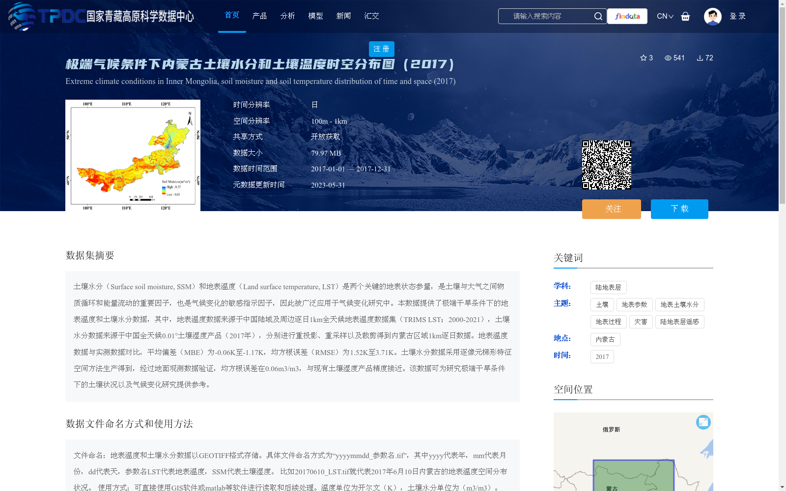
土壤水分(Surface soil moisture, SSM)和地表温度(Land surface temperature, LST)是两个关键的地表状态参量,是土壤与大气之间物质循环和能量流动的重要因子,也是气候变化的敏感指示因子,因此被广泛应用于气候变化研究中。本数据提供了极端干旱条件下的地表温度和土壤水分数据,其中,地表温度数据来源于中国陆域及周边逐日1km全天候地表温度数据集(TRIMS LST;2000-2021),土壤水分数据来源于中国全天候0.01°土壤湿度产品(2017年),分别进行重投影、重采样以及裁剪得到内蒙古区域1km逐日数据。地表温度数据与实测数据对比,平均偏差(MBE)为-0.06K至-1.17K,均方根误差(RMSE)为1.52K至3.71K。土壤水分数据采用逐像元梯形特征空间方法生产得到,经过地面观测数据验证,均方根误差在0.06m3/m3,与现有土壤湿度产品精度接近。该数据可为研究极端干旱条件下的土壤状况以及气候变化研究提供参考。
Surface soil moisture (SSM) and land surface temperature (LST) are two critical land surface state parameters, which serve as vital factors for material cycling and energy flow between the soil and the atmosphere, as well as sensitive indicators of climate change. Thus, they are widely applied in climate change research.
This dataset provides land surface temperature and soil moisture data under extreme drought conditions. Specifically, the LST data is derived from the daily 1 km all-weather land surface temperature dataset for China's mainland and surrounding areas (TRIMS LST; 2000–2021), while the soil moisture data comes from the China all-weather 0.01° soil moisture product (2017). Both datasets were respectively reprojected, resampled and clipped to generate daily 1 km data for the Inner Mongolia region.
When compared with in-situ measured data, the LST data has a mean bias error (MBE) ranging from -0.06 K to -1.17 K and a root mean square error (RMSE) ranging from 1.52 K to 3.71 K. The soil moisture data was produced using the pixel-wise trapezoidal feature space method. Validated with ground observation data, it has a root mean square error of 0.06 m³/m³, with accuracy comparable to existing soil moisture products.
This dataset can serve as a reference for studies on soil conditions under extreme drought and climate change research.
提供机构:
宋小宁
创建时间:
2022-12-20
搜集汇总
数据集介绍
背景与挑战
背景概述
该数据集提供了2017年内蒙古地区在极端干旱条件下的逐日土壤水分和地表温度时空分布数据,空间分辨率为1公里,数据来源于高质量的全天候遥感产品并经过验证,精度可靠。数据集以开放获取方式共享,适用于气候变化研究和土壤状况分析,支持GIS等软件直接处理。
以上内容由遇见数据集搜集并总结生成


