中国区域每月地下水水位栅格数据集(2005-2022)
收藏国家青藏高原科学数据中心2024-09-09 更新2025-04-12 收录
下载链接:
https://data.tpdc.ac.cn/zh-hans/data/96e53121-8c2e-419d-92e6-ff0e495087a3
下载链接
链接失效反馈官方服务:
资源简介:
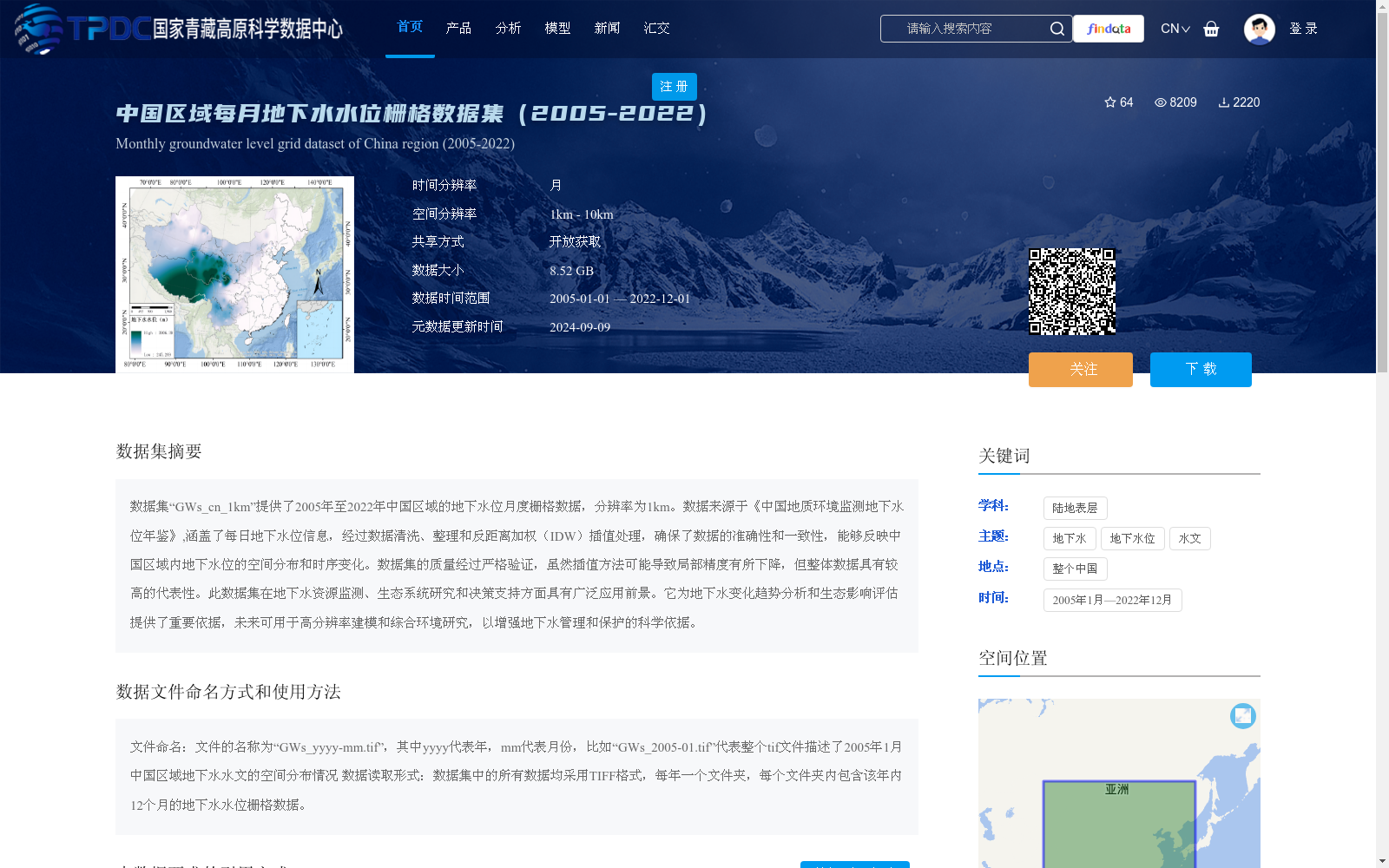
数据集“GWs_cn_1km”提供了2005年至2022年中国区域的地下水位月度栅格数据,分辨率为1km。数据来源于《中国地质环境监测地下水位年鉴》,涵盖了每日地下水位信息,经过数据清洗、整理和反距离加权(IDW)插值处理,确保了数据的准确性和一致性,能够反映中国区域内地下水位的空间分布和时序变化。数据集的质量经过严格验证,虽然插值方法可能导致局部精度有所下降,但整体数据具有较高的代表性。此数据集在地下水资源监测、生态系统研究和决策支持方面具有广泛应用前景。它为地下水变化趋势分析和生态影响评估提供了重要依据,未来可用于高分辨率建模和综合环境研究,以增强地下水管理和保护的科学依据。
The dataset "GWs_cn_1km" provides monthly raster data of groundwater levels in China from 2005 to 2022, with a spatial resolution of 1 km. The data is sourced from the *China Geological Environment Monitoring Groundwater Level Yearbook*, which originally contains daily groundwater level records. The raw data has undergone data cleaning, organization, and inverse distance weighting (IDW) interpolation to ensure accuracy and consistency, enabling the reflection of the spatial distribution and temporal variations of groundwater levels across China. The quality of this dataset has been rigorously verified. Although the interpolation method may lead to a certain decline in local accuracy, the overall dataset boasts high representativeness. This dataset has broad application prospects in groundwater resource monitoring, ecosystem research and decision support. It provides an important basis for groundwater trend analysis and ecological impact assessment, and can be utilized for high-resolution modeling and comprehensive environmental research in the future, so as to strengthen the scientific foundation for groundwater management and conservation.
提供机构:
王梦然,么嘉棋,常奂宇,刘蓉,曹永强,赵勇
创建时间:
2024-09-08
搜集汇总
数据集介绍
背景与挑战
背景概述
该数据集提供了2005年至2022年中国区域每月地下水水位栅格数据,空间分辨率为1km,时间覆盖完整,数据来源于年鉴并经过清洗和插值处理,确保了准确性和一致性。它能够反映地下水位的时空变化,适用于地下水资源监测、生态系统研究和决策支持等领域,具有较高的科学价值和应用前景。
以上内容由遇见数据集搜集并总结生成


