太湖蓝藻水华反演产品数据集(2016年)
收藏国家地球系统科学数据中心2026-01-27 更新2024-03-04 收录
下载链接:
https://www.geodata.cn/data/datadetails.html?dataguid=181799171164084&docId=201
下载链接
链接失效反馈官方服务:
资源简介:
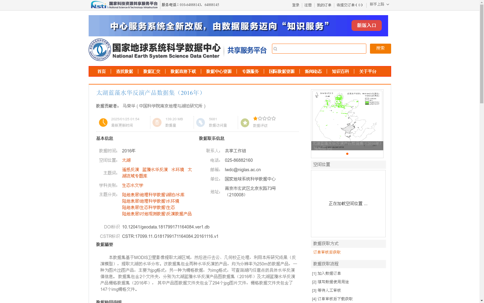
本数据集基于MODIS卫星影像提取太湖区域,然后进行去云、几何校正处理,利用本所研究成果(反演模型),提取太湖的水华分布。该数据集包含两种水华反演的产品,均为分辨率为250m的数据产品,一种为图片出图产品,主要为jpg格式;另一种为栅格数据,为img格式,可查询湖内任意点的具体水华反演值信息。
数据集包含2个文件夹,分别为太湖蓝藻水华反演产品图数据集(2016年)及太湖蓝藻水华反演产品栅格数据集(2016年), 其中产品图数据文件夹包含了294个jpg图片文件,栅格数据文件夹包含了147个img栅格文件。
This dataset is developed by first extracting the Lake Taihu region from MODIS satellite imagery, followed by cloud removal and geometric correction. Subsequently, the distribution of cyanobacterial harmful algal blooms over Lake Taihu is retrieved using the inversion model developed by our institute.
This dataset includes two types of bloom inversion products, both with a spatial resolution of 250 meters. One is an image product primarily in JPG format, and the other is raster data in IMG format, which allows querying the specific bloom inversion values at any point within Lake Taihu.
The dataset contains two folders, namely the Lake Taihu cyanobacterial bloom inversion product image dataset (2016) and the Lake Taihu cyanobacterial bloom inversion product raster dataset (2016). The product image data folder includes 294 JPG image files, while the raster data folder contains 147 IMG raster files.
提供机构:
中国科学院南京地理与湖泊研究所
创建时间:
2016-11-16
搜集汇总
数据集介绍
背景与挑战
背景概述
该数据集是基于2016年MODIS卫星影像,针对太湖区域生成的蓝藻水华反演产品,包含分辨率为250米的jpg图片和img栅格两种格式,分别用于可视化展示和定量分析。数据集采用改进的反演算法,结合气象数据并首次应用像元生长法,提高了蓝藻水华面积监测的准确性,适用于湖泊水环境研究和生态监测。
以上内容由遇见数据集搜集并总结生成


