EMAG2v3: Earth Magnetic Anomaly Grid (2-arc-minute resolution)
收藏DataCite Commons2025-02-19 更新2025-04-16 收录
下载链接:
https://www.ncei.noaa.gov/access/metadata/landing-page/bin/iso?id=gov.noaa.ngdc.mgg.geophysical_models:EMAG2_V3
下载链接
链接失效反馈官方服务:
资源简介:
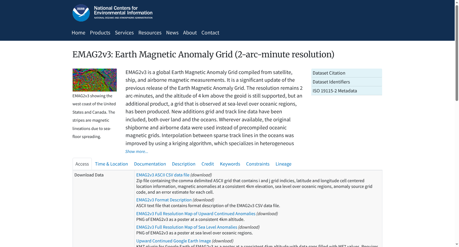
EMAG2v3 is a global Earth Magnetic Anomaly Grid compiled from satellite, ship, and airborne magnetic measurements. It is a significant update of the previous release of the Earth Magnetic Anomaly Grid. The resolution remains 2 arc-minutes, and the altitude of 4 km above the geoid is still supported, but an additional product, a grid that is observed at sea-level over oceanic regions, has been produced. New additions grid and track line data have been included, both over land and the oceans. Wherever available, the original shipborne and airborne data were used instead of precompiled oceanic magnetic grids. Interpolation between sparse track lines in the oceans was improved by using a kriging algorithm, which specializes in heterogeneous data distribution gridding, in order to create a compilation as true to the observed data as possible, and avoid using a priori information. The longest wavelengths (>300 km) were replaced with the latests satellite lithosphere magnetic field model, MF7.
EMAG2v3是一款全球地球磁异常网格(Earth Magnetic Anomaly Grid)数据集,其数据整合自卫星、船舶与航空磁测数据。该数据集是前代地球磁异常网格版本的重大更新,分辨率仍维持2弧分,且依旧支持距大地水准面4公里的高度层数据,但新增了一款针对海洋区域的海平面观测网格产品。本次更新纳入了覆盖陆地与洋区的新增网格及测线数据集;在有原始数据可用的区域,优先采用原始船载与航空磁测数据,而非预编译的海洋磁异常网格。针对洋区内分布稀疏的测线,研究团队采用适配非均匀数据分布网格化的克里金(kriging)算法优化插值流程,以最大程度还原实测数据的真实面貌,避免引入先验信息。对于波长大于300公里的超长波分量,数据集替换为最新的卫星岩石圈磁场模型MF7。
提供机构:
NOAA National Centers for Environmental Information
创建时间:
2016-06-08
搜集汇总
数据集介绍
背景与挑战
背景概述
EMAG2v3是一个全球地球磁异常网格数据集,整合了卫星、船舶和航空磁测量数据,分辨率保持2弧分钟,新增了海洋区域海平面观测网格。该数据集通过克里金算法优化稀疏数据插值,并采用MF7模型更新长波长数据,适用于地壳结构和组成研究。
以上内容由遇见数据集搜集并总结生成


