河南省1km土地覆被林地类型数据(2015年)
收藏国家地球系统科学数据中心2021-07-24 更新2024-04-21 收录
下载链接:
https://www.geodata.cn/data/datadetails.html?dataguid=1523604&docId=10953
下载链接
链接失效反馈官方服务:
资源简介:
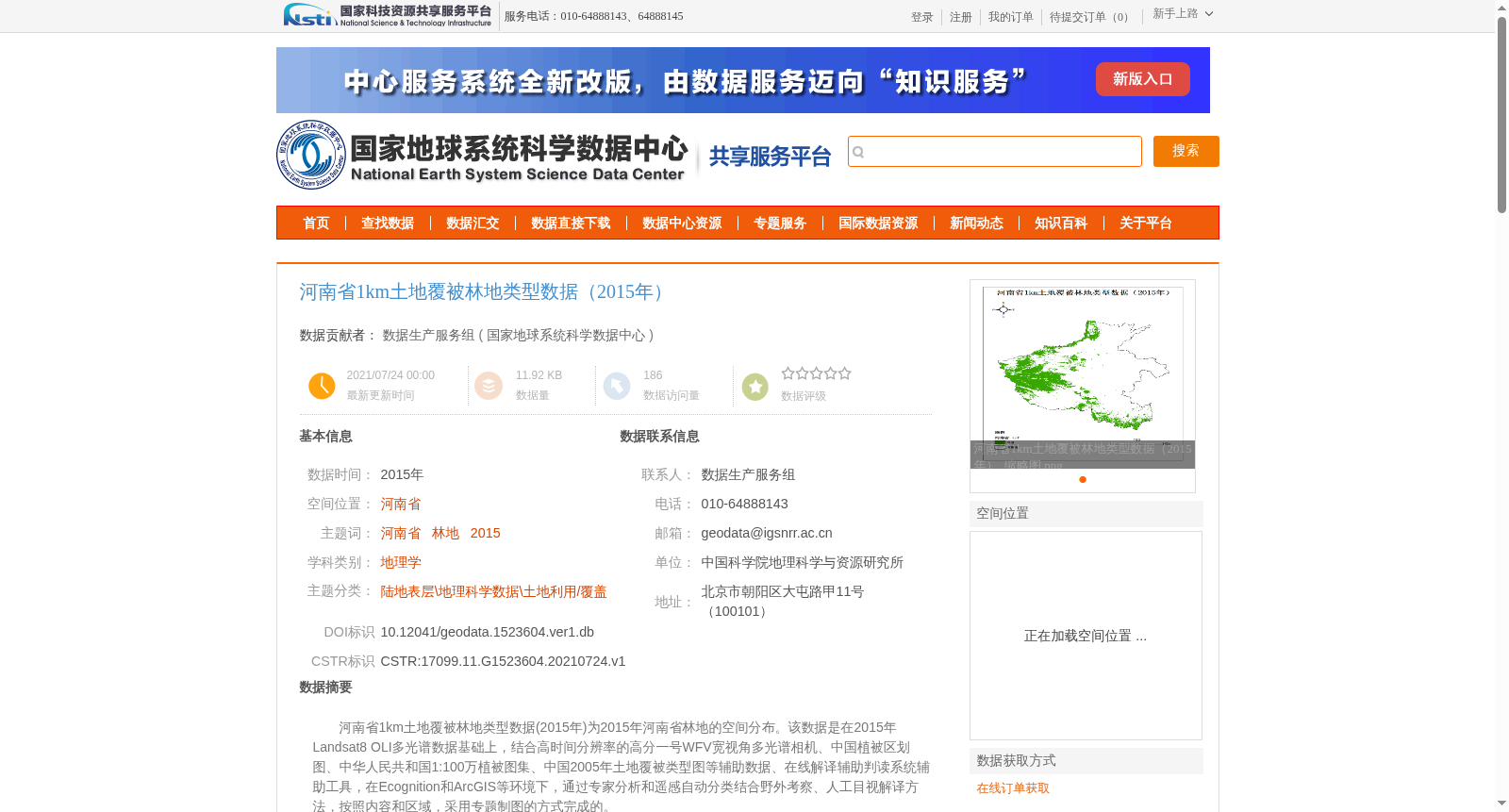
河南省1km土地覆被林地类型数据(2015年)为2015年河南省林地的空间分布。该数据是在2015年Landsat8 OLI多光谱数据基础上,结合高时间分辨率的高分一号WFV宽视角多光谱相机、中国植被区划图、中华人民共和国1:100万植被图集、中国2005年土地覆被类型图等辅助数据、在线解译辅助判读系统辅助工具,在Ecognition和ArcGIS等环境下,通过专家分析和遥感自动分类结合野外考察、人工目视解译方法,按照内容和区域,采用专题制图的方式完成的。
The 1km land cover forest type dataset of Henan Province (2015) depicts the spatial distribution of forest lands in Henan Province in 2015. This dataset was developed using the 2015 Landsat 8 OLI multispectral data as the core data source, supplemented by a range of auxiliary datasets and tools including high-temporal-resolution GF-1 WFV wide-angle multispectral camera data, the Vegetation Regionalization Map of China, the 1:1,000,000 Vegetation Atlas of the People's Republic of China, the 2005 Land Cover Type Map of China, and the online interpretation-assisted judgment system. It was finalized through a workflow integrating expert analysis, automated remote sensing classification, field surveys, and manual visual interpretation, implemented within the Ecognition and ArcGIS software environments, following specified thematic content and regional divisions, and completed via thematic cartographic methods.
提供机构:
国家地球系统科学数据中心
创建时间:
2021-07-24
搜集汇总
数据集介绍
背景与挑战
背景概述
该数据集是2015年河南省1公里分辨率的林地空间分布数据,基于Landsat8 OLI多光谱数据,结合高分一号WFV等辅助资料,通过专家分析、人工目视解译和野外验证方法制作而成,适用于土地利用/覆盖等地理学研究,具有高精度和权威性。
以上内容由遇见数据集搜集并总结生成


