RSC: 2025年3月28日缅甸震后环境减灾二号E星遥感影像数据集
收藏国家青藏高原科学数据中心2025-03-30 更新2025-03-29 收录
下载链接:
https://data.tpdc.ac.cn/zh-hans/data/1c971a2c-6b1c-41eb-a404-6571a5ad2d16
下载链接
链接失效反馈官方服务:
资源简介:
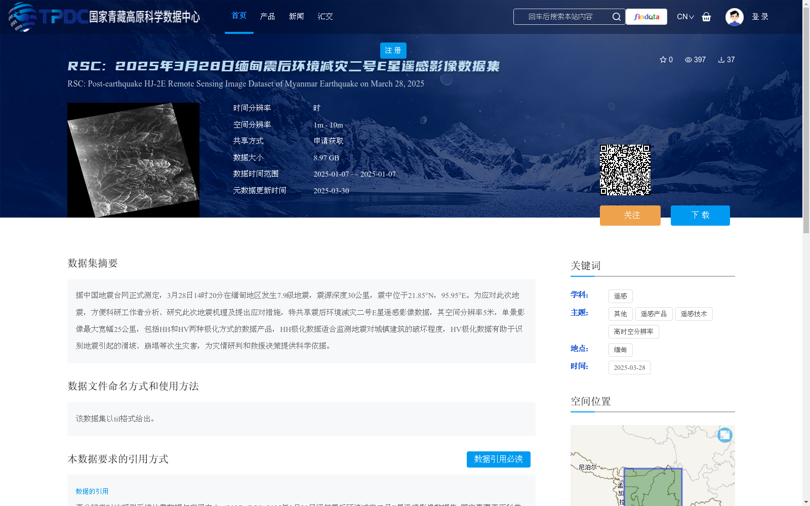
据中国地震台网正式测定,3月28日14时20分在缅甸地区发生7.9级地震,震源深度30公里,震中位于21.85°N,95.95°E。为应对此次地震,方便科研工作者分析、研究此次地震机理及提出应对措施,特共享震后环境减灾二号E星遥感影像数据,其空间分辨率5米,单景影像最大宽幅25公里,包括HH和HV两种极化方式的数据产品,HH极化数据适合监测地震对城镇建筑的破坏程度,HV极化数据有助于识别地震引起的滑坡、崩塌等次生灾害,为灾情研判和救援决策提供科学依据。
Officially confirmed by the China Earthquake Networks Center (CENC), a magnitude 7.9 earthquake struck Myanmar at 14:20 on March 28, with a focal depth of 30 km and its epicenter located at 21.85°N, 95.95°E. To respond to this earthquake and facilitate scientific researchers' analysis of the earthquake mechanism and formulation of response measures, we hereby share the post-earthquake remote sensing image data acquired by the Environmental and Disaster Reduction Satellite-2E (HJ-2E). The data has a spatial resolution of 5 meters, with a maximum swath width of 25 km per single scene. The dataset includes data products with two polarization modes: HH and HV. HH-polarized data is suitable for monitoring the damage to urban buildings caused by the earthquake, while HV-polarized data helps identify secondary disasters such as landslides and collapses triggered by the earthquake, providing scientific basis for disaster situation assessment and rescue decision-making.
提供机构:
高分辨率对地观测系统甘肃数据与应用中心
创建时间:
2025-03-29
搜集汇总
数据集介绍
背景与挑战
背景概述
该数据集为2025年3月28日缅甸7.9级地震后的环境减灾二号E星遥感影像数据,空间分辨率5米,包含HH和HV两种极化方式的数据产品,分别用于监测地震对城镇建筑的破坏程度和识别地震引起的次生灾害,为灾情研判和救援决策提供科学依据。
以上内容由遇见数据集搜集并总结生成


