2023年全球10米地表覆盖精细分类数据集(GLC_FCS10)
收藏地球大数据科学工程2025-08-28 更新2025-12-20 收录
下载链接:
https://data.casearth.cn/dataset/68ae9791913dfd1b2d6cdfb9
下载链接
链接失效反馈官方服务:
资源简介:
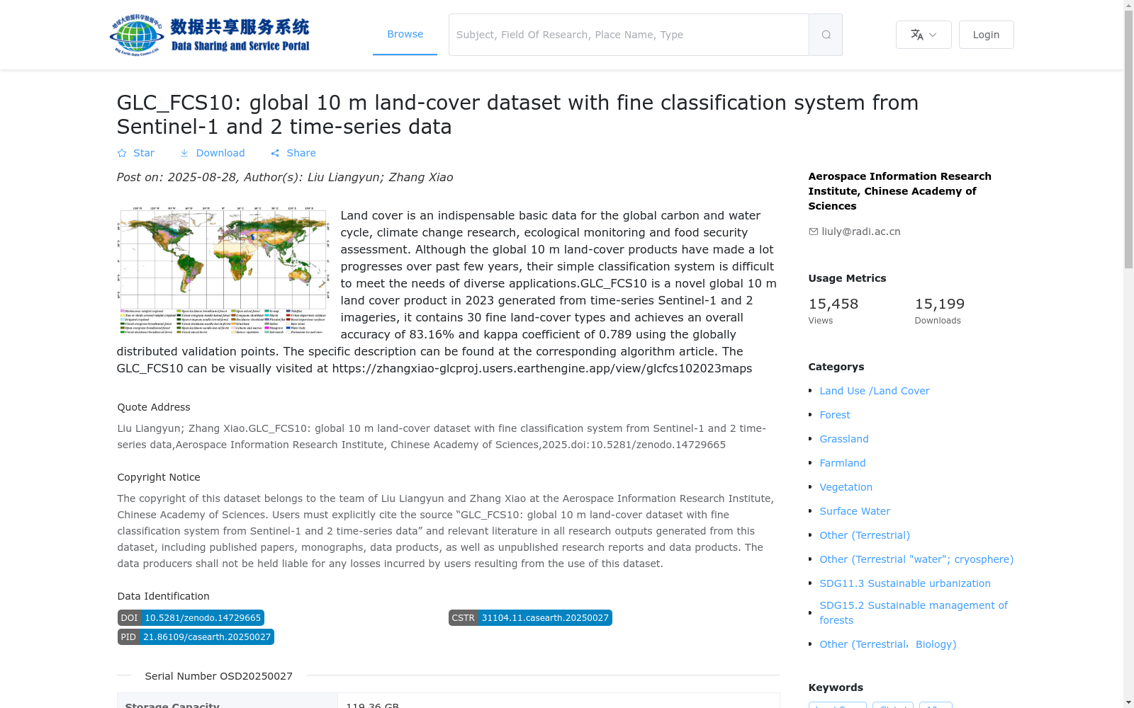
土地覆盖是全球碳水循环、气候变化研究、生态监测及粮食安全评估不可或缺的基础数据。尽管近年来全球10米土地覆盖产品取得显著进展,但其简单的分类体系难以满足多样化应用需求。GLC_FCS10是基于哨兵-1和哨兵-2卫星时序影像生成的2023年新型全球10米土地覆盖产品,包含30种精细土地覆盖类型,通过全球分布的验证点实现83.16%的总体准确率和0.789的卡帕系数。具体描述详见对应算法论文https://zhangxiao-glcproj.users.earthengine.app/view/glcfcs102023maps。
Land cover is an indispensable foundational dataset for global carbon and water cycle research, climate change studies, ecological monitoring, and food security assessment. Although global 10-meter land cover products have made remarkable progress in recent years, their simplistic classification systems fail to meet the requirements of diverse applications. GLC_FCS10 is a novel global 10-meter land cover product for the year 2023, generated using Sentinel-1 and Sentinel-2 satellite time-series imagery. It includes 30 fine-grained land cover types and achieves an overall accuracy of 83.16% and a Kappa coefficient of 0.789 based on globally distributed validation points. For detailed descriptions, please refer to the corresponding algorithm paper at https://zhangxiao-glcproj.users.earthengine.app/view/glcfcs102023maps.
创建时间:
2025-08-27
搜集汇总
数据集介绍
背景与挑战
背景概述
GLC_FCS10是2023年发布的全球10米地表覆盖精细分类数据集,基于Sentinel-1和2时间序列数据生成,包含30种精细土地覆盖类型,总体精度达83.16%。该数据集采用Geotiff格式,具有10米空间分辨率和年度时间分辨率,覆盖全球范围。
以上内容由遇见数据集搜集并总结生成


