青藏高原10米分辨率植被图(2020)
收藏国家青藏高原科学数据中心2023-01-03 更新2024-03-01 收录
下载链接:
https://data.tpdc.ac.cn/zh-hans/data/8c12e483-bd59-402d-a6b5-fbc72da9f771
下载链接
链接失效反馈官方服务:
资源简介:
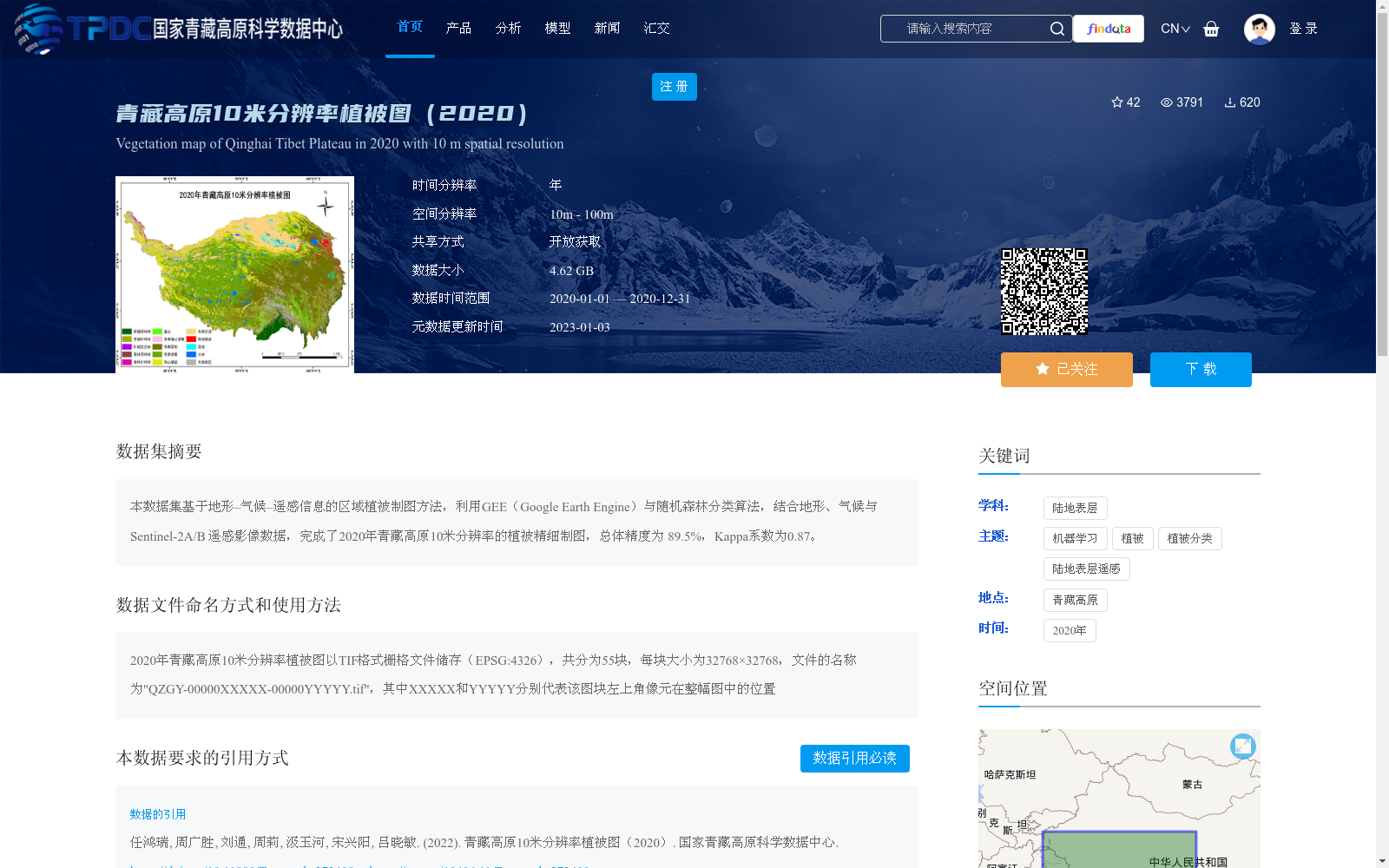
本数据集基于地形–气候–遥感信息的区域植被制图方法,利用GEE(Google Earth Engine)与随机森林分类算法,结合地形、气候与Sentinel-2A/B 遥感影像数据,完成了2020年青藏高原10米分辨率的植被精细制图,总体精度为 89.5%,Kappa系数为0.87。
This dataset is developed based on a regional vegetation mapping method integrating terrain, climate and remote sensing information. By utilizing Google Earth Engine (GEE) and the random forest classification algorithm, combined with terrain, climate and Sentinel-2A/B remote sensing imagery, fine-scale vegetation mapping at 10-meter resolution across the Qinghai-Tibet Plateau in 2020 was completed. The dataset achieves an overall accuracy of 89.5% and a Kappa coefficient of 0.87.
提供机构:
任鸿瑞,周广胜,刘通,周莉,汲玉河,宋兴阳,吕晓敏
创建时间:
2022-05-19
搜集汇总
数据集介绍
背景与挑战
背景概述
该数据集是2020年青藏高原的10米分辨率植被图,采用地形-气候-遥感信息结合的方法,利用Google Earth Engine和随机森林算法对Sentinel-2A/B影像进行分类制图,总体精度达89.5%。数据以TIF格式存储,覆盖整个青藏高原区域,适用于高精度植被分布研究。
以上内容由遇见数据集搜集并总结生成


