2025年3月28日缅甸地震50 km缓冲区数据
收藏国家青藏高原科学数据中心2025-03-29 更新2025-03-29 收录
下载链接:
https://data.tpdc.ac.cn/zh-hans/data/697af59c-a39f-415c-af55-76e9785be37b
下载链接
链接失效反馈官方服务:
资源简介:
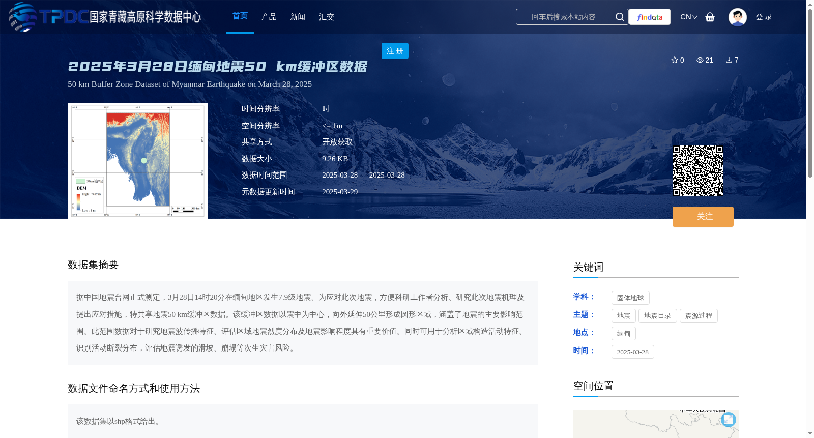
据中国地震台网正式测定,3月28日14时20分在缅甸地区发生7.9级地震。为应对此次地震,方便科研工作者分析、研究此次地震机理及提出应对措施,特共享地震50 km缓冲区数据。该缓冲区数据以震中为中心,向外延伸50公里形成圆形区域,涵盖了地震的主要影响范围。此范围数据对于研究地震波传播特征、评估区域地震烈度分布及地震影响程度具有重要价值。同时可用于分析区域构造活动特征、识别活动断裂分布,评估地震诱发的滑坡、崩塌等次生灾害风险。
Officially determined by the China Earthquake Networks Center, a magnitude 7.9 earthquake struck the Myanmar region at 14:20 on March 28. To respond to this earthquake and facilitate researchers' analysis and study of the earthquake's mechanism as well as the formulation of response measures, the 50 km buffer zone data of this earthquake is hereby shared. Centered on the earthquake's epicenter, this buffer zone data forms a circular area extending 50 km outward, covering the main affected area of the earthquake. This dataset is of great value for researching the propagation characteristics of seismic waves, evaluating the regional seismic intensity distribution and the extent of earthquake impacts. Additionally, it can be used to analyze the characteristics of regional tectonic activities, identify the distribution of active faults, and assess the risks of secondary disasters such as landslides and collapses induced by the earthquake.
提供机构:
李虎
创建时间:
2025-03-29
搜集汇总
数据集介绍
背景与挑战
背景概述
该数据集是2025年3月28日缅甸7.9级地震的50公里缓冲区shp格式数据,空间分辨率<=1米,覆盖地震主要影响范围,可用于地震机理研究和次生灾害评估。数据通过国家青藏高原科学数据中心开放共享。
以上内容由遇见数据集搜集并总结生成


