太湖叶绿素a年均值(1984-2019年)
收藏国家地球系统科学数据中心2024-01-29 更新2024-03-04 收录
下载链接:
https://www.geodata.cn/data/datadetails.html?dataguid=144578488266082&docId=3981
下载链接
链接失效反馈官方服务:
资源简介:
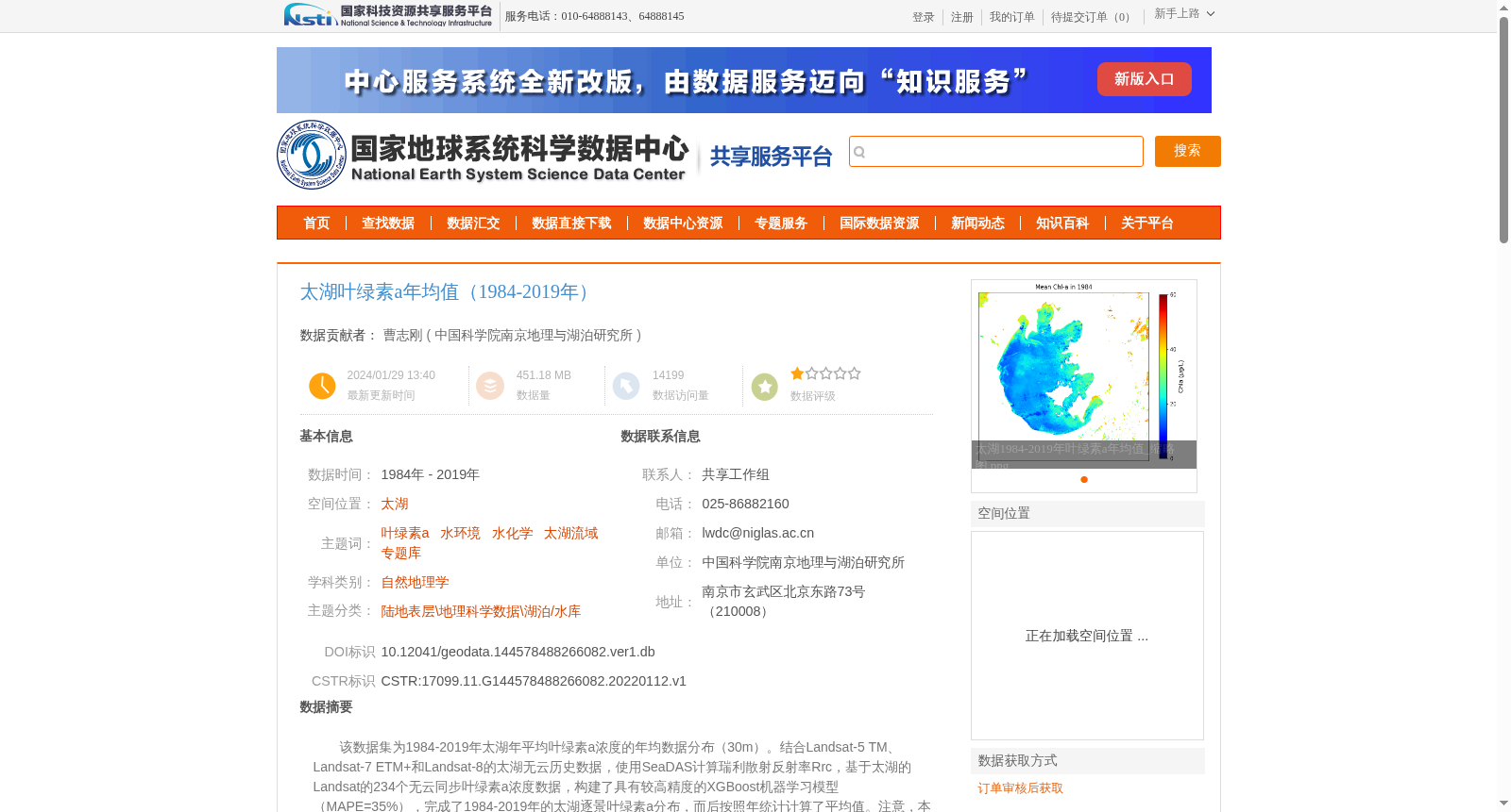
该数据集为1984-2019年太湖年平均叶绿素a浓度的年均数据分布(30m)。结合Landsat-5 TM、Landsat-7 ETM+和Landsat-8的太湖无云历史数据,使用SeaDAS计算瑞利散射反射率Rrc,基于太湖的Landsat的234个无云同步叶绿素a浓度数据,构建了具有较高精度的XGBoost机器学习模型(MAPE=35%),完成了1984-2019年的太湖逐景叶绿素a分布,而后按照年统计计算了平均值。注意,本数据集生产过程中去除了蓝藻水华和水生植被覆盖的区域,因此为“正常水体”的叶绿素a产品。
该数据集包含36个GeoTIFF数据和36个图片数据。
This dataset provides the annual average chlorophyll-a concentration distribution (30 m spatial resolution) of Lake Taihu from 1984 to 2019. We leveraged cloud-free historical Landsat-5 TM, Landsat-7 ETM+, and Landsat-8 imagery over Lake Taihu, used SeaDAS to compute the Rayleigh-corrected reflectance Rrc, and developed a high-precision XGBoost machine learning model based on 234 cloud-free synchronous chlorophyll-a concentration datasets paired with Landsat observations over Lake Taihu, with a mean absolute percentage error (MAPE) of 35%. We then generated per-scene chlorophyll-a concentration distribution maps of Lake Taihu for the 1984–2019 period, and calculated the annual average values through annual statistical processing. Note that areas covered by cyanobacterial blooms and aquatic vegetation were excluded during the dataset production workflow, so this product is a chlorophyll-a dataset for "normal water bodies".
This dataset contains 36 GeoTIFF files and 36 image files.
提供机构:
中国科学院南京地理与湖泊研究所
创建时间:
2022-01-12
搜集汇总
数据集介绍
背景与挑战
背景概述
该数据集提供了1984-2019年太湖年平均叶绿素a浓度的空间分布数据,基于Landsat卫星影像和XGBoost模型构建,精度较高(MAPE=35%),排除了蓝藻水华和水生植被的影响,包含36个GeoTIFF和图片数据文件。
以上内容由遇见数据集搜集并总结生成


