中国土地利用分类统计表(2000年)
收藏国家地球系统科学数据中心2017-09-22 更新2024-04-21 收录
下载链接:
https://www.geodata.cn/data/datadetails.html?dataguid=263118987096055&docId=26484
下载链接
链接失效反馈官方服务:
资源简介:
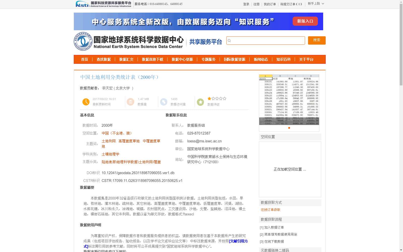
本数据集是2000年32省县级行政单元的土地利用类型面积统计数据。土地利用类型包括:水田,旱地,有林地,灌木林地,疏林地,其它林地,高覆盖度草地,中覆盖度草地,低覆盖度草,河渠,湖泊,水库坑塘,冰川和永久,涂滩地,城镇,农村居民点,工交建设用,沙地,戈壁,盐碱地,沼泽地,裸土地,裸岩石砾地,其它未利用。数据以省为单元存放,数据格式为execl
This dataset provides statistical area data for land use types of county-level administrative units across 32 provinces in the year 2000. The covered land use types are as follows: paddy fields, dry farmland, closed forest lands, shrub woodlands, sparse woodlands, other forest lands, high-coverage grasslands, medium-coverage grasslands, low-coverage grasslands, rivers and canals, lakes, reservoir ponds, glaciers and permanent ice/snow, tidal flats, urban areas, rural residential areas, industrial, transportation and construction lands, sandy lands, Gobi deserts, saline-alkali lands, marshes, bare lands, bare rock and gravel lands, and other unused lands. The data is stored on a provincial basis, with the file format being Excel.
提供机构:
北京大学
创建时间:
2015-06-25
搜集汇总
数据集介绍
背景与挑战
背景概述
该数据集是2000年中国32个省级行政单元的土地利用类型面积统计数据,覆盖水田、旱地、有林地等多种土地利用类型,以Excel格式存储,适用于土壤地理学和土地利用相关研究。
以上内容由遇见数据集搜集并总结生成


