格陵兰Landsat-8影像图(2014-2015)
收藏地球大数据科学工程2024-03-04 收录
下载链接:
https://data.casearth.cn/sdo/detail/6538a306819aec0f26125209
下载链接
链接失效反馈官方服务:
资源简介:
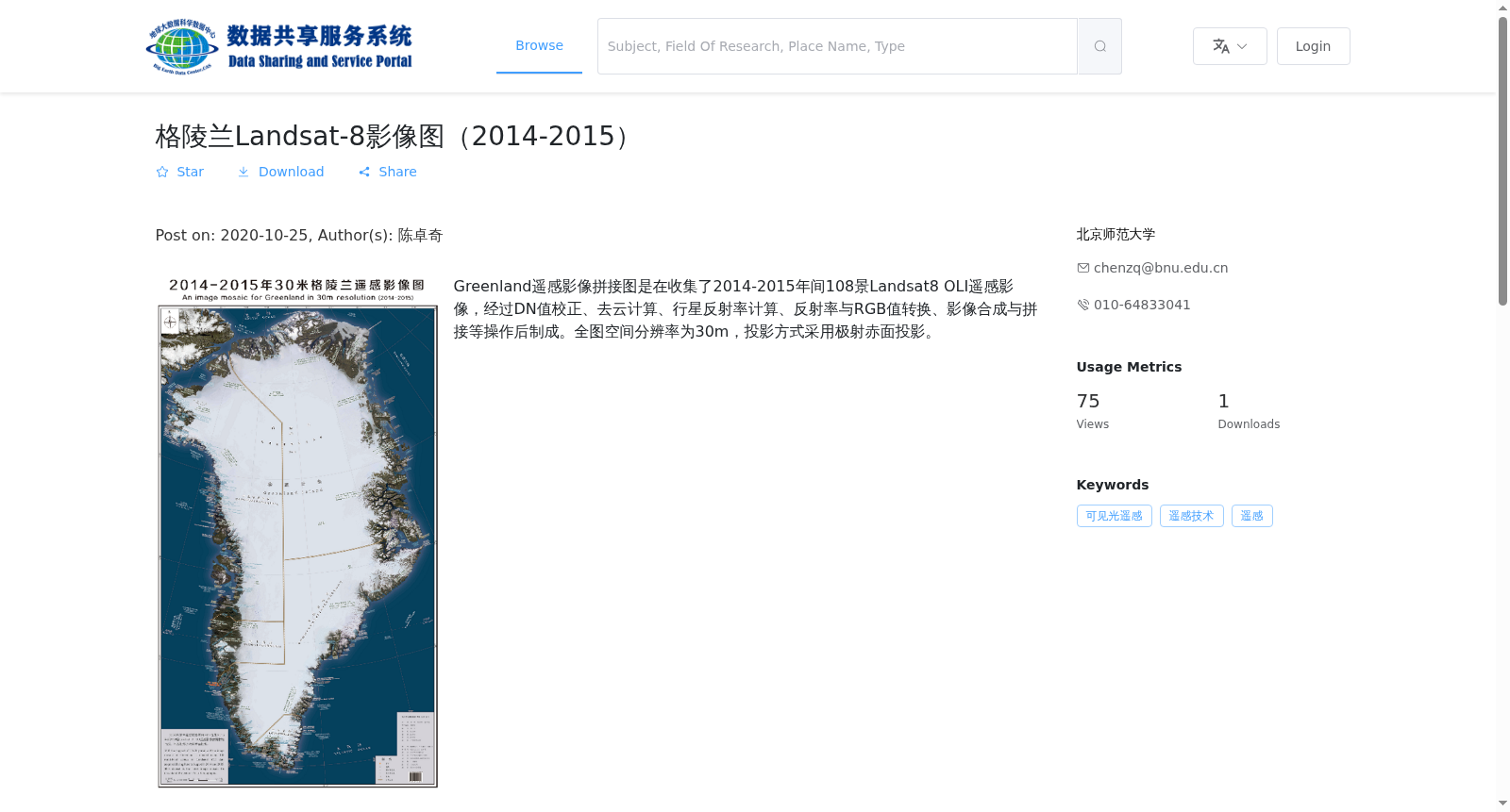
Greenland遥感影像拼接图是在收集了2014-2015年间108景Landsat8 OLI遥感影像,经过DN值校正、去云计算、行星反射率计算、反射率与RGB值转换、影像合成与拼接等操作后制成。全图空间分辨率为30m,投影方式采用极射赤面投影。
The mosaicked Greenland remote sensing imagery dataset was generated from 108 scenes of Landsat 8 OLI remote sensing images acquired between 2014 and 2015, following a standardized processing workflow consisting of DN value correction, cloud removal, planetary reflectance computation, conversion between reflectance and RGB values, as well as image compositing and mosaicking. The dataset has a spatial resolution of 30 m and utilizes the polar stereographic projection as its coordinate projection.
提供机构:
北京师范大学
搜集汇总
数据集介绍
背景与挑战
背景概述
该数据集是2014-2015年间格陵兰的Landsat-8 OLI遥感影像拼接图,经过多步处理制成,空间分辨率为30m,采用极射赤面投影,存储容量为52.57 GB,包含423个GeoTiff格式的栅格文件。
以上内容由遇见数据集搜集并总结生成


