广西10 m分辨率红树林分布动态数据集(2016-2020年)
收藏国家地球系统科学数据中心2025-10-16 更新2025-12-20 收录
下载链接:
https://www.geodata.cn/data/datadetails.html?dataguid=87522520677329&docId=825
下载链接
链接失效反馈官方服务:
资源简介:
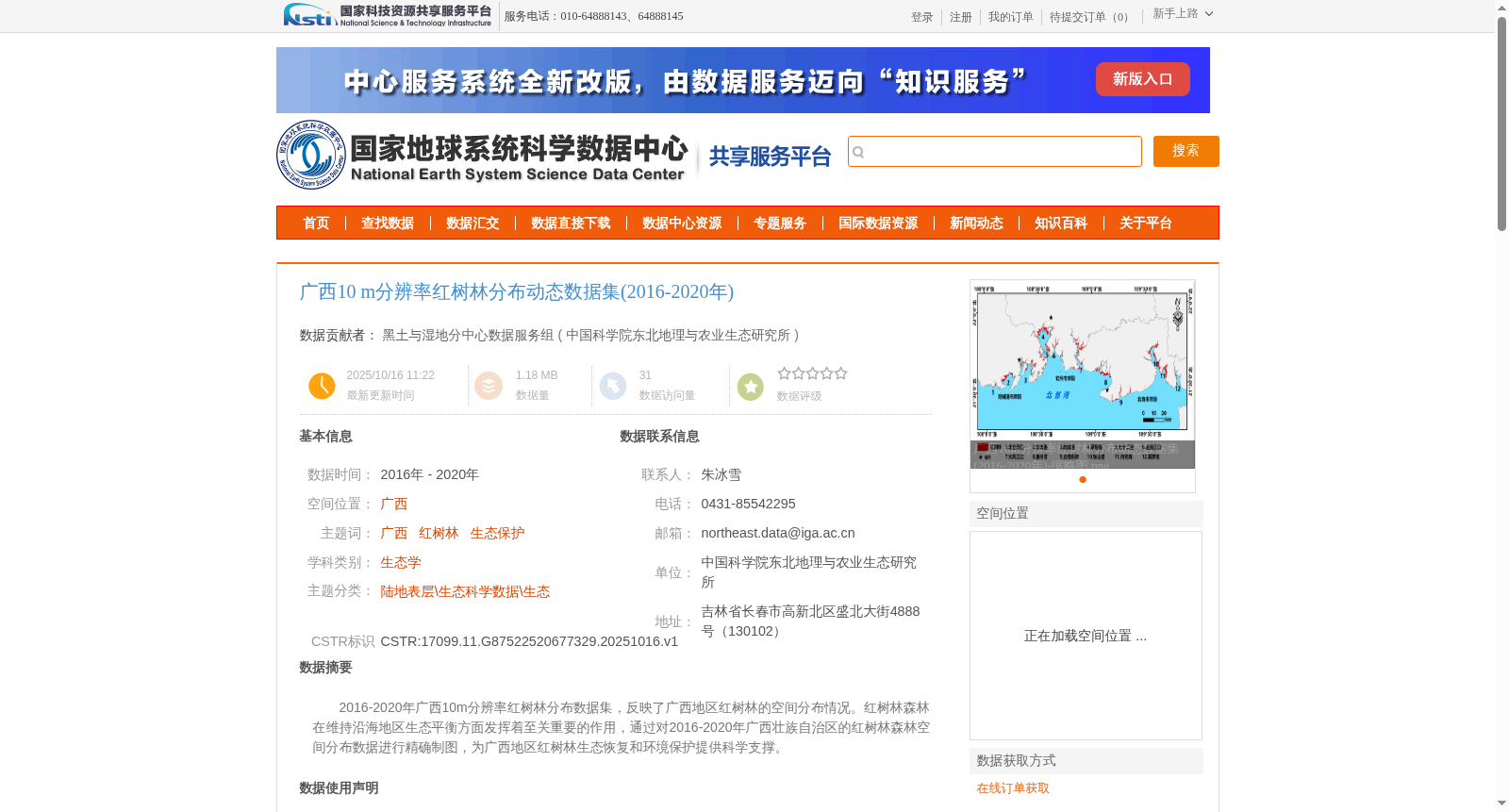
2016-2020年广西10m分辨率红树林分布数据集,反映了广西地区红树林的空间分布情况。红树林森林在维持沿海地区生态平衡方面发挥着至关重要的作用,通过对2016-2020年广西壮族自治区的红树林森林空间分布数据进行精确制图,为广西地区红树林生态恢复和环境保护提供科学支撑。
10m-resolution mangrove distribution dataset of Guangxi Zhuang Autonomous Region (2016–2020). This dataset depicts the spatial distribution of mangroves in Guangxi. Mangrove forests play a crucial role in maintaining the ecological balance of coastal areas. By accurately mapping the spatial distribution data of mangrove forests in Guangxi Zhuang Autonomous Region from 2016 to 2020, this dataset provides scientific support for mangrove ecological restoration and environmental protection in Guangxi.
提供机构:
中国科学院东北地理与农业生态研究所
创建时间:
2025-10-16
搜集汇总
数据集介绍
背景与挑战
背景概述
该数据集提供了2016-2020年广西地区10米分辨率的红树林空间分布动态信息,采用Sentinel-2遥感影像结合随机森林分类方法提取,分类精度超过90%。数据集旨在为广西红树林生态恢复和环境保护提供科学支撑。
以上内容由遇见数据集搜集并总结生成


