2000-2020年中国典型大气颗粒物人口暴露数据集
收藏地球大数据科学工程2024-04-21 收录
下载链接:
https://data.casearth.cn/sdo/detail/65388505819aec0f26f4a568
下载链接
链接失效反馈官方服务:
资源简介:
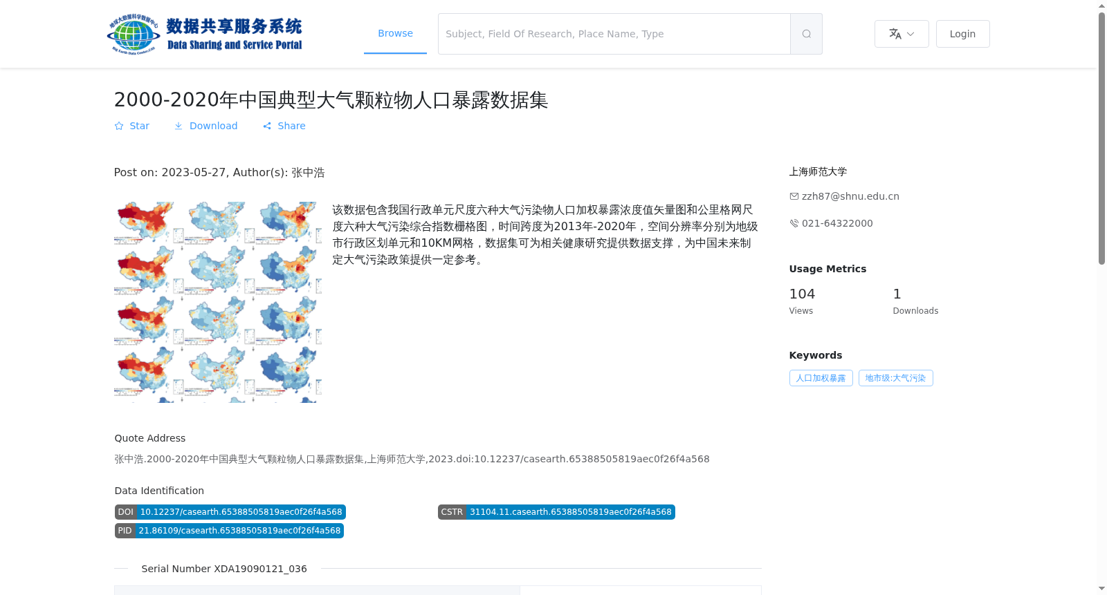
该数据包含我国行政单元尺度六种大气污染物人口加权暴露浓度值矢量图和公里格网尺度六种大气污染综合指数栅格图,时间跨度为2013年-2020年,空间分辨率分别为地级市行政区划单元和10KM网格,数据集可为相关健康研究提供数据支撑,为中国未来制定大气污染政策提供一定参考。
This dataset contains vector maps of population-weighted exposure concentrations of six atmospheric pollutants at the administrative unit scale, as well as raster maps of six air pollution composite indices at the kilometer grid scale. The temporal coverage spans from 2013 to 2020, with spatial resolutions corresponding to prefecture-level administrative divisions and 10-kilometer grids respectively. This dataset can provide data support for relevant health research and offer credible references for formulating future air pollution policies in China.
提供机构:
上海师范大学
搜集汇总
数据集介绍
背景与挑战
背景概述
该数据集提供了2013年至2020年中国地级市行政单元和10公里网格尺度上的六种大气污染物人口加权暴露浓度和污染综合指数数据,以矢量图和栅格图形式呈现。数据集旨在支持大气污染相关的健康研究和政策制定,数据格式为tif和shp,由上海师范大学于2023年发布。
以上内容由遇见数据集搜集并总结生成


