全球土壤总磷含量空间分布数据集
收藏国家生态科学数据中心2024-03-04 收录
下载链接:
http://www.nesdc.org.cn/sdo/detail?id=6243af1f7e28172589a71fe3
下载链接
链接失效反馈官方服务:
资源简介:
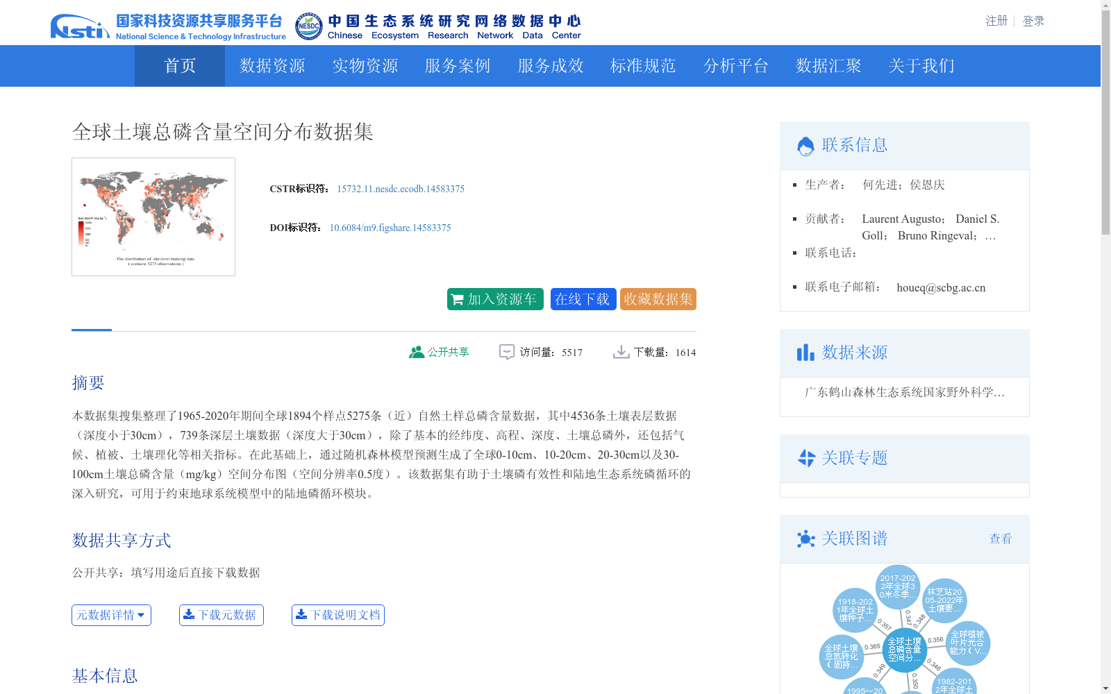
本数据集搜集整理了1965-2020年期间全球1894个样点5275条(近)自然土样总磷含量数据,其中4536条土壤表层数据(深度小于30cm),739条深层土壤数据(深度大于30cm),除了基本的经纬度、高程、深度、土壤总磷外,还包括气候、植被、土壤理化等相关指标。在此基础上,通过随机森林模型预测生成了全球0-10cm、10-20cm、20-30cm以及30-100cm土壤总磷含量(mg/kg)空间分布图(空间分辨率0.5度)。该数据集有助于土壤磷有效性和陆地生态系统磷循环的深入研究,可用于约束地球系统模型中的陆地磷循环模块。
This dataset compiles 5275 total phosphorus concentration records of (near-)natural soil samples from 1894 sampling sites globally during 1965–2020. Of these, 4536 records are from topsoil (depth < 30 cm) and 739 from subsoil (depth > 30 cm). In addition to basic attributes including latitude, longitude, elevation, sampling depth, and soil total phosphorus, the dataset also covers relevant indicators such as climate, vegetation, and soil physicochemical properties. Based on this compilation, spatial distribution maps of soil total phosphorus concentrations (mg/kg) for four depth layers (0–10 cm, 10–20 cm, 20–30 cm, and 30–100 cm) across the globe were generated via random forest modeling, with a spatial resolution of 0.5°. This dataset facilitates in-depth research on soil phosphorus availability and the phosphorus cycle of terrestrial ecosystems, and can be used to constrain terrestrial phosphorus cycle modules in Earth System Models (ESMs).
提供机构:
台站
创建时间:
2021-05-13
搜集汇总
数据集介绍
背景与挑战
背景概述
该数据集收集了1965-2020年期间全球1894个样点的5275条土壤总磷含量数据,包括表层和深层土壤信息,并利用随机森林模型生成了全球0.5度分辨率的土壤总磷空间分布图。数据集以栅格图像形式存储,大小为4.30MB,覆盖全球范围,旨在支持土壤磷有效性和陆地生态系统磷循环的研究,可用于约束地球系统模型中的磷循环模块。
以上内容由遇见数据集搜集并总结生成


